Property Record
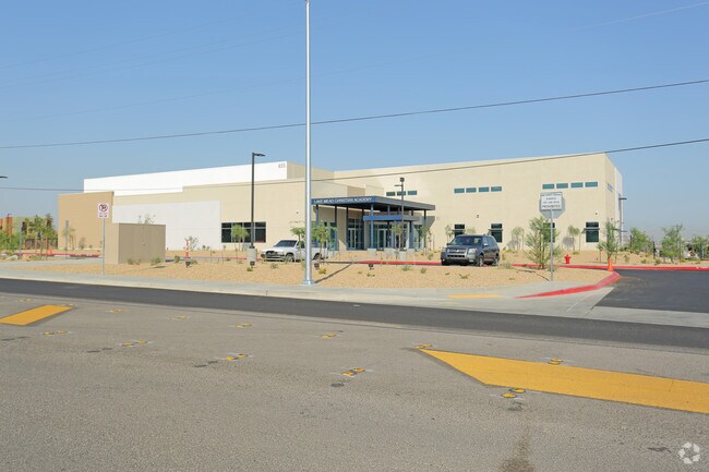
655 E Lake Mead Pky, Henderson, NV 89015


Property Detail
655 E Lake Mead Pky
Las Vegas-Henderson-North Las Vegas, NV
PARCEL MAP FILE 120 PAGE 22 LOT 2
179-08-201-019
Clark
Publicschool
Nevada
B and X Area of moderate flood hazard, usually the area between the limits of the 100-year and 500-year floods.
2
0
13.98 AC
2026
SE Las Vegas/Henderson
005438
Las Vegas
48,511 SF
NEARBY LISTINGS FOR SALE OR LEASE
-
-
View all Henderson listings for sale on LoopNet.com
DEMOGRAPHICS near 655 E Lake Mead Pky
1 mile
3 mile
5 mile
2025 Total Population
17,047
84,312
199,782
2030 Population
18,391
90,309
211,664
Pop Growth 2025-2030
+ 7.88%
+ 7.11%
+ 5.95%
Average Age
39
42
41
2025 Total Households
6,319
32,249
76,342
HH Growth 2025-2030
+ 8.12%
+ 7.19%
+ 6.04%
Median Household Inc
$70,454
$86,576
$87,974
Avg Household Size
2.60
2.50
2.50
2025 Avg HH Vehicles
2.00
2.00
2.00
Median Home Value
$417,169
$446,578
$453,211
Median Year Built
1994
1998
2000
Nearby Places
Map Layers
Map Styles
 Street
 Aerial
Layers
 Traffic
 Biking
Places
Listings with unknown addresses are not visible on the map
- Restaurants
- Banks
- Shops
- Fitness
- Groceries
PUBLIC TRANSPORTATION
AIRPORT
Boulder City Municipal
Drive
Walk
Distance
Boulder City Municipal
20 min
11.9 mi
Harry Reid International
Drive
Walk
Distance
Harry Reid International
20 min
14.1 mi
Freight Ports
Port of Long Beach
Drive
Walk
Distance
Port of Long Beach
317 min
282.7 mi
Nearby Properties
Address
Land Use
TOTAL SIZE
Lot Size
Zoning
Address
Land Use
TOTAL SIZE
Lot Size
Zoning
62,258 SF
59.95 AC
Address
Land Use
TOTAL SIZE
Lot Size
Zoning
Address
Land Use
TOTAL SIZE
Lot Size
Zoning
31,463 SF
191.46 AC
PS
Address
Land Use
TOTAL SIZE
Lot Size
Zoning
502,625 SF
45.92 AC
Address
Land Use
TOTAL SIZE
Lot Size
Zoning
9,493 SF
15.37 AC
Address
Land Use
TOTAL SIZE
Lot Size
Zoning
350.47 AC
PS
Address
Land Use
TOTAL SIZE
Lot Size
Zoning
10.50 AC
Address
Land Use
TOTAL SIZE
Lot Size
Zoning
81,485 SF
160.06 AC
PS
Address
Land Use
TOTAL SIZE
Lot Size
Zoning
387,990 SF
22.04 AC
Address
Land Use
TOTAL SIZE
Lot Size
Zoning
1,500 SF
25.08 AC
Address
Land Use
TOTAL SIZE
Lot Size
Zoning
9,000 SF
96.81 AC
RE
Address
Land Use
TOTAL SIZE
Lot Size
Zoning
40,031 SF
21.25 AC
Address
Land Use
TOTAL SIZE
Lot Size
Zoning
78,760 SF
1.23 AC
Address
Land Use
TOTAL SIZE
Lot Size
Zoning
23,087 SF
71.36 AC
PS
Address
Land Use
TOTAL SIZE
Lot Size
Zoning
239,288 SF
14.10 AC
Address
Land Use
TOTAL SIZE
Lot Size
Zoning
250,076 SF
24.61 AC
Address
Land Use
TOTAL SIZE
Lot Size
Zoning
295,238 SF
23.49 AC
IP
Address
Land Use
TOTAL SIZE
Lot Size
Zoning
71,133 SF
7.56 AC
DP
Address
Land Use
TOTAL SIZE
Lot Size
Zoning
19,753 SF
10.21 AC
DP
Address
Land Use
TOTAL SIZE
Lot Size
Zoning
213,472 SF
7.46 AC
Address
Land Use
TOTAL SIZE
Lot Size
Zoning
3,664 SF
16.09 AC
RH20
Address
Land Use
TOTAL SIZE
Lot Size
Zoning
14,463 SF
19.48 AC
Address
Land Use
TOTAL SIZE
Lot Size
Zoning
3,293 SF
17.37 AC
H:RM-16-MP
Address
Land Use
TOTAL SIZE
Lot Size
Zoning
186,000 SF
13.63 AC
H:IG-MP
Address
Land Use
TOTAL SIZE
Lot Size
Zoning
136,465 SF
34.67 AC
Address
Land Use
TOTAL SIZE
Lot Size
Zoning
241,207 SF
13.42 AC
IG
Address
Land Use
TOTAL SIZE
Lot Size
Zoning
168,361 SF
10.84 AC
Address
Land Use
TOTAL SIZE
Lot Size
Zoning
358,284 SF
17.44 AC
IG
Address
Land Use
TOTAL SIZE
Lot Size
Zoning
236,015 SF
17.43 AC
IG
The World's #1 Commercial Real Estate Marketplace
Connect with us
© 2026 CoStar Group
The information above has been obtained from sources believed reliable. While we do not doubt its accuracy we have not verified it and make no guarantee, warranty or representation about it. It is your responsibility to independently confirm its accuracy and completeness. Any projections, opinions, assumptions, or estimates used are for example only and do not represent the current or future performance of the property. The value of this transaction to you depends on tax and other factors which should be evaluated by your tax, financial, and legal advisors. You and your advisors should conduct a careful, independent investigation of the property to determine to your satisfaction the suitability of the property for your needs.