Property Record
655 Parr Rd, Wentzville, MO 63385
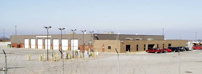

Property Detail
655 Parr Rd
4-0072-2670-00-0001.2000000
PT SUR 2670
Industrialgeneral
Saint Charles
AC1
Missouri
B and X Area of moderate flood hazard, usually the area between the limits of the 100-year and 500-year floods.
1
2024
23.54 AC
2025
St Charles County
312094
St. Louis
43,040 SF
St. Louis, MO-IL
NEARBY LISTINGS FOR SALE OR LEASE
DEMOGRAPHICS near 655 Parr Rd
1 mile
3 mile
5 mile
2025 Total Population
3,827
34,089
82,211
2030 Population
3,928
35,826
86,401
Pop Growth 2025-2030
+ 2.64%
+ 5.10%
+ 5.10%
Average Age
35
38
39
2025 Total Households
1,350
12,249
29,389
HH Growth 2025-2030
+ 2.81%
+ 5.29%
+ 5.30%
Median Household Inc
$100,297
$103,720
$110,758
Avg Household Size
2.80
2.70
2.80
2025 Avg HH Vehicles
2.00
2.00
2.00
Median Home Value
$309,524
$337,237
$362,526
Median Year Built
2007
2005
2005
Nearby Places
Map Layers
Map Styles
 Street
 Aerial
Layers
 Traffic
 Biking
Places
Listings with unknown addresses are not visible on the map
- Restaurants
- Banks
- Shops
- Fitness
- Groceries
PUBLIC TRANSPORTATION
AIRPORT
St Louis Lambert International
Drive
Walk
Distance
St Louis Lambert International
42 min
31.9 mi
Nearby Properties
Address
Land Use
TOTAL SIZE
Lot Size
Zoning
Address
Land Use
TOTAL SIZE
Lot Size
Zoning
1,150,000 SF
76.64 AC
Address
Land Use
TOTAL SIZE
Lot Size
Zoning
4,406,283 SF
88.45 AC
Address
Land Use
TOTAL SIZE
Lot Size
Zoning
371,934 SF
347.72 AC
AB6
Address
Land Use
TOTAL SIZE
Lot Size
Zoning
380,762 SF
24.76 AC
Address
Land Use
TOTAL SIZE
Lot Size
Zoning
479,232 SF
36.53 AC
AA7
Address
Land Use
TOTAL SIZE
Lot Size
Zoning
Address
Land Use
TOTAL SIZE
Lot Size
Zoning
26,068 SF
10.01 AC
Address
Land Use
TOTAL SIZE
Lot Size
Zoning
200,008 SF
14.30 AC
Address
Land Use
TOTAL SIZE
Lot Size
Zoning
420,000 SF
20.75 AC
Address
Land Use
TOTAL SIZE
Lot Size
Zoning
210,333 SF
25.16 AC
Address
Land Use
TOTAL SIZE
Lot Size
Zoning
18,284 SF
15.50 AC
Address
Land Use
TOTAL SIZE
Lot Size
Zoning
235,850 SF
12.97 AC
Address
Land Use
TOTAL SIZE
Lot Size
Zoning
133,028 SF
2.63 AC
Address
Land Use
TOTAL SIZE
Lot Size
Zoning
165,953 SF
14 AC
Address
Land Use
TOTAL SIZE
Lot Size
Zoning
215,329 SF
19.29 AC
Address
Land Use
TOTAL SIZE
Lot Size
Zoning
68,644 SF
4.68 AC
Address
Land Use
TOTAL SIZE
Lot Size
Zoning
293,124 SF
22.81 AC
Address
Land Use
TOTAL SIZE
Lot Size
Zoning
285,050 SF
20.84 AC
Address
Land Use
TOTAL SIZE
Lot Size
Zoning
150,141 SF
54.62 AC
AC4
Address
Land Use
TOTAL SIZE
Lot Size
Zoning
55,263 SF
1.65 AC
Address
Land Use
TOTAL SIZE
Lot Size
Zoning
140,375 SF
13.17 AC
Address
Land Use
TOTAL SIZE
Lot Size
Zoning
69,965 SF
8.09 AC
Address
Land Use
TOTAL SIZE
Lot Size
Zoning
136,594 SF
14.44 AC
Address
Land Use
TOTAL SIZE
Lot Size
Zoning
126,308 SF
11.63 AC
Address
Land Use
TOTAL SIZE
Lot Size
Zoning
18.75 AC
Address
Land Use
TOTAL SIZE
Lot Size
Zoning
10,690 SF
11.23 AC
AA2
Address
Land Use
TOTAL SIZE
Lot Size
Zoning
52,222 SF
1.68 AC
Address
Land Use
TOTAL SIZE
Lot Size
Zoning
54,059 SF
2.06 AC
Address
Land Use
TOTAL SIZE
Lot Size
Zoning
83,191 SF
9.56 AC
Address
Land Use
TOTAL SIZE
Lot Size
Zoning
73.30 AC
AB7
The World's #1 Commercial Real Estate Marketplace
Connect with us
© 2026 CoStar Group
The information above has been obtained from sources believed reliable. While we do not doubt its accuracy we have not verified it and make no guarantee, warranty or representation about it. It is your responsibility to independently confirm its accuracy and completeness. Any projections, opinions, assumptions, or estimates used are for example only and do not represent the current or future performance of the property. The value of this transaction to you depends on tax and other factors which should be evaluated by your tax, financial, and legal advisors. You and your advisors should conduct a careful, independent investigation of the property to determine to your satisfaction the suitability of the property for your needs.