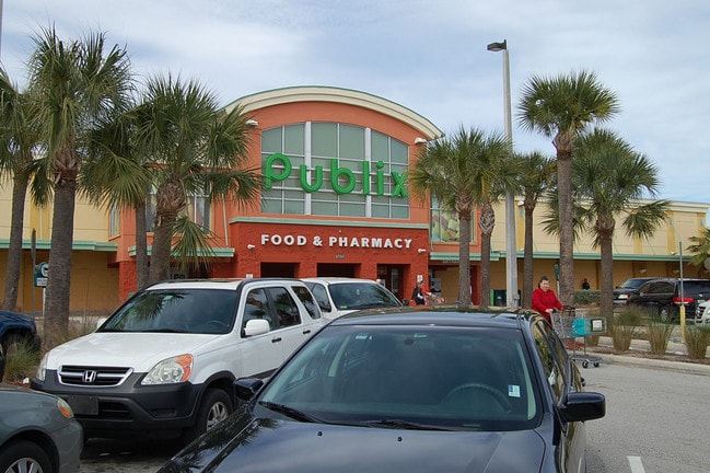
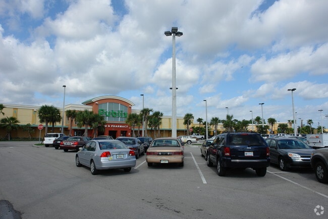
Property Record
6550 S Kanner Hwy, Stuart, FL 34997


Property Detail
6550 S Kanner Hwy
55-38-41-450-000-00010-0
LOT 1 KANNER CROSSING ACCORDING TO PLBK 16 PG 27 TOGETHER WITH AN EASEMENT TO BENEFIT PARCEL AS CONTAINED IN DECLARATION OF RESTRICTIONS COVENANTS AND CONDITIONS & GRANT OF EASEMENTS FOR KANNER CROSSING RECORDED IN OR BK 2059/1461
Regionalshoppingcenterormallwithanchorstore
MARTIN
GC
Florida
B and X Area of moderate flood hazard, usually the area between the limits of the 100-year and 500-year floods.
1
2024
17.36 AC
2025
Martin
001103
Port St Lucie/Fort Pierce
63,552 SF
Port St. Lucie, FL
NEARBY LISTINGS FOR SALE OR LEASE
DEMOGRAPHICS near 6550 S Kanner Hwy
1 mile
3 mile
5 mile
2025 Total Population
2,917
30,228
82,276
2030 Population
3,019
31,090
84,911
Pop Growth 2025-2030
+ 3.50%
+ 2.85%
+ 3.20%
Average Age
46
47
48
2025 Total Households
1,155
12,472
35,304
HH Growth 2025-2030
+ 3.29%
+ 2.80%
+ 3.14%
Median Household Inc
$94,130
$80,903
$75,074
Avg Household Size
2.40
2.30
2.20
2025 Avg HH Vehicles
2.00
2.00
2.00
Median Home Value
$489,749
$457,246
$424,903
Median Year Built
1995
1991
1987
Nearby Places
Map Layers
Map Styles
 Street
 Aerial
Layers
 Traffic
 Biking
Places
Listings with unknown addresses are not visible on the map
- Restaurants
- Banks
- Shops
- Fitness
- Groceries
Nearby Properties
Address
Land Use
TOTAL SIZE
Lot Size
Zoning
Address
Land Use
TOTAL SIZE
Lot Size
Zoning
232,042 SF
30.99 AC
PUDR
Address
Land Use
TOTAL SIZE
Lot Size
Zoning
13.62 AC
R2
Address
Land Use
TOTAL SIZE
Lot Size
Zoning
118,989 SF
12.43 AC
PUDC
Address
Land Use
TOTAL SIZE
Lot Size
Zoning
15.79 AC
Address
Land Use
TOTAL SIZE
Lot Size
Zoning
200,686 SF
9.98 AC
RPUD
Address
Land Use
TOTAL SIZE
Lot Size
Zoning
85,872 SF
7.91 AC
CPUD
Address
Land Use
TOTAL SIZE
Lot Size
Zoning
126,304 SF
36 AC
R2
Address
Land Use
TOTAL SIZE
Lot Size
Zoning
334,117 SF
54 AC
RPUD
Address
Land Use
TOTAL SIZE
Lot Size
Zoning
182,982 SF
28.90 AC
PUDR
Address
Land Use
TOTAL SIZE
Lot Size
Zoning
45,029 SF
11.80 AC
PUDC
Address
Land Use
TOTAL SIZE
Lot Size
Zoning
48,450 SF
7.94 AC
Address
Land Use
TOTAL SIZE
Lot Size
Zoning
59,023 SF
12.31 AC
Address
Land Use
TOTAL SIZE
Lot Size
Zoning
106,105 SF
7.41 AC
PUDR
Address
Land Use
TOTAL SIZE
Lot Size
Zoning
102,843 SF
9.03 AC
Address
Land Use
TOTAL SIZE
Lot Size
Zoning
39,801 SF
8.50 AC
LI
Address
Land Use
TOTAL SIZE
Lot Size
Zoning
56,281 SF
28.86 AC
LI
Address
Land Use
TOTAL SIZE
Lot Size
Zoning
50,773 SF
9.40 AC
COR2
Address
Land Use
TOTAL SIZE
Lot Size
Zoning
69,133 SF
6 AC
PUDC
Address
Land Use
TOTAL SIZE
Lot Size
Zoning
1,168 SF
2.37 AC
B2
Address
Land Use
TOTAL SIZE
Lot Size
Zoning
63,133 SF
19.65 AC
A1
Address
Land Use
TOTAL SIZE
Lot Size
Zoning
135,537 SF
15.28 AC
CPUD
Address
Land Use
TOTAL SIZE
Lot Size
Zoning
56,665 SF
10 AC
CPUD
Address
Land Use
TOTAL SIZE
Lot Size
Zoning
60,542 SF
4.67 AC
Address
Land Use
TOTAL SIZE
Lot Size
Zoning
22.77 AC
Address
Land Use
TOTAL SIZE
Lot Size
Zoning
97,783 SF
6.34 AC
LI
Address
Land Use
TOTAL SIZE
Lot Size
Zoning
63,874 SF
4.39 AC
PUDC
Address
Land Use
TOTAL SIZE
Lot Size
Zoning
97,017 SF
4.60 AC
GC
Address
Land Use
TOTAL SIZE
Lot Size
Zoning
37,429 SF
15.74 AC
GC
Address
Land Use
TOTAL SIZE
Lot Size
Zoning
79,929 SF
5.98 AC
CPUD
The World's #1 Commercial Real Estate Marketplace
Connect with us
© 2026 CoStar Group
The information above has been obtained from sources believed reliable. While we do not doubt its accuracy we have not verified it and make no guarantee, warranty or representation about it. It is your responsibility to independently confirm its accuracy and completeness. Any projections, opinions, assumptions, or estimates used are for example only and do not represent the current or future performance of the property. The value of this transaction to you depends on tax and other factors which should be evaluated by your tax, financial, and legal advisors. You and your advisors should conduct a careful, independent investigation of the property to determine to your satisfaction the suitability of the property for your needs.