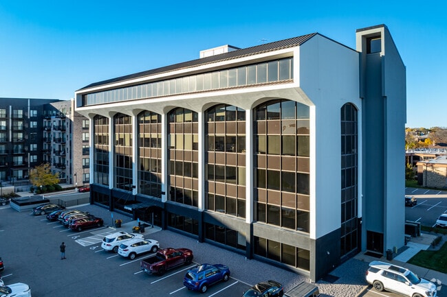
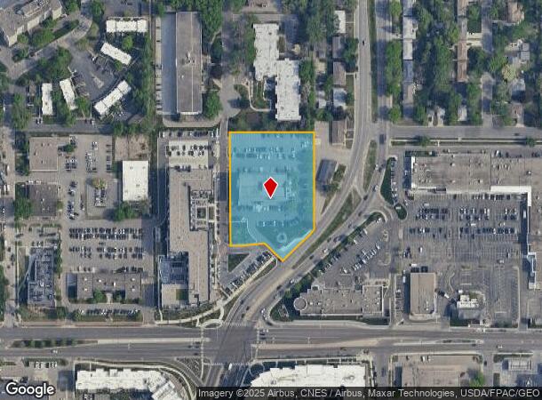
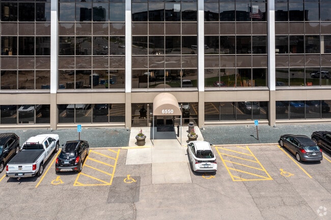
Property Record
6550 York Ave S, Minneapolis, MN 55435
Current Lease Availabilities
NEARBY LISTINGS FOR SALE OR LEASE
Property Detail
6550 York Ave S
Minneapolis-St. Paul-Bloomington, MN-WI
Cassins Outlots
29-028-24-24-0225
LOT 005 A CASSINS OUTLOTS THAT PART OF LOT 5 LYING WEST OF A LINE BEGINNING AT A POINT ON THE SOUTH LINE OF SAID LOT 5 DISTANT 219.1 FEET WEST FROM THE SOUTHEAST T IRREGULAR
Commercialnec
Hennepin
X
Minnesota
27053C0364F
5
2024
2.16 AC
2024
I-494 Corridor
024005
Minneapolis/St Paul
DEMOGRAPHICS near 6550 York Ave S
1 Mile
3 Mile
5 Mile
2024 Total Population
18,109
123,639
312,820
2029 Population
18,050
121,639
307,832
Pop Growth 2024-2029
(0.33%)
(1.62%)
(1.59%)
Average Age
43
42
40
2024 Total Households
8,423
52,378
136,477
HH Growth 2024-2029
(0.11%)
(1.64%)
(1.61%)
Median Household Inc
$83,745
$102,712
$90,642
Avg Household Size
2.10
2.30
2.20
2024 Avg HH Vehicles
2.00
2.00
2.00
Median Home Value
$345,058
$411,064
$369,475
Median Year Built
1964
1959
1960
Nearby Places
Map Layers
Map Styles
 Street
 Aerial
- Restaurants
- Banks
- Shops
- Fitness
- Groceries
PUBLIC TRANSPORTATION
COMMUTER RAIL
Target Field Station (Northstar Corridor - Northstar Commuter Rail)
DRIVE
WALK
Distance
Target Field Station (Northstar Corridor - Northstar Commuter Rail)
18 min
9.6 mi
AIRPORT
Minneapolis-St Paul International/Wold-Chamberlain
DRIVE
WALK
Distance
Minneapolis-St Paul International/Wold-Chamberlain
15 min
8.0 mi
Nearby Properties
Address
Land Use
TOTAL SIZE
Lot Size
Zoning
Address
Land Use
TOTAL SIZE
Lot Size
Zoning
364,730 SF
13.40 AC
PCD3
Address
Land Use
TOTAL SIZE
Lot Size
Zoning
18,088 SF
5.44 AC
MDD6
Address
Land Use
TOTAL SIZE
Lot Size
Zoning
21.50 AC
Address
Land Use
TOTAL SIZE
Lot Size
Zoning
12,308 SF
1.25 AC
PCD3
Address
Land Use
TOTAL SIZE
Lot Size
Zoning
22,654 SF
5.22 AC
Address
Land Use
TOTAL SIZE
Lot Size
Zoning
45.77 AC
Address
Land Use
TOTAL SIZE
Lot Size
Zoning
79,717 SF
4.62 AC
Address
Land Use
TOTAL SIZE
Lot Size
Zoning
19,726 SF
2.08 AC
PCD1
Address
Land Use
TOTAL SIZE
Lot Size
Zoning
461,748 SF
5.87 AC
Address
Land Use
TOTAL SIZE
Lot Size
Zoning
35.28 AC
Address
Land Use
TOTAL SIZE
Lot Size
Zoning
1.50 AC
Address
Land Use
TOTAL SIZE
Lot Size
Zoning
3.51 AC
Address
Land Use
TOTAL SIZE
Lot Size
Zoning
50,484 SF
5.12 AC
Address
Land Use
TOTAL SIZE
Lot Size
Zoning
8.55 AC
Address
Land Use
TOTAL SIZE
Lot Size
Zoning
25,780 SF
5.24 AC
Address
Land Use
TOTAL SIZE
Lot Size
Zoning
435,796 SF
36.44 AC
Address
Land Use
TOTAL SIZE
Lot Size
Zoning
31,646 SF
5.85 AC
Address
Land Use
TOTAL SIZE
Lot Size
Zoning
Address
Land Use
TOTAL SIZE
Lot Size
Zoning
1.74 AC
Address
Land Use
TOTAL SIZE
Lot Size
Zoning
7,614 SF
2.01 AC
PCD3
Address
Land Use
TOTAL SIZE
Lot Size
Zoning
25,909 SF
6.09 AC
Address
Land Use
TOTAL SIZE
Lot Size
Zoning
94,827 SF
5.86 AC
RMD
Address
Land Use
TOTAL SIZE
Lot Size
Zoning
22,119 SF
4.02 AC
Address
Land Use
TOTAL SIZE
Lot Size
Zoning
8.80 AC
Address
Land Use
TOTAL SIZE
Lot Size
Zoning
Address
Land Use
TOTAL SIZE
Lot Size
Zoning
21.69 AC
Address
Land Use
TOTAL SIZE
Lot Size
Zoning
60,320 SF
11.50 AC
Address
Land Use
TOTAL SIZE
Lot Size
Zoning
Address
Land Use
TOTAL SIZE
Lot Size
Zoning
2.23 AC
Address
Land Use
TOTAL SIZE
Lot Size
Zoning
39,118 SF
3.48 AC
The World's #1 Commercial Real Estate Marketplace
Connect with us
© 2026 CoStar Group
The information above has been obtained from sources believed reliable. While we do not doubt its accuracy we have not verified it and make no guarantee, warranty or representation about it. It is your responsibility to independently confirm its accuracy and completeness. Any projections, opinions, assumptions, or estimates used are for example only and do not represent the current or future performance of the property. The value of this transaction to you depends on tax and other factors which should be evaluated by your tax, financial, and legal advisors. You and your advisors should conduct a careful, independent investigation of the property to determine to your satisfaction the suitability of the property for your needs.