Property Record
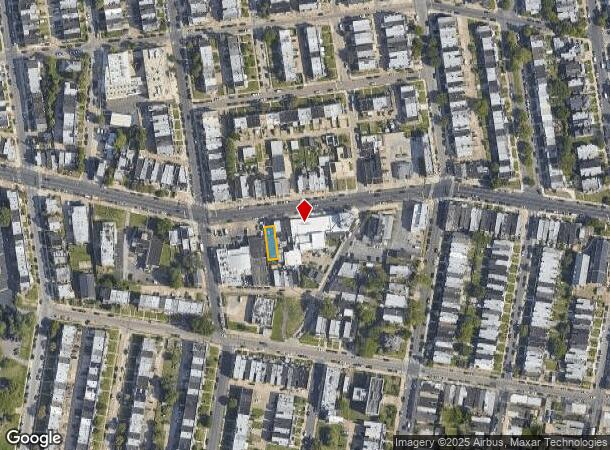
6552 Haverford Ave, Philadelphia, PA 19151


NEARBY LISTINGS FOR SALE OR LEASE
Property Detail
6552 Haverford Ave
882020350
274113/4 W ATWOOD ST
Autorepair
Philadelphia
X
Pennsylvania
42091C0432G
0.28 AC
2024
West Philadelphia
2026
Philadelphia
010000
Philadelphia-Camden-Wilmington, PA-NJ-DE-MD
8,819 SF
DEMOGRAPHICS near 6552 Haverford Ave
1 Mile
3 Mile
5 Mile
2024 Total Population
49,807
334,275
796,958
2029 Population
48,154
328,301
784,618
Pop Growth 2024-2029
(3.32%)
(1.79%)
(1.55%)
Average Age
39
38
38
2024 Total Households
19,576
131,320
331,946
HH Growth 2024-2029
(3.60%)
(2.06%)
(1.79%)
Median Household Inc
$45,496
$50,005
$59,405
Avg Household Size
2.40
2.40
2.30
2024 Avg HH Vehicles
1.00
1.00
1.00
Median Home Value
$140,883
$188,587
$246,626
Median Year Built
1946
1947
1949
Nearby Places
Map Layers
Map Styles
 Street
 Aerial
- Restaurants
- Banks
- Shops
- Fitness
- Groceries
PUBLIC TRANSPORTATION
TRANSIT/SUBWAY
Haverford Av & 63Rd St (Route 15 - SEPTA)
DRIVE
WALK
Distance
Haverford Av & 63Rd St (Route 15 - SEPTA)
0 min
6 min
0.3 mi
Haverford Av & 62Nd St (Route 15 - SEPTA)
DRIVE
WALK
Distance
Haverford Av & 62Nd St (Route 15 - SEPTA)
1 min
8 min
0.4 mi
Girard And 63Rd (Route 15 - Southeastern Pennsylvania Transportation Authority Rapid Transit (SEPTA Subway & Trolley))
DRIVE
WALK
Distance
Girard And 63Rd (Route 15 - Southeastern Pennsylvania Transportation Authority Rapid Transit (SEPTA Subway & Trolley))
1 min
8 min
0.4 mi
Lansdowne Avenue And 63Rd Street (Route 10 - Southeastern Pennsylvania Transportation Authority Rapid Transit (SEPTA Subway & Trolley))
DRIVE
WALK
Distance
Lansdowne Avenue And 63Rd Street (Route 10 - Southeastern Pennsylvania Transportation Authority Rapid Transit (SEPTA Subway & Trolley))
1 min
8 min
0.5 mi
Girard Av & 62Nd St (63rd-Girard to Richmond-Westmorelnd - SEPTA)
DRIVE
WALK
Distance
Girard Av & 62Nd St (63rd-Girard to Richmond-Westmorelnd - SEPTA)
1 min
9 min
0.5 mi
COMMUTER RAIL
Overbrook (R5 - Southeastern Pennsylvania Transportation Authority Regional Rail (SEPTA Regional Rail))
DRIVE
WALK
Distance
Overbrook (R5 - Southeastern Pennsylvania Transportation Authority Regional Rail (SEPTA Regional Rail))
4 min
1.6 mi
Merion (R5 - Southeastern Pennsylvania Transportation Authority Regional Rail (SEPTA Regional Rail))
DRIVE
WALK
Distance
Merion (R5 - Southeastern Pennsylvania Transportation Authority Regional Rail (SEPTA Regional Rail))
7 min
2.3 mi
AIRPORT
Philadelphia International
DRIVE
WALK
Distance
Philadelphia International
23 min
9.5 mi
Freight Ports
South Jersey Port
DRIVE
WALK
Distance
South Jersey Port
20 min
9.4 mi
SALE & LEASE HISTORY
LISTING DATE
SALE/LEASE

Jun 03, 2022
For Lease
Apr 09, 2024
For Sale
Nearby Properties
Address
Land Use
TOTAL SIZE
Lot Size
Zoning
Address
Land Use
TOTAL SIZE
Lot Size
Zoning
26,690 SF
500 AC
SPINS
Address
Land Use
TOTAL SIZE
Lot Size
Zoning
385,000 SF
2.49 AC
SPINS
Address
Land Use
TOTAL SIZE
Lot Size
Zoning
375,500 SF
1.40 AC
CMX5
Address
Land Use
TOTAL SIZE
Lot Size
Zoning
303,750 SF
1.36 AC
SPINS
Address
Land Use
TOTAL SIZE
Lot Size
Zoning
239,760 SF
5.51 AC
SPINS
Address
Land Use
TOTAL SIZE
Lot Size
Zoning
2,178,860 SF
48.65 AC
R3
Address
Land Use
TOTAL SIZE
Lot Size
Zoning
158,496 SF
Address
Land Use
TOTAL SIZE
Lot Size
Zoning
269,171 SF
2.64 AC
SPINS
Address
Land Use
TOTAL SIZE
Lot Size
Zoning
Address
Land Use
TOTAL SIZE
Lot Size
Zoning
251,000 SF
0.78 AC
SPINS
Address
Land Use
TOTAL SIZE
Lot Size
Zoning
175,069 SF
2.20 AC
CMX3
Address
Land Use
TOTAL SIZE
Lot Size
Zoning
206,365 SF
3.40 AC
RSA5
Address
Land Use
TOTAL SIZE
Lot Size
Zoning
473,841 SF
CMX4
Address
Land Use
TOTAL SIZE
Lot Size
Zoning
304,552 SF
1 AC
SPINS
Address
Land Use
TOTAL SIZE
Lot Size
Zoning
76,614 SF
1.53 AC
CMX3
Address
Land Use
TOTAL SIZE
Lot Size
Zoning
175,000 SF
0.90 AC
SPINS
Address
Land Use
TOTAL SIZE
Lot Size
Zoning
1,455,130 SF
6.80 AC
RSD3
Address
Land Use
TOTAL SIZE
Lot Size
Zoning
1,188,574 SF
12.58 AC
CMX4
Address
Land Use
TOTAL SIZE
Lot Size
Zoning
162,000 SF
8.16 AC
SPPOA
Address
Land Use
TOTAL SIZE
Lot Size
Zoning
1,600 SF
177.07 AC
SPPOA
Address
Land Use
TOTAL SIZE
Lot Size
Zoning
165,000 SF
0.91 AC
SPINS
Address
Land Use
TOTAL SIZE
Lot Size
Zoning
156,275 SF
0.30 AC
SPINS
Address
Land Use
TOTAL SIZE
Lot Size
Zoning
154,555 SF
1.42 AC
SPINS
Address
Land Use
TOTAL SIZE
Lot Size
Zoning
232,225 SF
0.86 AC
CMX4
Address
Land Use
TOTAL SIZE
Lot Size
Zoning
511,806 SF
1.70 AC
RM4
Address
Land Use
TOTAL SIZE
Lot Size
Zoning
461,834 SF
4.73 AC
CMX3
Address
Land Use
TOTAL SIZE
Lot Size
Zoning
304,000 SF
1.58 AC
CMX4
Address
Land Use
TOTAL SIZE
Lot Size
Zoning
374,105 SF
5.63 AC
CMX3
Address
Land Use
TOTAL SIZE
Lot Size
Zoning
250,500 SF
0.99 AC
CMX5
Address
Land Use
TOTAL SIZE
Lot Size
Zoning
448,864 SF
32.89 AC
The World's #1 Commercial Real Estate Marketplace
Connect with us
© 2026 CoStar Group
The information above has been obtained from sources believed reliable. While we do not doubt its accuracy we have not verified it and make no guarantee, warranty or representation about it. It is your responsibility to independently confirm its accuracy and completeness. Any projections, opinions, assumptions, or estimates used are for example only and do not represent the current or future performance of the property. The value of this transaction to you depends on tax and other factors which should be evaluated by your tax, financial, and legal advisors. You and your advisors should conduct a careful, independent investigation of the property to determine to your satisfaction the suitability of the property for your needs.