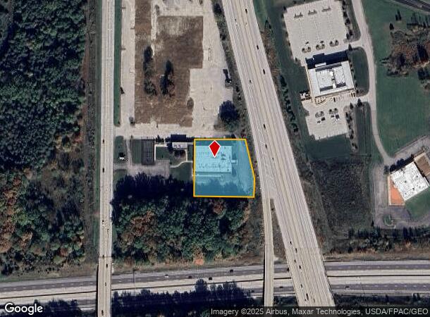
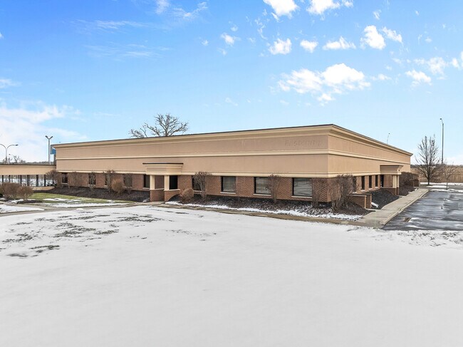
Property Record
6555 Dean Memorial Pkwy, Hudson, OH 44236
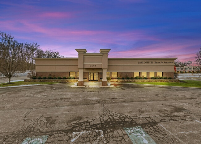

This Property Is For Sale
NEARBY LISTINGS FOR SALE OR LEASE
Property Detail
6555 Dean Memorial Pkwy
Akron, OH
Hines Hill
13-00961
LOT 3 S OF S OF S OF HINES HILL RD & W OF TR 8 LESS PT FOR RD 49-WLV
Officebuilding
Summit
X
Ohio
39035C0345E
3
2023
1.38 AC
2025
Akron
532600
Cleveland
18,170 SF
DEMOGRAPHICS near 6555 Dean Memorial Pkwy
1 Mile
3 Mile
5 Mile
2024 Total Population
784
14,886
49,459
2029 Population
767
14,823
48,873
Pop Growth 2024-2029
(2.17%)
(0.42%)
(1.18%)
Average Age
43
43
43
2024 Total Households
282
5,594
19,200
HH Growth 2024-2029
(2.13%)
(0.29%)
(1.16%)
Median Household Inc
$120,356
$127,719
$111,292
Avg Household Size
2.80
2.60
2.50
2024 Avg HH Vehicles
3.00
2.00
2.00
Median Home Value
$414,545
$343,351
$312,400
Median Year Built
1978
1994
1984
Nearby Places
- Restaurants
- Banks
- Shops
- Fitness
- Groceries
PUBLIC TRANSPORTATION
COMMUTER RAIL
DRIVE
WALK
Distance
9 min
3.9 mi
DRIVE
WALK
Distance
10 min
5.4 mi
AIRPORT
Akron-Canton Regional
DRIVE
WALK
Distance
Akron-Canton Regional
36 min
26.7 mi
Cleveland-Hopkins International
DRIVE
WALK
Distance
Cleveland-Hopkins International
40 min
28.6 mi
Nearby Properties
Address
Land Use
TOTAL SIZE
Lot Size
Zoning
Address
Land Use
TOTAL SIZE
Lot Size
Zoning
Address
Land Use
TOTAL SIZE
Lot Size
Zoning
439,460 SF
146.63 AC
Address
Land Use
TOTAL SIZE
Lot Size
Zoning
1,020,250 SF
63.69 AC
Address
Land Use
TOTAL SIZE
Lot Size
Zoning
Address
Land Use
TOTAL SIZE
Lot Size
Zoning
230,501 SF
39.59 AC
Address
Land Use
TOTAL SIZE
Lot Size
Zoning
44,697 SF
17.83 AC
Address
Land Use
TOTAL SIZE
Lot Size
Zoning
110,681 SF
6.85 AC
Address
Land Use
TOTAL SIZE
Lot Size
Zoning
69,972 SF
15 AC
Address
Land Use
TOTAL SIZE
Lot Size
Zoning
178.21 AC
Address
Land Use
TOTAL SIZE
Lot Size
Zoning
258,840 SF
25.62 AC
Address
Land Use
TOTAL SIZE
Lot Size
Zoning
136,800 SF
7.86 AC
Address
Land Use
TOTAL SIZE
Lot Size
Zoning
107,836 SF
9.08 AC
Address
Land Use
TOTAL SIZE
Lot Size
Zoning
Address
Land Use
TOTAL SIZE
Lot Size
Zoning
41,480 SF
7.09 AC
Address
Land Use
TOTAL SIZE
Lot Size
Zoning
111,766 SF
32.18 AC
Address
Land Use
TOTAL SIZE
Lot Size
Zoning
14,247 SF
262 AC
Address
Land Use
TOTAL SIZE
Lot Size
Zoning
87,860 SF
8.71 AC
Address
Land Use
TOTAL SIZE
Lot Size
Zoning
64,944 SF
443.23 AC
Address
Land Use
TOTAL SIZE
Lot Size
Zoning
179,862 SF
15.81 AC
Address
Land Use
TOTAL SIZE
Lot Size
Zoning
99,702 SF
10.86 AC
Address
Land Use
TOTAL SIZE
Lot Size
Zoning
41,774 SF
31.40 AC
Address
Land Use
TOTAL SIZE
Lot Size
Zoning
Address
Land Use
TOTAL SIZE
Lot Size
Zoning
Address
Land Use
TOTAL SIZE
Lot Size
Zoning
38,863 SF
239.55 AC
Address
Land Use
TOTAL SIZE
Lot Size
Zoning
254,000 SF
20 AC
Address
Land Use
TOTAL SIZE
Lot Size
Zoning
147,780 SF
15.31 AC
Address
Land Use
TOTAL SIZE
Lot Size
Zoning
171,464 SF
20.64 AC
Address
Land Use
TOTAL SIZE
Lot Size
Zoning
148,800 SF
13.63 AC
Address
Land Use
TOTAL SIZE
Lot Size
Zoning
146,666 SF
13.52 AC
Address
Land Use
TOTAL SIZE
Lot Size
Zoning
42,040 SF
7.45 AC
The World's #1 Commercial Real Estate Marketplace
Connect with us
© 2025 CoStar Group
The information above has been obtained from sources believed reliable. While we do not doubt its accuracy we have not verified it and make no guarantee, warranty or representation about it. It is your responsibility to independently confirm its accuracy and completeness. Any projections, opinions, assumptions, or estimates used are for example only and do not represent the current or future performance of the property. The value of this transaction to you depends on tax and other factors which should be evaluated by your tax, financial, and legal advisors. You and your advisors should conduct a careful, independent investigation of the property to determine to your satisfaction the suitability of the property for your needs.