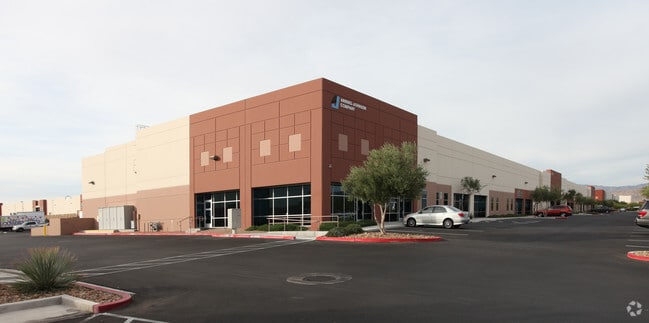
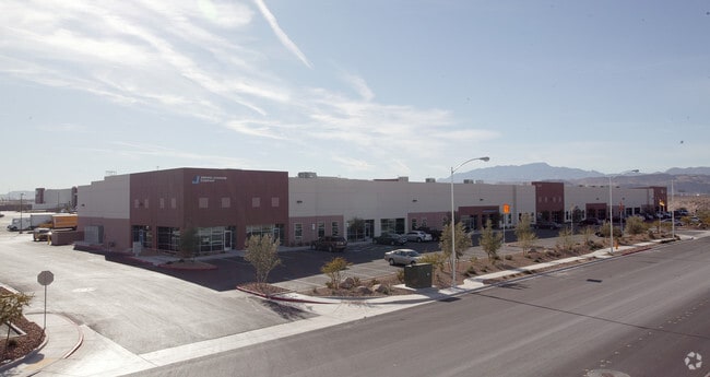
Property Record
7465 W Sunset Rd, Las Vegas, NV 89113
NEARBY LISTINGS FOR SALE OR LEASE
Property Detail
7465 W Sunset Rd
Las Vegas-Henderson-Paradise, NV
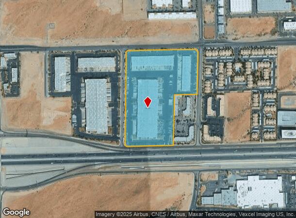
Parcel Map File 121 Page 015
176-03-101-018
PARCEL MAP FILE 121 PAGE 15 LOT 1
Shipyard
Clark
X
Nevada
32003C2535F
1
2025
22.21 AC
2025
SW Las Vegas
002975
Las Vegas
305,881 SF
DEMOGRAPHICS near 7465 W Sunset Rd
1 Mile
3 Mile
5 Mile
2024 Total Population
9,957
162,344
372,089
2029 Population
10,902
175,539
402,254
Pop Growth 2024-2029
+ 9.49%
+ 8.13%
+ 8.11%
Average Age
38
38
39
2024 Total Households
3,929
61,855
142,614
HH Growth 2024-2029
+ 9.39%
+ 8.05%
+ 8.03%
Median Household Inc
$72,008
$71,686
$70,830
Avg Household Size
2.50
2.60
2.60
2024 Avg HH Vehicles
2.00
2.00
2.00
Median Home Value
$375,729
$386,036
$400,284
Median Year Built
2005
2003
2002
Nearby Places
Map Layers
Map Styles
 Street
 Aerial
- Restaurants
- Banks
- Shops
- Fitness
- Groceries
PUBLIC TRANSPORTATION
AIRPORT
Harry Reid International
DRIVE
WALK
Distance
Harry Reid International
13 min
9.0 mi
Boulder City Municipal
DRIVE
WALK
Distance
Boulder City Municipal
38 min
28.6 mi
Freight Ports
Port of Long Beach
DRIVE
WALK
Distance
Port of Long Beach
315 min
280.6 mi
SALE & LEASE HISTORY
LISTING DATE
SALE/LEASE

Aug 28, 2017
For Lease
Nearby Properties
Address
Land Use
TOTAL SIZE
Lot Size
Zoning
Address
Land Use
TOTAL SIZE
Lot Size
Zoning
552,417 SF
49.39 AC
H1
Address
Land Use
TOTAL SIZE
Lot Size
Zoning
412,086 SF
33.58 AC
CP
Address
Land Use
TOTAL SIZE
Lot Size
Zoning
190,129 SF
36.24 AC
C1
Address
Land Use
TOTAL SIZE
Lot Size
Zoning
35.25 AC
MD
Address
Land Use
TOTAL SIZE
Lot Size
Zoning
257,910 SF
31.47 AC
Address
Land Use
TOTAL SIZE
Lot Size
Zoning
29.59 AC
CP
Address
Land Use
TOTAL SIZE
Lot Size
Zoning
760,651 SF
41.25 AC
Address
Land Use
TOTAL SIZE
Lot Size
Zoning
9,279 SF
24.36 AC
Address
Land Use
TOTAL SIZE
Lot Size
Zoning
317,500 SF
19.26 AC
Address
Land Use
TOTAL SIZE
Lot Size
Zoning
353,690 SF
17.23 AC
Address
Land Use
TOTAL SIZE
Lot Size
Zoning
349,295 SF
25.97 AC
Address
Land Use
TOTAL SIZE
Lot Size
Zoning
8,754 SF
17.14 AC
C2
Address
Land Use
TOTAL SIZE
Lot Size
Zoning
262,750 SF
17.95 AC
Address
Land Use
TOTAL SIZE
Lot Size
Zoning
6,142 SF
13.96 AC
C2
Address
Land Use
TOTAL SIZE
Lot Size
Zoning
151,243 SF
22.93 AC
Address
Land Use
TOTAL SIZE
Lot Size
Zoning
930,204 SF
53.28 AC
MD
Address
Land Use
TOTAL SIZE
Lot Size
Zoning
401,023 SF
17.61 AC
R-3
Address
Land Use
TOTAL SIZE
Lot Size
Zoning
222,625 SF
16.99 AC
Address
Land Use
TOTAL SIZE
Lot Size
Zoning
35.55 AC
PF
Address
Land Use
TOTAL SIZE
Lot Size
Zoning
18.62 AC
PF
Address
Land Use
TOTAL SIZE
Lot Size
Zoning
374,101 SF
31.11 AC
Address
Land Use
TOTAL SIZE
Lot Size
Zoning
396,742 SF
17.10 AC
Address
Land Use
TOTAL SIZE
Lot Size
Zoning
239,500 SF
13.18 AC
Address
Land Use
TOTAL SIZE
Lot Size
Zoning
10,869 SF
14.77 AC
Address
Land Use
TOTAL SIZE
Lot Size
Zoning
1,961 SF
4.34 AC
Address
Land Use
TOTAL SIZE
Lot Size
Zoning
9.34 AC
Address
Land Use
TOTAL SIZE
Lot Size
Zoning
5,374 SF
12.36 AC
Address
Land Use
TOTAL SIZE
Lot Size
Zoning
4,199 SF
12.11 AC
RE
Address
Land Use
TOTAL SIZE
Lot Size
Zoning
220,718 SF
3.99 AC
C2
The World's #1 Commercial Real Estate Marketplace
Connect with us
© 2025 CoStar Group
The information above has been obtained from sources believed reliable. While we do not doubt its accuracy we have not verified it and make no guarantee, warranty or representation about it. It is your responsibility to independently confirm its accuracy and completeness. Any projections, opinions, assumptions, or estimates used are for example only and do not represent the current or future performance of the property. The value of this transaction to you depends on tax and other factors which should be evaluated by your tax, financial, and legal advisors. You and your advisors should conduct a careful, independent investigation of the property to determine to your satisfaction the suitability of the property for your needs.