Property Record
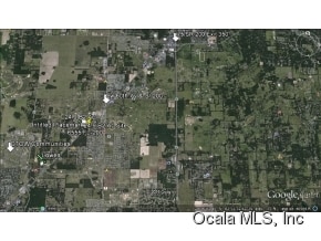
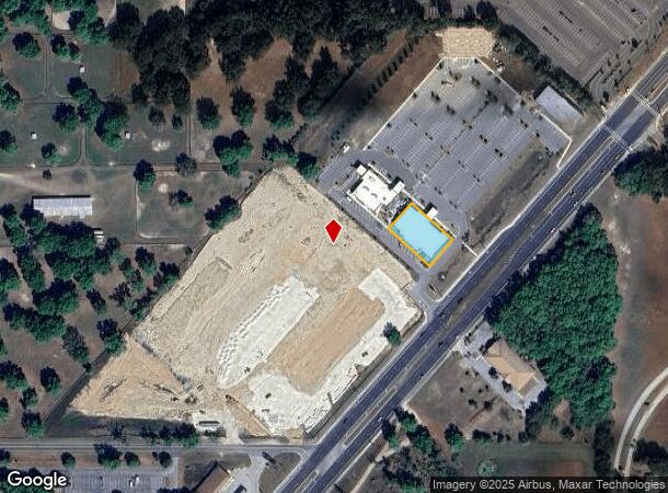
6555 Sw Highway 200, Ocala, FL 34476
NEARBY LISTINGS FOR SALE OR LEASE
Property Detail
6555 Sw Highway 200
35485-100-00
Cvi Professional Park
Medicalbuilding
SEC 08 TWP 16 RGE 21 CVI PROFESSIONAL PARK A CONDOMINIUM RECORDED IN OR BK 7205/1435 AND RESTATED AND AMENDED IN OR BK 7218/0192 UNIT 100 BEING MORE PARTICULARLY DESCRIBED AS FOLLOWS: COM AT THE SW COR OF SECTION 8-16-21 TH N ALG THE W BDY OF SAID SE
X
Marion
12083C0701E
Florida
0
0.43 AC
2025
Outlying Marion County
002505
Ocala
15,620 SF
Ocala, FL
DEMOGRAPHICS near 6555 Sw Highway 200
1 Mile
3 Mile
5 Mile
2024 Total Population
2,621
27,963
64,211
2029 Population
2,972
31,636
72,732
Pop Growth 2024-2029
+ 13.39%
+ 13.14%
+ 13.27%
Average Age
54
54
54
2024 Total Households
1,225
13,106
30,173
HH Growth 2024-2029
+ 13.31%
+ 13.09%
+ 13.19%
Median Household Inc
$52,340
$58,083
$58,068
Avg Household Size
2.10
2.10
2.10
2024 Avg HH Vehicles
2.00
2.00
2.00
Median Home Value
$184,787
$217,315
$211,212
Median Year Built
1996
1999
1997
Nearby Places
Map Layers
Map Styles
 Street
 Aerial
- Restaurants
- Banks
- Shops
- Fitness
- Groceries
SALE & LEASE HISTORY
LISTING DATE
SALE/LEASE

Sep 24, 2016
For Sale
Oct 11, 2017
For Sale
Nearby Properties
Address
Land Use
TOTAL SIZE
Lot Size
Zoning
Address
Land Use
TOTAL SIZE
Lot Size
Zoning
156,201 SF
36.77 AC
INST
Address
Land Use
TOTAL SIZE
Lot Size
Zoning
120,296 SF
35.67 AC
PD
Address
Land Use
TOTAL SIZE
Lot Size
Zoning
192,480 SF
23.19 AC
R3
Address
Land Use
TOTAL SIZE
Lot Size
Zoning
189,662 SF
25.54 AC
B2
Address
Land Use
TOTAL SIZE
Lot Size
Zoning
380,749 SF
40.05 AC
PUD
Address
Land Use
TOTAL SIZE
Lot Size
Zoning
124,557 SF
39.04 AC
GU
Address
Land Use
TOTAL SIZE
Lot Size
Zoning
304,259 SF
31.62 AC
PUD
Address
Land Use
TOTAL SIZE
Lot Size
Zoning
59,706 SF
10.01 AC
PD
Address
Land Use
TOTAL SIZE
Lot Size
Zoning
96,094 SF
13.66 AC
B2
Address
Land Use
TOTAL SIZE
Lot Size
Zoning
62,253 SF
6.52 AC
PUD
Address
Land Use
TOTAL SIZE
Lot Size
Zoning
95,496 SF
25.25 AC
R3
Address
Land Use
TOTAL SIZE
Lot Size
Zoning
74,928 SF
7.80 AC
PUD
Address
Land Use
TOTAL SIZE
Lot Size
Zoning
18,035 SF
3.33 AC
B2
Address
Land Use
TOTAL SIZE
Lot Size
Zoning
68,372 SF
21.78 AC
B4
Address
Land Use
TOTAL SIZE
Lot Size
Zoning
44,276 SF
5 AC
O1
Address
Land Use
TOTAL SIZE
Lot Size
Zoning
139,728 SF
22.86 AC
B4
Address
Land Use
TOTAL SIZE
Lot Size
Zoning
84,004 SF
9.77 AC
SC
Address
Land Use
TOTAL SIZE
Lot Size
Zoning
65,060 SF
11.90 AC
B2
Address
Land Use
TOTAL SIZE
Lot Size
Zoning
23,783 SF
3.27 AC
B2
Address
Land Use
TOTAL SIZE
Lot Size
Zoning
60,706 SF
84.49 AC
PUD
Address
Land Use
TOTAL SIZE
Lot Size
Zoning
77,877 SF
13.38 AC
B2
Address
Land Use
TOTAL SIZE
Lot Size
Zoning
128,206 SF
11.38 AC
SC
Address
Land Use
TOTAL SIZE
Lot Size
Zoning
42,673 SF
13.72 AC
A1
Address
Land Use
TOTAL SIZE
Lot Size
Zoning
11,837 SF
3.99 AC
OP
Address
Land Use
TOTAL SIZE
Lot Size
Zoning
42,159 SF
5.95 AC
B2
Address
Land Use
TOTAL SIZE
Lot Size
Zoning
20,982 SF
4 AC
O1
Address
Land Use
TOTAL SIZE
Lot Size
Zoning
99,045 SF
7.19 AC
B2
Address
Land Use
TOTAL SIZE
Lot Size
Zoning
82,465 SF
6.13 AC
B2
Address
Land Use
TOTAL SIZE
Lot Size
Zoning
82,904 SF
10.51 AC
B2
Address
Land Use
TOTAL SIZE
Lot Size
Zoning
47,600 SF
735.53 AC
PD
The World's #1 Commercial Real Estate Marketplace
Connect with us
© 2026 CoStar Group
The information above has been obtained from sources believed reliable. While we do not doubt its accuracy we have not verified it and make no guarantee, warranty or representation about it. It is your responsibility to independently confirm its accuracy and completeness. Any projections, opinions, assumptions, or estimates used are for example only and do not represent the current or future performance of the property. The value of this transaction to you depends on tax and other factors which should be evaluated by your tax, financial, and legal advisors. You and your advisors should conduct a careful, independent investigation of the property to determine to your satisfaction the suitability of the property for your needs.