Property Record
656 Center St, Ludlow, MA 01056


Save to a Folder
{{folder.Name}}
{{folder.ListingIds.length}} Properties
{{folder.ListingIds.length}} Property
Create a New Folder
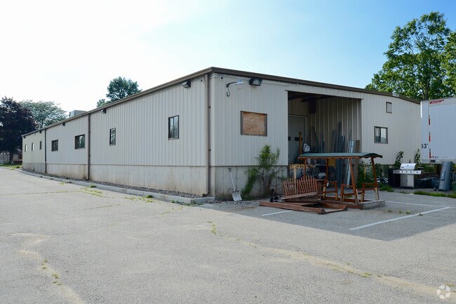
Property Detail
656 Center St
LUDL-160355-C000013-000001
Hampden
Commercialnec
Massachusetts
B and X Area of moderate flood hazard, usually the area between the limits of the 100-year and 500-year floods.
5.73 AC
2025
Hampden County
2025
Hartford
810414
Springfield, MA
NEARBY LISTINGS FOR SALE OR LEASE
DEMOGRAPHICS near 656 Center St
1 mile
3 mile
5 mile
2025 Total Population
3,255
31,912
91,913
2030 Population
3,270
32,075
92,917
Pop Growth 2025-2030
+ 0.46%
+ 0.51%
+ 1.09%
Average Age
47
43
42
2025 Total Households
1,394
12,644
36,432
HH Growth 2025-2030
+ 0.36%
+ 0.47%
+ 1.17%
Median Household Inc
$67,922
$72,385
$70,881
Avg Household Size
2.20
2.40
2.40
2025 Avg HH Vehicles
2.00
2.00
2.00
Median Home Value
$308,458
$324,074
$294,933
Median Year Built
1972
1962
1977
Nearby Places
Map Layers
Map Styles
 Street
 Aerial
Layers
 Traffic
 Biking
Places
Listings with unknown addresses are not visible on the map
- Restaurants
- Banks
- Shops
- Fitness
- Groceries
PUBLIC TRANSPORTATION
AIRPORT
Bradley International
Drive
Walk
Distance
Bradley International
47 min
24.1 mi
Freight Ports
Port of New Haven
Drive
Walk
Distance
Port of New Haven
98 min
74.9 mi
Nearby Properties
Address
Land Use
TOTAL SIZE
Lot Size
Zoning
Address
Land Use
TOTAL SIZE
Lot Size
Zoning
45,444 SF
13.80 AC
Address
Land Use
TOTAL SIZE
Lot Size
Zoning
131,942 SF
40.30 AC
R1
Address
Land Use
TOTAL SIZE
Lot Size
Zoning
60.25 AC
Address
Land Use
TOTAL SIZE
Lot Size
Zoning
39,776 SF
8.16 AC
R2
Address
Land Use
TOTAL SIZE
Lot Size
Zoning
71,911 SF
9.19 AC
Address
Land Use
TOTAL SIZE
Lot Size
Zoning
136,326 SF
65.19 AC
Address
Land Use
TOTAL SIZE
Lot Size
Zoning
15.31 AC
GB
Address
Land Use
TOTAL SIZE
Lot Size
Zoning
34 AC
Address
Land Use
TOTAL SIZE
Lot Size
Zoning
3,534 SF
38.61 AC
R-3
Address
Land Use
TOTAL SIZE
Lot Size
Zoning
109,136 SF
5.01 AC
Address
Land Use
TOTAL SIZE
Lot Size
Zoning
139,292 SF
12.54 AC
SB1I2
Address
Land Use
TOTAL SIZE
Lot Size
Zoning
34.44 AC
I
Address
Land Use
TOTAL SIZE
Lot Size
Zoning
13.02 AC
Address
Land Use
TOTAL SIZE
Lot Size
Zoning
133,600 SF
23.27 AC
R3
Address
Land Use
TOTAL SIZE
Lot Size
Zoning
116,670 SF
13 AC
GB
Address
Land Use
TOTAL SIZE
Lot Size
Zoning
243.13 AC
109
Address
Land Use
TOTAL SIZE
Lot Size
Zoning
1,292 SF
8.92 AC
B1
Address
Land Use
TOTAL SIZE
Lot Size
Zoning
88,560 SF
2.81 AC
GB
Address
Land Use
TOTAL SIZE
Lot Size
Zoning
193,769 SF
22.62 AC
SB1R2
Address
Land Use
TOTAL SIZE
Lot Size
Zoning
77,200 SF
10.63 AC
I
Address
Land Use
TOTAL SIZE
Lot Size
Zoning
72,793 SF
1.50 AC
Address
Land Use
TOTAL SIZE
Lot Size
Zoning
1,200 SF
1.61 AC
B2
Address
Land Use
TOTAL SIZE
Lot Size
Zoning
30,428 SF
1.46 AC
R2
Address
Land Use
TOTAL SIZE
Lot Size
Zoning
62,702 SF
3.99 AC
SB1I2
Address
Land Use
TOTAL SIZE
Lot Size
Zoning
1,230 SF
38.23 AC
OS
Address
Land Use
TOTAL SIZE
Lot Size
Zoning
82.05 AC
AG
Address
Land Use
TOTAL SIZE
Lot Size
Zoning
17,692 SF
4.35 AC
Address
Land Use
TOTAL SIZE
Lot Size
Zoning
16.50 AC
Address
Land Use
TOTAL SIZE
Lot Size
Zoning
26,712 SF
6.18 AC
GB
Address
Land Use
TOTAL SIZE
Lot Size
Zoning
26,796 SF
14.84 AC
GB
The World's #1 Commercial Real Estate Marketplace
Connect with us
© 2026 CoStar Group
The information above has been obtained from sources believed reliable. While we do not doubt its accuracy we have not verified it and make no guarantee, warranty or representation about it. It is your responsibility to independently confirm its accuracy and completeness. Any projections, opinions, assumptions, or estimates used are for example only and do not represent the current or future performance of the property. The value of this transaction to you depends on tax and other factors which should be evaluated by your tax, financial, and legal advisors. You and your advisors should conduct a careful, independent investigation of the property to determine to your satisfaction the suitability of the property for your needs.