Property Record
6565 Saint Elmo Rd, Bartlett, TN 38135


NEARBY LISTINGS FOR SALE OR LEASE
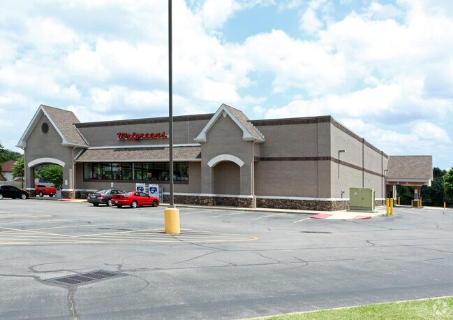
Property Detail
6565 Saint Elmo Rd
Memphis, TN-MS-AR
Alturia Creek Commercial Center
B0-157-0-0900
SS ST ELMO RD COR MEMPHIS ARLINGTON RD (SE) SEE MAP D1-57W (TILE# 316)
Storebuilding
Shelby
X
Tennessee
47157C0301G
4
2024
2.04 AC
2025
Northeast
020634
Memphis
14,897 SF
DEMOGRAPHICS near 6565 Saint Elmo Rd
1 Mile
3 Mile
5 Mile
2024 Total Population
10,355
58,728
128,808
2029 Population
9,977
56,787
125,188
Pop Growth 2024-2029
(3.65%)
(3.31%)
(2.81%)
Average Age
42
40
38
2024 Total Households
3,999
21,473
48,921
HH Growth 2024-2029
(3.80%)
(3.43%)
(2.88%)
Median Household Inc
$88,584
$75,758
$64,210
Avg Household Size
2.50
2.70
2.60
2024 Avg HH Vehicles
2.00
2.00
2.00
Median Home Value
$220,478
$208,999
$198,643
Median Year Built
1990
1987
1986
Nearby Places
Map Layers
Map Styles
 Street
 Aerial
- Restaurants
- Banks
- Shops
- Fitness
- Groceries
PUBLIC TRANSPORTATION
AIRPORT
Memphis International
DRIVE
WALK
Distance
Memphis International
32 min
18.7 mi
Nearby Properties
Address
Land Use
TOTAL SIZE
Lot Size
Zoning
Address
Land Use
TOTAL SIZE
Lot Size
Zoning
1,153,892 SF
50.47 AC
I-P
Address
Land Use
TOTAL SIZE
Lot Size
Zoning
207,537 SF
21.73 AC
C-G
Address
Land Use
TOTAL SIZE
Lot Size
Zoning
498,680 SF
46.61 AC
I-P
Address
Land Use
TOTAL SIZE
Lot Size
Zoning
62,852 SF
10.15 AC
RS-12
Address
Land Use
TOTAL SIZE
Lot Size
Zoning
108,678 SF
8.99 AC
R-E
Address
Land Use
TOTAL SIZE
Lot Size
Zoning
56,431 SF
1.24 AC
C-G
Address
Land Use
TOTAL SIZE
Lot Size
Zoning
133,020 SF
11.73 AC
SC-1
Address
Land Use
TOTAL SIZE
Lot Size
Zoning
198,103 SF
17.75 AC
CG-MS
Address
Land Use
TOTAL SIZE
Lot Size
Zoning
199,320 SF
9.05 AC
CA
Address
Land Use
TOTAL SIZE
Lot Size
Zoning
134,599 SF
6.43 AC
I-P
Address
Land Use
TOTAL SIZE
Lot Size
Zoning
256,617 SF
10.54 AC
I-P
Address
Land Use
TOTAL SIZE
Lot Size
Zoning
86,875 SF
7.09 AC
I-P
Address
Land Use
TOTAL SIZE
Lot Size
Zoning
142,703 SF
18.62 AC
CMU-3
Address
Land Use
TOTAL SIZE
Lot Size
Zoning
39,018 SF
22.21 AC
RU-2
Address
Land Use
TOTAL SIZE
Lot Size
Zoning
67,961 SF
19.02 AC
RU-3
Address
Land Use
TOTAL SIZE
Lot Size
Zoning
67,640 SF
20.28 AC
R-M
Address
Land Use
TOTAL SIZE
Lot Size
Zoning
181,319 SF
14.82 AC
CMU-2
Address
Land Use
TOTAL SIZE
Lot Size
Zoning
76,169 SF
5.39 AC
I-P
Address
Land Use
TOTAL SIZE
Lot Size
Zoning
120,000 SF
9.64 AC
I-P
Address
Land Use
TOTAL SIZE
Lot Size
Zoning
269,880 SF
15.24 AC
I-P
Address
Land Use
TOTAL SIZE
Lot Size
Zoning
43,419 SF
5.73 AC
I-O
Address
Land Use
TOTAL SIZE
Lot Size
Zoning
85,332 SF
10.51 AC
R-M
Address
Land Use
TOTAL SIZE
Lot Size
Zoning
140,987 SF
16.22 AC
SC-1
Address
Land Use
TOTAL SIZE
Lot Size
Zoning
63,096 SF
7.10 AC
CMU-3
Address
Land Use
TOTAL SIZE
Lot Size
Zoning
38,833 SF
4.84 AC
I-P
Address
Land Use
TOTAL SIZE
Lot Size
Zoning
50,538 SF
5 AC
R-10
Address
Land Use
TOTAL SIZE
Lot Size
Zoning
232,375 SF
20 AC
I-P
Address
Land Use
TOTAL SIZE
Lot Size
Zoning
69,158 SF
7.75 AC
RU-3
Address
Land Use
TOTAL SIZE
Lot Size
Zoning
59,392 SF
6.83 AC
CA
Address
Land Use
TOTAL SIZE
Lot Size
Zoning
51,770 SF
2.02 AC
I-O
The World's #1 Commercial Real Estate Marketplace
Connect with us
© 2025 CoStar Group
The information above has been obtained from sources believed reliable. While we do not doubt its accuracy we have not verified it and make no guarantee, warranty or representation about it. It is your responsibility to independently confirm its accuracy and completeness. Any projections, opinions, assumptions, or estimates used are for example only and do not represent the current or future performance of the property. The value of this transaction to you depends on tax and other factors which should be evaluated by your tax, financial, and legal advisors. You and your advisors should conduct a careful, independent investigation of the property to determine to your satisfaction the suitability of the property for your needs.