Property Record
6567 Main St, Trumbull, CT 06611
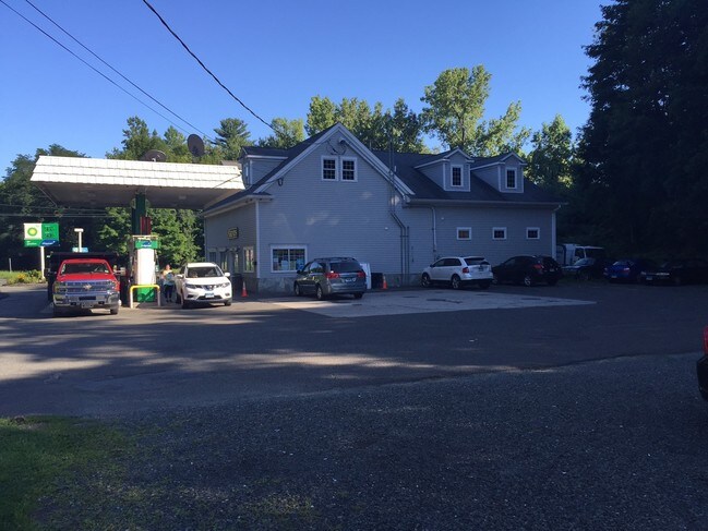


Property Detail
6567 Main St
TRUM-000003D-000000-000243
Greater Bridgeport
Commercialbuilding
Connecticut
A
243
B and X Area of moderate flood hazard, usually the area between the limits of the 100-year and 500-year floods.
0.84 AC
2025
Trumbull
2025
Westchester/So Connecticut
090200
Bridgeport-Stamford-Danbury, CT
2,860 SF
NEARBY LISTINGS FOR SALE OR LEASE
DEMOGRAPHICS near 6567 Main St
1 mile
3 mile
5 mile
2025 Total Population
5,430
31,997
100,556
2030 Population
5,582
32,924
104,028
Pop Growth 2025-2030
+ 2.80%
+ 2.90%
+ 3.45%
Average Age
44
43
42
2025 Total Households
1,910
11,000
34,543
HH Growth 2025-2030
+ 2.77%
+ 2.93%
+ 3.49%
Median Household Inc
$183,799
$175,723
$139,296
Avg Household Size
2.70
2.80
2.80
2025 Avg HH Vehicles
2.00
2.00
2.00
Median Home Value
$558,566
$573,081
$489,103
Median Year Built
1970
1966
1966
Nearby Places
Map Layers
Map Styles
 Street
 Aerial
Layers
 Traffic
 Biking
Places
Listings with unknown addresses are not visible on the map
- Restaurants
- Banks
- Shops
- Fitness
- Groceries
PUBLIC TRANSPORTATION
COMMUTER RAIL
Stratford Station (New Haven Line - Metro-North Commuter Railroad Company (Metro-North))
Drive
Walk
Distance
Stratford Station (New Haven Line - Metro-North Commuter Railroad Company (Metro-North))
17 min
9.1 mi
Bridgeport Station (New Haven Line - Metro-North Commuter Railroad Company (Metro-North))
Drive
Walk
Distance
Bridgeport Station (New Haven Line - Metro-North Commuter Railroad Company (Metro-North))
14 min
9.8 mi
AIRPORT
Tweed/New Haven
Drive
Walk
Distance
Tweed/New Haven
42 min
25.2 mi
Westchester County
Drive
Walk
Distance
Westchester County
55 min
37.7 mi
Long Island MacArthur
Drive
Walk
Distance
Long Island MacArthur
122 min
44.2 mi
Freight Ports
Port of New Haven
Drive
Walk
Distance
Port of New Haven
36 min
22.4 mi
SALE & LEASE HISTORY
LISTING DATE
SALE/LEASE

Sep 29, 2023
For Lease
Mar 27, 2017
For Sale
Jul 03, 2019
For Lease
Nearby Properties
Address
Land Use
TOTAL SIZE
Lot Size
Zoning
Address
Land Use
TOTAL SIZE
Lot Size
Zoning
273,968 SF
10 AC
AA
Address
Land Use
TOTAL SIZE
Lot Size
Zoning
1,482 SF
215.26 AC
R3
Address
Land Use
TOTAL SIZE
Lot Size
Zoning
150,135 SF
9 AC
AA
Address
Land Use
TOTAL SIZE
Lot Size
Zoning
32.50 AC
AA
Address
Land Use
TOTAL SIZE
Lot Size
Zoning
17.76 AC
BC
Address
Land Use
TOTAL SIZE
Lot Size
Zoning
12.41 AC
BC
Address
Land Use
TOTAL SIZE
Lot Size
Zoning
112,342 SF
87.75 AC
AA
Address
Land Use
TOTAL SIZE
Lot Size
Zoning
42.08 AC
Address
Land Use
TOTAL SIZE
Lot Size
Zoning
114,000 SF
10.37 AC
IL2
Address
Land Use
TOTAL SIZE
Lot Size
Zoning
13.84 AC
Address
Land Use
TOTAL SIZE
Lot Size
Zoning
167,262 SF
26.01 AC
I3
Address
Land Use
TOTAL SIZE
Lot Size
Zoning
83,043 SF
19.97 AC
AA
Address
Land Use
TOTAL SIZE
Lot Size
Zoning
63,784 SF
4.60 AC
Address
Land Use
TOTAL SIZE
Lot Size
Zoning
110,520 SF
9.21 AC
IL2
Address
Land Use
TOTAL SIZE
Lot Size
Zoning
16.09 AC
AA
Address
Land Use
TOTAL SIZE
Lot Size
Zoning
16.96 AC
AA
Address
Land Use
TOTAL SIZE
Lot Size
Zoning
175 AC
RF3 R
Address
Land Use
TOTAL SIZE
Lot Size
Zoning
4,000 SF
238.88 AC
AAA
Address
Land Use
TOTAL SIZE
Lot Size
Zoning
9,796 SF
24.75 AC
I3
Address
Land Use
TOTAL SIZE
Lot Size
Zoning
52,786 SF
20 AC
A
Address
Land Use
TOTAL SIZE
Lot Size
Zoning
60,749 SF
7.25 AC
B1
Address
Land Use
TOTAL SIZE
Lot Size
Zoning
80,580 SF
6.49 AC
IL2
Address
Land Use
TOTAL SIZE
Lot Size
Zoning
61,723 SF
15.26 AC
RF1
Address
Land Use
TOTAL SIZE
Lot Size
Zoning
40,849 SF
16.45 AC
R-1
Address
Land Use
TOTAL SIZE
Lot Size
Zoning
58,767 SF
32.50 AC
RF2
Address
Land Use
TOTAL SIZE
Lot Size
Zoning
86,611 SF
6.46 AC
IL
Address
Land Use
TOTAL SIZE
Lot Size
Zoning
53,439 SF
4.97 AC
IL2
Address
Land Use
TOTAL SIZE
Lot Size
Zoning
53,107 SF
5.02 AC
B2
Address
Land Use
TOTAL SIZE
Lot Size
Zoning
48,501 SF
5.84 AC
B1
Address
Land Use
TOTAL SIZE
Lot Size
Zoning
26,062 SF
3.12 AC
A
The World's #1 Commercial Real Estate Marketplace
Connect with us
© 2026 CoStar Group
The information above has been obtained from sources believed reliable. While we do not doubt its accuracy we have not verified it and make no guarantee, warranty or representation about it. It is your responsibility to independently confirm its accuracy and completeness. Any projections, opinions, assumptions, or estimates used are for example only and do not represent the current or future performance of the property. The value of this transaction to you depends on tax and other factors which should be evaluated by your tax, financial, and legal advisors. You and your advisors should conduct a careful, independent investigation of the property to determine to your satisfaction the suitability of the property for your needs.