Property Record
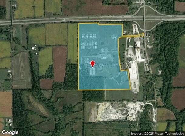
6569 State Route 503 N, Lewisburg, OH 45338

NEARBY LISTINGS FOR SALE OR LEASE
Property Detail
6569 State Route 503 N
Foodprocessing
SE 1/4
X
Preble
39135C0160E
Ohio
2024
107.04 AC
2024
Preble County
420100
Cincinnati/Dayton
128,750 SF
D14-7333-4-0-00-001-8001
DEMOGRAPHICS near 6569 State Route 503 N
1 Mile
3 Mile
5 Mile
2024 Total Population
492
3,641
6,085
2029 Population
488
3,610
6,000
Pop Growth 2024-2029
(0.81%)
(0.85%)
(1.40%)
Average Age
41
42
42
2024 Total Households
197
1,455
2,415
HH Growth 2024-2029
(0.51%)
(0.82%)
(1.37%)
Median Household Inc
$67,312
$65,675
$65,287
Avg Household Size
2.40
2.50
2.50
2024 Avg HH Vehicles
2.00
2.00
2.00
Median Home Value
$173,015
$163,799
$171,505
Median Year Built
1957
1957
1958
Nearby Places
Map Layers
Map Styles
 Street
 Aerial
- Restaurants
- Banks
- Shops
- Fitness
- Groceries
PUBLIC TRANSPORTATION
AIRPORT
James M Cox Dayton International
DRIVE
WALK
Distance
James M Cox Dayton International
32 min
21.9 mi
Freight Ports
Port of Toledo
DRIVE
WALK
Distance
Port of Toledo
194 min
165.6 mi
Nearby Properties
Address
Land Use
TOTAL SIZE
Lot Size
Zoning
Address
Land Use
TOTAL SIZE
Lot Size
Zoning
3,271 SF
0.81 AC
Address
Land Use
TOTAL SIZE
Lot Size
Zoning
18,982 SF
20.81 AC
Address
Land Use
TOTAL SIZE
Lot Size
Zoning
76,162 SF
30.83 AC
Address
Land Use
TOTAL SIZE
Lot Size
Zoning
Address
Land Use
TOTAL SIZE
Lot Size
Zoning
12,988 SF
Address
Land Use
TOTAL SIZE
Lot Size
Zoning
40,000 SF
18 AC
Address
Land Use
TOTAL SIZE
Lot Size
Zoning
Address
Land Use
TOTAL SIZE
Lot Size
Zoning
18,000 SF
10.53 AC
Address
Land Use
TOTAL SIZE
Lot Size
Zoning
16,132 SF
14.52 AC
Address
Land Use
TOTAL SIZE
Lot Size
Zoning
1,020 SF
1.19 AC
Address
Land Use
TOTAL SIZE
Lot Size
Zoning
9,000 SF
1.09 AC
Address
Land Use
TOTAL SIZE
Lot Size
Zoning
12,000 SF
2.97 AC
Address
Land Use
TOTAL SIZE
Lot Size
Zoning
704 SF
0.50 AC
Address
Land Use
TOTAL SIZE
Lot Size
Zoning
174.30 AC
Address
Land Use
TOTAL SIZE
Lot Size
Zoning
31,500 SF
10.68 AC
Address
Land Use
TOTAL SIZE
Lot Size
Zoning
1.13 AC
Address
Land Use
TOTAL SIZE
Lot Size
Zoning
3,360 SF
116.94 AC
Address
Land Use
TOTAL SIZE
Lot Size
Zoning
4,961 SF
3.80 AC
Address
Land Use
TOTAL SIZE
Lot Size
Zoning
123.05 AC
Address
Land Use
TOTAL SIZE
Lot Size
Zoning
1,374 SF
3.51 AC
Address
Land Use
TOTAL SIZE
Lot Size
Zoning
116.62 AC
Address
Land Use
TOTAL SIZE
Lot Size
Zoning
119.56 AC
Address
Land Use
TOTAL SIZE
Lot Size
Zoning
121.83 AC
Address
Land Use
TOTAL SIZE
Lot Size
Zoning
141.58 AC
Address
Land Use
TOTAL SIZE
Lot Size
Zoning
1,888 SF
119.05 AC
Address
Land Use
TOTAL SIZE
Lot Size
Zoning
Address
Land Use
TOTAL SIZE
Lot Size
Zoning
8,000 SF
12.78 AC
Address
Land Use
TOTAL SIZE
Lot Size
Zoning
6.44 AC
Address
Land Use
TOTAL SIZE
Lot Size
Zoning
2,104 SF
67.86 AC
The World's #1 Commercial Real Estate Marketplace
Connect with us
© 2025 CoStar Group
The information above has been obtained from sources believed reliable. While we do not doubt its accuracy we have not verified it and make no guarantee, warranty or representation about it. It is your responsibility to independently confirm its accuracy and completeness. Any projections, opinions, assumptions, or estimates used are for example only and do not represent the current or future performance of the property. The value of this transaction to you depends on tax and other factors which should be evaluated by your tax, financial, and legal advisors. You and your advisors should conduct a careful, independent investigation of the property to determine to your satisfaction the suitability of the property for your needs.