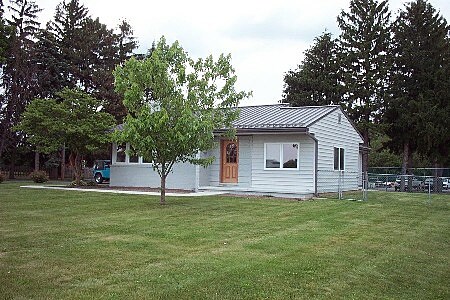
Property Record
657 Forge Rd, Carlisle, PA 17015


NEARBY LISTINGS FOR SALE OR LEASE
Property Detail
657 Forge Rd
40-10-0636-012
LAND APPROX 6 ACRES
Commercialofficeresidentialmixeduse
Cumberland
X
Pennsylvania
42041C0242E
5.95 AC
2025
Harrisburg Area West
2025
Philadelphia
012502
Harrisburg-Carlisle, PA
DEMOGRAPHICS near 657 Forge Rd
1 Mile
3 Mile
5 Mile
2024 Total Population
3,350
24,227
52,878
2029 Population
3,595
25,918
56,582
Pop Growth 2024-2029
+ 7.31%
+ 6.98%
+ 7.00%
Average Age
42
41
41
2024 Total Households
1,276
9,886
21,206
HH Growth 2024-2029
+ 7.68%
+ 7.16%
+ 7.12%
Median Household Inc
$119,880
$76,579
$73,522
Avg Household Size
2.60
2.30
2.30
2024 Avg HH Vehicles
2.00
2.00
2.00
Median Home Value
$273,457
$245,561
$228,901
Median Year Built
1991
1970
1971
Nearby Places
Map Layers
Map Styles
 Street
 Aerial
- Restaurants
- Banks
- Shops
- Fitness
- Groceries
PUBLIC TRANSPORTATION
AIRPORT
Harrisburg International
DRIVE
WALK
Distance
Harrisburg International
46 min
29.0 mi
Freight Ports
Port of Baltimore
DRIVE
WALK
Distance
Port of Baltimore
120 min
82.1 mi
SALE & LEASE HISTORY
LISTING DATE
SALE/LEASE

May 25, 2017
For Sale
Aug 07, 2017
For Sale
Nearby Properties
Address
Land Use
TOTAL SIZE
Lot Size
Zoning
Address
Land Use
TOTAL SIZE
Lot Size
Zoning
213.18 AC
Address
Land Use
TOTAL SIZE
Lot Size
Zoning
61.14 AC
Address
Land Use
TOTAL SIZE
Lot Size
Zoning
34.64 AC
Address
Land Use
TOTAL SIZE
Lot Size
Zoning
56.28 AC
Address
Land Use
TOTAL SIZE
Lot Size
Zoning
0.55 AC
Address
Land Use
TOTAL SIZE
Lot Size
Zoning
55.72 AC
Address
Land Use
TOTAL SIZE
Lot Size
Zoning
31.85 AC
Address
Land Use
TOTAL SIZE
Lot Size
Zoning
31.47 AC
Address
Land Use
TOTAL SIZE
Lot Size
Zoning
36.54 AC
Address
Land Use
TOTAL SIZE
Lot Size
Zoning
2.72 AC
Address
Land Use
TOTAL SIZE
Lot Size
Zoning
7.15 AC
Address
Land Use
TOTAL SIZE
Lot Size
Zoning
10.20 AC
Address
Land Use
TOTAL SIZE
Lot Size
Zoning
229.09 AC
Address
Land Use
TOTAL SIZE
Lot Size
Zoning
9.99 AC
Address
Land Use
TOTAL SIZE
Lot Size
Zoning
12.19 AC
Address
Land Use
TOTAL SIZE
Lot Size
Zoning
10.70 AC
Address
Land Use
TOTAL SIZE
Lot Size
Zoning
1.77 AC
Address
Land Use
TOTAL SIZE
Lot Size
Zoning
3.10 AC
Address
Land Use
TOTAL SIZE
Lot Size
Zoning
15.20 AC
Address
Land Use
TOTAL SIZE
Lot Size
Zoning
24.44 AC
Address
Land Use
TOTAL SIZE
Lot Size
Zoning
17.24 AC
Address
Land Use
TOTAL SIZE
Lot Size
Zoning
0.22 AC
Address
Land Use
TOTAL SIZE
Lot Size
Zoning
12.13 AC
Address
Land Use
TOTAL SIZE
Lot Size
Zoning
0.87 AC
Address
Land Use
TOTAL SIZE
Lot Size
Zoning
13.88 AC
Address
Land Use
TOTAL SIZE
Lot Size
Zoning
12.84 AC
Address
Land Use
TOTAL SIZE
Lot Size
Zoning
Address
Land Use
TOTAL SIZE
Lot Size
Zoning
4.26 AC
Address
Land Use
TOTAL SIZE
Lot Size
Zoning
0.50 AC
Address
Land Use
TOTAL SIZE
Lot Size
Zoning
3.25 AC
The World's #1 Commercial Real Estate Marketplace
Connect with us
© 2026 CoStar Group
The information above has been obtained from sources believed reliable. While we do not doubt its accuracy we have not verified it and make no guarantee, warranty or representation about it. It is your responsibility to independently confirm its accuracy and completeness. Any projections, opinions, assumptions, or estimates used are for example only and do not represent the current or future performance of the property. The value of this transaction to you depends on tax and other factors which should be evaluated by your tax, financial, and legal advisors. You and your advisors should conduct a careful, independent investigation of the property to determine to your satisfaction the suitability of the property for your needs.