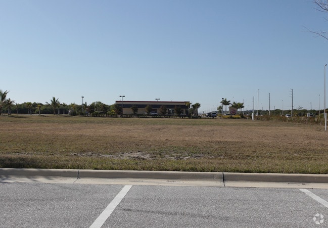
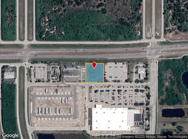
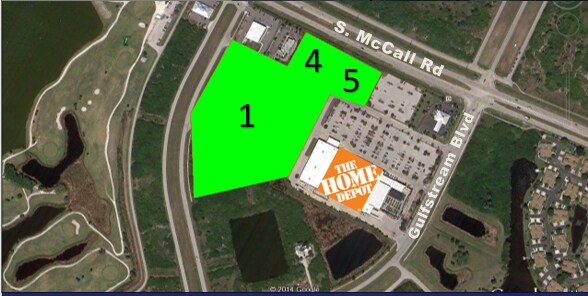
Property Record
12591 S Mccall Rd, Port Charlotte, FL 33981
NEARBY LISTINGS FOR SALE OR LEASE
Property Detail
12591 S Mccall Rd
Punta Gorda, FL
Crown Plaza West
412105482002
CROWN PLAZA WEST LT5 E3332/629 CT3486/1295 3757/1230 4045/1396 5027/161 3243192
Commercialacreage
Charlotte
AE
Florida
12015C0211G
5
2024
1.01 AC
2025
Charlotte County
030102
Southwest Florida
DEMOGRAPHICS near 12591 S Mccall Rd
1 Mile
3 Mile
5 Mile
2024 Total Population
2,285
22,551
48,299
2029 Population
2,765
27,348
58,746
Pop Growth 2024-2029
+ 21.01%
+ 21.27%
+ 21.63%
Average Age
51
54
56
2024 Total Households
1,059
10,352
22,927
HH Growth 2024-2029
+ 21.15%
+ 21.44%
+ 21.83%
Median Household Inc
$59,521
$61,545
$60,830
Avg Household Size
2.10
2.20
2.10
2024 Avg HH Vehicles
2.00
2.00
2.00
Median Home Value
$234,293
$272,830
$276,466
Median Year Built
1988
1997
1997
Nearby Places
- Restaurants
- Banks
- Shops
- Fitness
- Groceries
PUBLIC TRANSPORTATION
AIRPORT
Punta Gorda
DRIVE
WALK
Distance
Punta Gorda
37 min
21.6 mi
Freight Ports
Port Manatee
DRIVE
WALK
Distance
Port Manatee
84 min
61.8 mi
SALE & LEASE HISTORY
LISTING DATE
SALE/LEASE

Sep 24, 2016
For Sale
Nearby Properties
Address
Land Use
TOTAL SIZE
Lot Size
Zoning
Address
Land Use
TOTAL SIZE
Lot Size
Zoning
99,840 SF
7.60 AC
IG
Address
Land Use
TOTAL SIZE
Lot Size
Zoning
67,466 SF
16.30 AC
CG
Address
Land Use
TOTAL SIZE
Lot Size
Zoning
27.65 AC
RMF15
Address
Land Use
TOTAL SIZE
Lot Size
Zoning
108,048 SF
14.84 AC
CG
Address
Land Use
TOTAL SIZE
Lot Size
Zoning
132.79 AC
PKR
Address
Land Use
TOTAL SIZE
Lot Size
Zoning
2,016 SF
315.56 AC
PD
Address
Land Use
TOTAL SIZE
Lot Size
Zoning
51,683 SF
7.16 AC
CG
Address
Land Use
TOTAL SIZE
Lot Size
Zoning
100,910 SF
22.85 AC
RSF3.5
Address
Land Use
TOTAL SIZE
Lot Size
Zoning
34.11 AC
CG
Address
Land Use
TOTAL SIZE
Lot Size
Zoning
20.12 AC
CG
Address
Land Use
TOTAL SIZE
Lot Size
Zoning
38.14 AC
IG
Address
Land Use
TOTAL SIZE
Lot Size
Zoning
6,055 SF
2.74 AC
RMF15
Address
Land Use
TOTAL SIZE
Lot Size
Zoning
12,300 SF
5.02 AC
IG
Address
Land Use
TOTAL SIZE
Lot Size
Zoning
11,509 SF
12.06 AC
RSF3.5
Address
Land Use
TOTAL SIZE
Lot Size
Zoning
0.20 AC
RSF3.5
Address
Land Use
TOTAL SIZE
Lot Size
Zoning
6,476 SF
17.26 AC
II
Address
Land Use
TOTAL SIZE
Lot Size
Zoning
560 SF
10.23 AC
IG
Address
Land Use
TOTAL SIZE
Lot Size
Zoning
16.53 AC
CG
Address
Land Use
TOTAL SIZE
Lot Size
Zoning
8,510 SF
2.25 AC
CG
Address
Land Use
TOTAL SIZE
Lot Size
Zoning
5,222 SF
85.60 AC
RMF10
Address
Land Use
TOTAL SIZE
Lot Size
Zoning
3,864 SF
2 AC
CG
Address
Land Use
TOTAL SIZE
Lot Size
Zoning
12,907 SF
165.69 AC
RSF5
Address
Land Use
TOTAL SIZE
Lot Size
Zoning
18,599 SF
1.96 AC
IG
Address
Land Use
TOTAL SIZE
Lot Size
Zoning
576 SF
5 AC
II
Address
Land Use
TOTAL SIZE
Lot Size
Zoning
10.88 AC
CG
Address
Land Use
TOTAL SIZE
Lot Size
Zoning
11,708 SF
9.99 AC
II
Address
Land Use
TOTAL SIZE
Lot Size
Zoning
3,767 SF
88.50 AC
RSF2
Address
Land Use
TOTAL SIZE
Lot Size
Zoning
4,000 SF
7.78 AC
RMF10
Address
Land Use
TOTAL SIZE
Lot Size
Zoning
3,589 SF
1.47 AC
CG
The World's #1 Commercial Real Estate Marketplace
Connect with us
© 2025 CoStar Group
The information above has been obtained from sources believed reliable. While we do not doubt its accuracy we have not verified it and make no guarantee, warranty or representation about it. It is your responsibility to independently confirm its accuracy and completeness. Any projections, opinions, assumptions, or estimates used are for example only and do not represent the current or future performance of the property. The value of this transaction to you depends on tax and other factors which should be evaluated by your tax, financial, and legal advisors. You and your advisors should conduct a careful, independent investigation of the property to determine to your satisfaction the suitability of the property for your needs.