Property Record
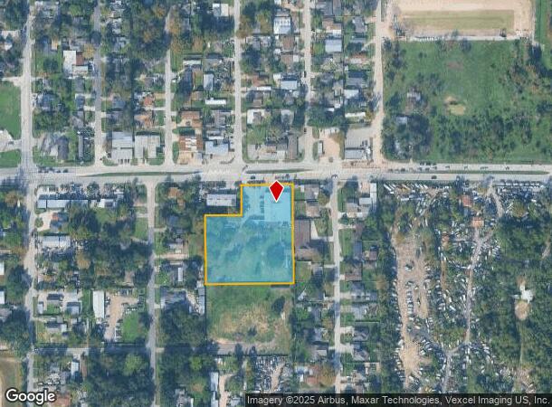
658 Aldine Mail Route Rd, Houston, TX 77037

NEARBY LISTINGS FOR SALE OR LEASE
Property Detail
658 Aldine Mail Route Rd
0451530000021
Abst 849 C Walter
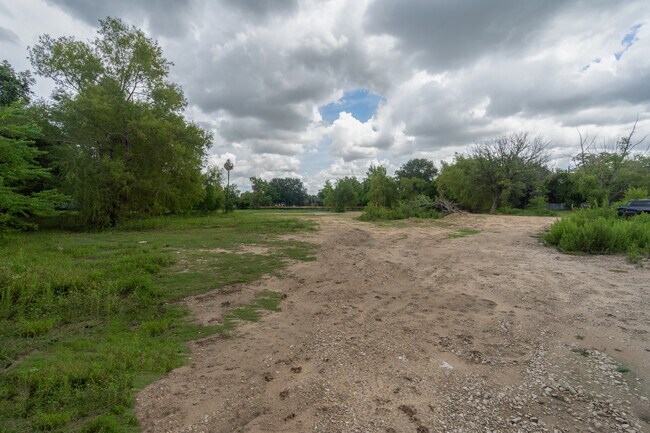
Warehouse
TR 12A ABST 849 C WALTER
X
Harris
48201C0470L
Texas
2024
2.48 AC
2025
Northeast Near
222401
Houston
9,580 SF
Houston-The Woodlands-Sugar Land, TX
DEMOGRAPHICS near 658 Aldine Mail Route Rd
1 Mile
3 Mile
5 Mile
2024 Total Population
9,078
97,068
280,185
2029 Population
9,159
98,171
285,317
Pop Growth 2024-2029
+ 0.89%
+ 1.14%
+ 1.83%
Average Age
34
34
34
2024 Total Households
2,453
28,431
86,626
HH Growth 2024-2029
+ 0.82%
+ 1.09%
+ 1.93%
Median Household Inc
$36,929
$36,866
$37,186
Avg Household Size
3.60
3.30
3.10
2024 Avg HH Vehicles
2.00
2.00
2.00
Median Home Value
$98,152
$135,596
$148,914
Median Year Built
1970
1973
1976
Nearby Places
- Restaurants
- Banks
- Shops
- Fitness
- Groceries
PUBLIC TRANSPORTATION
AIRPORT
George Bush Intcntl/Houston
DRIVE
WALK
Distance
George Bush Intcntl/Houston
13 min
10.0 mi
William P Hobby
DRIVE
WALK
Distance
William P Hobby
39 min
23.8 mi
Freight Ports
Port of Houston
DRIVE
WALK
Distance
Port of Houston
27 min
17.7 mi
SALE & LEASE HISTORY
LISTING DATE
SALE/LEASE

Sep 06, 2022
For Sale
Nearby Properties
Address
Land Use
TOTAL SIZE
Lot Size
Zoning
Address
Land Use
TOTAL SIZE
Lot Size
Zoning
145.62 AC
Address
Land Use
TOTAL SIZE
Lot Size
Zoning
704,105 SF
40.72 AC
Address
Land Use
TOTAL SIZE
Lot Size
Zoning
594,105 SF
43.68 AC
Address
Land Use
TOTAL SIZE
Lot Size
Zoning
718,600 SF
42.09 AC
Address
Land Use
TOTAL SIZE
Lot Size
Zoning
504,000 SF
32.25 AC
Address
Land Use
TOTAL SIZE
Lot Size
Zoning
350,500 SF
17.71 AC
Address
Land Use
TOTAL SIZE
Lot Size
Zoning
353,600 SF
23.45 AC
Address
Land Use
TOTAL SIZE
Lot Size
Zoning
284,476 SF
20 AC
Address
Land Use
TOTAL SIZE
Lot Size
Zoning
383,451 SF
15.98 AC
Address
Land Use
TOTAL SIZE
Lot Size
Zoning
240,240 SF
14.35 AC
Address
Land Use
TOTAL SIZE
Lot Size
Zoning
251,812 SF
12.22 AC
Address
Land Use
TOTAL SIZE
Lot Size
Zoning
244,864 SF
12.30 AC
Address
Land Use
TOTAL SIZE
Lot Size
Zoning
208,008 SF
8.32 AC
Address
Land Use
TOTAL SIZE
Lot Size
Zoning
244,760 SF
17.20 AC
Address
Land Use
TOTAL SIZE
Lot Size
Zoning
379,255 SF
22.65 AC
Address
Land Use
TOTAL SIZE
Lot Size
Zoning
293,270 SF
8.29 AC
Address
Land Use
TOTAL SIZE
Lot Size
Zoning
202,362 SF
8.02 AC
Address
Land Use
TOTAL SIZE
Lot Size
Zoning
261,000 SF
13.89 AC
Address
Land Use
TOTAL SIZE
Lot Size
Zoning
250,660 SF
14.22 AC
Address
Land Use
TOTAL SIZE
Lot Size
Zoning
193,972 SF
14.59 AC
Address
Land Use
TOTAL SIZE
Lot Size
Zoning
221,810 SF
13.96 AC
Address
Land Use
TOTAL SIZE
Lot Size
Zoning
109,025 SF
6 AC
Address
Land Use
TOTAL SIZE
Lot Size
Zoning
218,734 SF
11.24 AC
Address
Land Use
TOTAL SIZE
Lot Size
Zoning
201,292 SF
7.67 AC
Address
Land Use
TOTAL SIZE
Lot Size
Zoning
144,802 SF
6.21 AC
Address
Land Use
TOTAL SIZE
Lot Size
Zoning
361,869 SF
39.62 AC
Address
Land Use
TOTAL SIZE
Lot Size
Zoning
236,780 SF
35.30 AC
Address
Land Use
TOTAL SIZE
Lot Size
Zoning
139,886 SF
10.02 AC
Address
Land Use
TOTAL SIZE
Lot Size
Zoning
190,543 SF
9.09 AC
Address
Land Use
TOTAL SIZE
Lot Size
Zoning
304,019 SF
26.59 AC
The World's #1 Commercial Real Estate Marketplace
Connect with us
© 2025 CoStar Group
The information above has been obtained from sources believed reliable. While we do not doubt its accuracy we have not verified it and make no guarantee, warranty or representation about it. It is your responsibility to independently confirm its accuracy and completeness. Any projections, opinions, assumptions, or estimates used are for example only and do not represent the current or future performance of the property. The value of this transaction to you depends on tax and other factors which should be evaluated by your tax, financial, and legal advisors. You and your advisors should conduct a careful, independent investigation of the property to determine to your satisfaction the suitability of the property for your needs.