Property Record
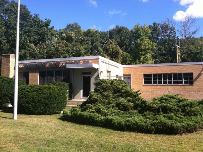
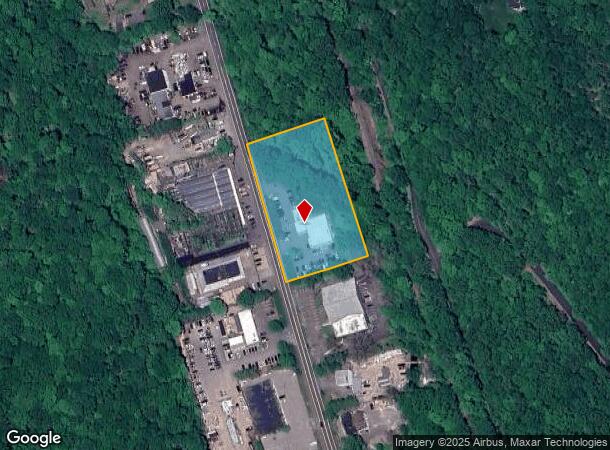
658 Danbury Rd, Wilton, CT 06897
NEARBY LISTINGS FOR SALE OR LEASE
Property Detail
658 Danbury Rd
Commercialnec
Fairfield
AE
Connecticut
09001C0381F
2.39 AC
2025
Wilton
2025
Westchester/So Connecticut
045102
Bridgeport-Stamford-Danbury, CT
8,096 SF
WILT-000023-000010
DEMOGRAPHICS near 658 Danbury Rd
1 mile
3 mile
5 mile
2024 Total Population
1,285
14,927
45,079
2029 Population
1,287
15,020
45,251
Pop Growth 2024-2029
+ 0.16%
+ 0.62%
+ 0.38%
Average Age
40
42
42
2024 Total Households
428
5,117
15,799
HH Growth 2024-2029
0.00%
+ 0.63%
+ 0.37%
Median Household Inc
$203,226
$185,876
$184,900
Avg Household Size
3.00
2.80
2.80
2024 Avg HH Vehicles
2.00
2.00
2.00
Median Home Value
$759,105
$770,076
$776,430
Median Year Built
1970
1971
1970
Nearby Places
Map Layers
Map Styles
 Street
 Aerial
Transit
 Traffic
 Biking
Places
Listings with unknown addresses are not visible on the map
- Restaurants
- Banks
- Shops
- Fitness
- Groceries
PUBLIC TRANSPORTATION
COMMUTER RAIL
Cannondale Station (New Haven Line - Metro-North Commuter Railroad Company (Metro-North))
Drive
Walk
Distance
Cannondale Station (New Haven Line - Metro-North Commuter Railroad Company (Metro-North))
3 min
1.9 mi
Branchville Station (New Haven Line - Metro-North Commuter Railroad Company (Metro-North))
Drive
Walk
Distance
Branchville Station (New Haven Line - Metro-North Commuter Railroad Company (Metro-North))
3 min
2.0 mi
AIRPORT
Westchester County
Drive
Walk
Distance
Westchester County
41 min
28.5 mi
Tweed/New Haven
Drive
Walk
Distance
Tweed/New Haven
60 min
40.1 mi
Freight Ports
Port of New Haven
Drive
Walk
Distance
Port of New Haven
55 min
37.2 mi
Nearby Properties
Address
Land Use
TOTAL SIZE
Lot Size
Zoning
Address
Land Use
TOTAL SIZE
Lot Size
Zoning
82.14 AC
R-2
Address
Land Use
TOTAL SIZE
Lot Size
Zoning
109.27 AC
R-2
Address
Land Use
TOTAL SIZE
Lot Size
Zoning
8.92 AC
R-2
Address
Land Use
TOTAL SIZE
Lot Size
Zoning
157.25 AC
R-2
Address
Land Use
TOTAL SIZE
Lot Size
Zoning
81,699 SF
4.28 AC
DE-5
Address
Land Use
TOTAL SIZE
Lot Size
Zoning
80,980 SF
5.95 AC
GB
Address
Land Use
TOTAL SIZE
Lot Size
Zoning
53,960 SF
12.50 AC
B-2
Address
Land Use
TOTAL SIZE
Lot Size
Zoning
1,200 SF
75.12 AC
R-2
Address
Land Use
TOTAL SIZE
Lot Size
Zoning
15.99 AC
R-2
Address
Land Use
TOTAL SIZE
Lot Size
Zoning
469 AC
C
Address
Land Use
TOTAL SIZE
Lot Size
Zoning
143,837 SF
7.96 AC
SB
Address
Land Use
TOTAL SIZE
Lot Size
Zoning
36,260 SF
4.77 AC
GB
Address
Land Use
TOTAL SIZE
Lot Size
Zoning
39,175 SF
1.01 AC
R-1
Address
Land Use
TOTAL SIZE
Lot Size
Zoning
6.10 AC
GB
Address
Land Use
TOTAL SIZE
Lot Size
Zoning
73,918 SF
5.95 AC
R-2
Address
Land Use
TOTAL SIZE
Lot Size
Zoning
29,370 SF
2.59 AC
B-1
Address
Land Use
TOTAL SIZE
Lot Size
Zoning
2.40 AC
WC
Address
Land Use
TOTAL SIZE
Lot Size
Zoning
4,312 SF
0.40 AC
Address
Land Use
TOTAL SIZE
Lot Size
Zoning
36.60 AC
R-2
Address
Land Use
TOTAL SIZE
Lot Size
Zoning
4.24 AC
R
Address
Land Use
TOTAL SIZE
Lot Size
Zoning
123.30 AC
R-2
Address
Land Use
TOTAL SIZE
Lot Size
Zoning
5,008 SF
8.03 AC
R-2
Address
Land Use
TOTAL SIZE
Lot Size
Zoning
9,995 SF
4.54 AC
R-2
Address
Land Use
TOTAL SIZE
Lot Size
Zoning
10,396 SF
4.87 AC
R-1
Address
Land Use
TOTAL SIZE
Lot Size
Zoning
52,179 SF
4.80 AC
DE-5
Address
Land Use
TOTAL SIZE
Lot Size
Zoning
14,211 SF
5.44 AC
GB
Address
Land Use
TOTAL SIZE
Lot Size
Zoning
6,045 SF
5.52 AC
R
Address
Land Use
TOTAL SIZE
Lot Size
Zoning
6,699 SF
7.36 AC
R-2
Address
Land Use
TOTAL SIZE
Lot Size
Zoning
44,000 SF
4.84 AC
B-2
Address
Land Use
TOTAL SIZE
Lot Size
Zoning
12,322 SF
3.77 AC
R-2
The World's #1 Commercial Real Estate Marketplace
Connect with us
© 2026 CoStar Group
The information above has been obtained from sources believed reliable. While we do not doubt its accuracy we have not verified it and make no guarantee, warranty or representation about it. It is your responsibility to independently confirm its accuracy and completeness. Any projections, opinions, assumptions, or estimates used are for example only and do not represent the current or future performance of the property. The value of this transaction to you depends on tax and other factors which should be evaluated by your tax, financial, and legal advisors. You and your advisors should conduct a careful, independent investigation of the property to determine to your satisfaction the suitability of the property for your needs.