Property Record
6580 General Rd, Jurupa Valley, CA 92509


NEARBY LISTINGS FOR SALE OR LEASE
Property Detail
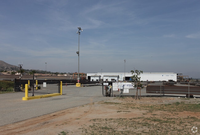
6580 General Rd
Riverside-San Bernardino-Ontario, CA
Parcel Map No 24176
163-400-018
23.83 ACRES NET IN PAR 2 PM 155/090 PM 24176
Lightindustrial
Riverside
X
California
06065C0702H
2
2024
23.83 AC
2025
Riverside
040404
Inland Empire (California)
110,088 SF
DEMOGRAPHICS near 6580 General Rd
1 Mile
3 Mile
5 Mile
2024 Total Population
7,593
106,620
281,495
2029 Population
7,998
111,761
295,196
Pop Growth 2024-2029
+ 5.33%
+ 4.82%
+ 4.87%
Average Age
37
36
36
2024 Total Households
2,148
28,878
79,001
HH Growth 2024-2029
+ 4.89%
+ 4.31%
+ 4.44%
Median Household Inc
$92,149
$80,326
$77,925
Avg Household Size
3.40
3.50
3.30
2024 Avg HH Vehicles
3.00
2.00
2.00
Median Home Value
$435,484
$437,199
$453,393
Median Year Built
1984
1973
1973
Nearby Places
Map Layers
Map Styles
 Street
 Aerial
- Restaurants
- Banks
- Shops
- Fitness
- Groceries
PUBLIC TRANSPORTATION
COMMUTER RAIL
Pedley (Riverside Line - Southern California Regional Rail Authority (Metrolink))
DRIVE
WALK
Distance
Pedley (Riverside Line - Southern California Regional Rail Authority (Metrolink))
4 min
1.9 mi
Riverside-La Sierra (91 Line - Southern California Regional Rail Authority (Metrolink), Inland Empire-Orange County Line - Southern California Regional Rail Authority (Metrolink))
DRIVE
WALK
Distance
Riverside-La Sierra (91 Line - Southern California Regional Rail Authority (Metrolink), Inland Empire-Orange County Line - Southern California Regional Rail Authority (Metrolink))
16 min
7.4 mi
AIRPORT
Ontario International
DRIVE
WALK
Distance
Ontario International
19 min
11.2 mi
Freight Ports
Port of Long Beach
DRIVE
WALK
Distance
Port of Long Beach
1 min
44.3 mi
Nearby Properties
Address
Land Use
TOTAL SIZE
Lot Size
Zoning
Address
Land Use
TOTAL SIZE
Lot Size
Zoning
169,980 SF
10.51 AC
C3
Address
Land Use
TOTAL SIZE
Lot Size
Zoning
43,152 SF
6.76 AC
R3S2
Address
Land Use
TOTAL SIZE
Lot Size
Zoning
855,621 SF
46.79 AC
I
Address
Land Use
TOTAL SIZE
Lot Size
Zoning
179,589 SF
18.62 AC
Address
Land Use
TOTAL SIZE
Lot Size
Zoning
157,112 SF
10.83 AC
Address
Land Use
TOTAL SIZE
Lot Size
Zoning
8.75 AC
R1065
Address
Land Use
TOTAL SIZE
Lot Size
Zoning
14,068 SF
6.61 AC
R3
Address
Land Use
TOTAL SIZE
Lot Size
Zoning
110,680 SF
11.88 AC
MP
Address
Land Use
TOTAL SIZE
Lot Size
Zoning
73,538 SF
4.11 AC
R3150
Address
Land Use
TOTAL SIZE
Lot Size
Zoning
63,718 SF
7.25 AC
R3
Address
Land Use
TOTAL SIZE
Lot Size
Zoning
18,480 SF
7.19 AC
Address
Land Use
TOTAL SIZE
Lot Size
Zoning
80,257 SF
5.02 AC
C1CP
Address
Land Use
TOTAL SIZE
Lot Size
Zoning
40,024 SF
4.84 AC
Address
Land Use
TOTAL SIZE
Lot Size
Zoning
149,829 SF
11.60 AC
Address
Land Use
TOTAL SIZE
Lot Size
Zoning
77,640 SF
10.11 AC
R1065
Address
Land Use
TOTAL SIZE
Lot Size
Zoning
97,459 SF
3.89 AC
Address
Land Use
TOTAL SIZE
Lot Size
Zoning
81,250 SF
6.22 AC
Address
Land Use
TOTAL SIZE
Lot Size
Zoning
130,900 SF
15.08 AC
A1R
Address
Land Use
TOTAL SIZE
Lot Size
Zoning
6.38 AC
Address
Land Use
TOTAL SIZE
Lot Size
Zoning
62,619 SF
3.08 AC
C1CP
Address
Land Use
TOTAL SIZE
Lot Size
Zoning
86,590 SF
5.63 AC
AIR
Address
Land Use
TOTAL SIZE
Lot Size
Zoning
6.25 AC
C3
Address
Land Use
TOTAL SIZE
Lot Size
Zoning
41,432 SF
8.86 AC
Address
Land Use
TOTAL SIZE
Lot Size
Zoning
144,158 SF
8.90 AC
Address
Land Use
TOTAL SIZE
Lot Size
Zoning
58,035 SF
1.75 AC
Address
Land Use
TOTAL SIZE
Lot Size
Zoning
27,802 SF
5.17 AC
Address
Land Use
TOTAL SIZE
Lot Size
Zoning
88,522 SF
20.89 AC
M1
Address
Land Use
TOTAL SIZE
Lot Size
Zoning
48,434 SF
2.33 AC
C1CP
The World's #1 Commercial Real Estate Marketplace
Connect with us
© 2025 CoStar Group
The information above has been obtained from sources believed reliable. While we do not doubt its accuracy we have not verified it and make no guarantee, warranty or representation about it. It is your responsibility to independently confirm its accuracy and completeness. Any projections, opinions, assumptions, or estimates used are for example only and do not represent the current or future performance of the property. The value of this transaction to you depends on tax and other factors which should be evaluated by your tax, financial, and legal advisors. You and your advisors should conduct a careful, independent investigation of the property to determine to your satisfaction the suitability of the property for your needs.