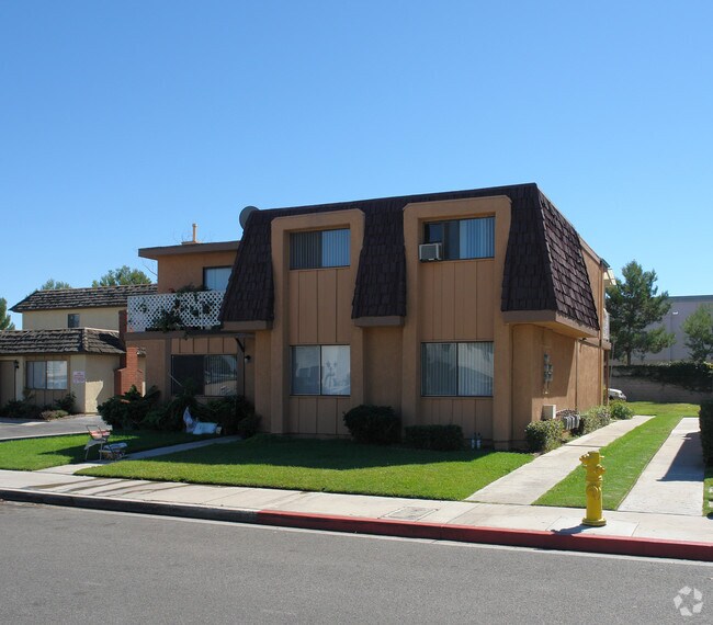
Property Record
6582 Westpark Pl, Westminster, CA 92683


NEARBY LISTINGS FOR SALE OR LEASE
Property Detail
6582 Westpark Pl
Anaheim-Santa Ana-Irvine, CA
Tract No: 9729 In The. City Of 'Westmnin
203-621-06
N TR 9729 BLK LOT 6
Multifamilydwelling
Orange
X
California
06059C0119J
6
2024
0.22 AC
2025
Westminster
099903
Orange County (California)
4,014 SF
DEMOGRAPHICS near 6582 Westpark Pl
1 mile
3 mile
5 mile
2024 Total Population
30,483
195,588
550,670
2029 Population
30,223
193,360
544,157
Pop Growth 2024-2029
(0.85%)
(1.14%)
(1.18%)
Average Age
40
42
42
2024 Total Households
9,091
61,441
176,390
HH Growth 2024-2029
(0.96%)
(1.26%)
(1.28%)
Median Household Inc
$65,958
$86,791
$87,138
Avg Household Size
3.20
3.10
3.00
2024 Avg HH Vehicles
2.00
2.00
2.00
Median Home Value
$740,102
$731,853
$743,281
Median Year Built
1967
1968
1968
Nearby Places
Map Layers
Map Styles
 Street
 Aerial
Transit
 Traffic
 Biking
Places
Listings with unknown addresses are not visible on the map
- Restaurants
- Banks
- Shops
- Fitness
- Groceries
PUBLIC TRANSPORTATION
COMMUTER RAIL
Buena Park (91 Line - Southern California Regional Rail Authority (Metrolink), Orange County Line - Southern California Regional Rail Authority (Metrolink))
Drive
Walk
Distance
Buena Park (91 Line - Southern California Regional Rail Authority (Metrolink), Orange County Line - Southern California Regional Rail Authority (Metrolink))
20 min
10.0 mi
AIRPORT
John Wayne/Orange County
Drive
Walk
Distance
John Wayne/Orange County
18 min
11.2 mi
Long Beach (Daugherty Field)
Drive
Walk
Distance
Long Beach (Daugherty Field)
17 min
11.6 mi
Los Angeles International
Drive
Walk
Distance
Los Angeles International
41 min
30.4 mi
Freight Ports
Port of Long Beach
Drive
Walk
Distance
Port of Long Beach
23 min
11.2 mi
Nearby Properties
Address
Land Use
TOTAL SIZE
Lot Size
Zoning
Address
Land Use
TOTAL SIZE
Lot Size
Zoning
Address
Land Use
TOTAL SIZE
Lot Size
Zoning
Address
Land Use
TOTAL SIZE
Lot Size
Zoning
Address
Land Use
TOTAL SIZE
Lot Size
Zoning
Address
Land Use
TOTAL SIZE
Lot Size
Zoning
292,787 SF
4.95 AC
Address
Land Use
TOTAL SIZE
Lot Size
Zoning
Address
Land Use
TOTAL SIZE
Lot Size
Zoning
1,226.28 AC
Address
Land Use
TOTAL SIZE
Lot Size
Zoning
Address
Land Use
TOTAL SIZE
Lot Size
Zoning
Address
Land Use
TOTAL SIZE
Lot Size
Zoning
316,420 SF
11.72 AC
Address
Land Use
TOTAL SIZE
Lot Size
Zoning
22.31 AC
Address
Land Use
TOTAL SIZE
Lot Size
Zoning
35.40 AC
Address
Land Use
TOTAL SIZE
Lot Size
Zoning
4.86 AC
Address
Land Use
TOTAL SIZE
Lot Size
Zoning
23.41 AC
Address
Land Use
TOTAL SIZE
Lot Size
Zoning
13.97 AC
Address
Land Use
TOTAL SIZE
Lot Size
Zoning
Address
Land Use
TOTAL SIZE
Lot Size
Zoning
3.77 AC
Address
Land Use
TOTAL SIZE
Lot Size
Zoning
5.76 AC
Address
Land Use
TOTAL SIZE
Lot Size
Zoning
203,886 SF
12.32 AC
Address
Land Use
TOTAL SIZE
Lot Size
Zoning
178,964 SF
11.62 AC
Address
Land Use
TOTAL SIZE
Lot Size
Zoning
Address
Land Use
TOTAL SIZE
Lot Size
Zoning
26,960 SF
64.86 AC
Address
Land Use
TOTAL SIZE
Lot Size
Zoning
Address
Land Use
TOTAL SIZE
Lot Size
Zoning
Address
Land Use
TOTAL SIZE
Lot Size
Zoning
Address
Land Use
TOTAL SIZE
Lot Size
Zoning
Address
Land Use
TOTAL SIZE
Lot Size
Zoning
3.12 AC
Address
Land Use
TOTAL SIZE
Lot Size
Zoning
196,168 SF
8.27 AC
Address
Land Use
TOTAL SIZE
Lot Size
Zoning
Address
Land Use
TOTAL SIZE
Lot Size
Zoning
2.55 AC
The World's #1 Commercial Real Estate Marketplace
Connect with us
© 2026 CoStar Group
The information above has been obtained from sources believed reliable. While we do not doubt its accuracy we have not verified it and make no guarantee, warranty or representation about it. It is your responsibility to independently confirm its accuracy and completeness. Any projections, opinions, assumptions, or estimates used are for example only and do not represent the current or future performance of the property. The value of this transaction to you depends on tax and other factors which should be evaluated by your tax, financial, and legal advisors. You and your advisors should conduct a careful, independent investigation of the property to determine to your satisfaction the suitability of the property for your needs.