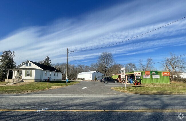
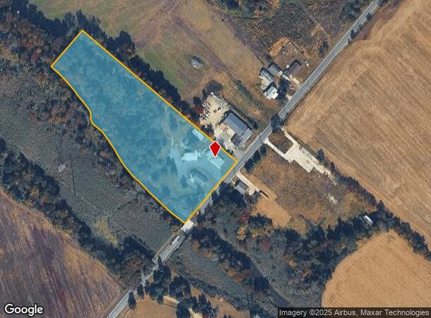
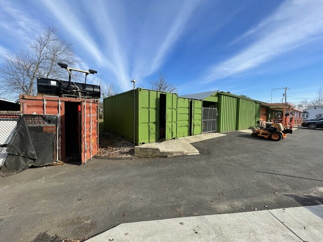
Property Record
659 Swedesboro Rd, Gibbstown, NJ 08027
NEARBY LISTINGS FOR SALE OR LEASE
Property Detail
659 Swedesboro Rd
07-00255-0000-00004
Gloucester
Storebuilding
New Jersey
AE
4
34015C0066F
5.74 AC
2024
Gloucester County
2025
Philadelphia
500500
Philadelphia-Camden-Wilmington, PA-NJ-DE-MD
1,286 SF
DEMOGRAPHICS near 659 Swedesboro Rd
1 Mile
3 Mile
5 Mile
2024 Total Population
270
14,665
45,348
2029 Population
280
15,133
46,539
Pop Growth 2024-2029
+ 3.70%
+ 3.19%
+ 2.63%
Average Age
42
41
39
2024 Total Households
101
5,436
15,880
HH Growth 2024-2029
+ 3.96%
+ 3.29%
+ 2.68%
Median Household Inc
$96,874
$91,807
$91,804
Avg Household Size
2.70
2.70
2.70
2024 Avg HH Vehicles
2.00
2.00
2.00
Median Home Value
$214,000
$273,914
$279,389
Median Year Built
1956
1968
1970
Nearby Places
Map Layers
Map Styles
 Street
 Aerial
- Restaurants
- Banks
- Shops
- Fitness
- Groceries
PUBLIC TRANSPORTATION
COMMUTER RAIL
Chester Transportation Center (R2 - SEPTA, Wilmington/Newark Line - SEPTA)
DRIVE
WALK
Distance
Chester Transportation Center (R2 - SEPTA, Wilmington/Newark Line - SEPTA)
16 min
9.6 mi
AIRPORT
Philadelphia International
DRIVE
WALK
Distance
Philadelphia International
26 min
16.0 mi
Freight Ports
Broadway Terminal - Pier 5
DRIVE
WALK
Distance
Broadway Terminal - Pier 5
18 min
12.5 mi
SALE & LEASE HISTORY
LISTING DATE
SALE/LEASE

Jan 10, 2024
For Sale
Dec 26, 2023
For Sale
Nearby Properties
Address
Land Use
TOTAL SIZE
Lot Size
Zoning
Address
Land Use
TOTAL SIZE
Lot Size
Zoning
653.90 AC
Address
Land Use
TOTAL SIZE
Lot Size
Zoning
28 AC
IC
Address
Land Use
TOTAL SIZE
Lot Size
Zoning
Address
Land Use
TOTAL SIZE
Lot Size
Zoning
40.25 AC
M
Address
Land Use
TOTAL SIZE
Lot Size
Zoning
34.58 AC
Address
Land Use
TOTAL SIZE
Lot Size
Zoning
Address
Land Use
TOTAL SIZE
Lot Size
Zoning
Address
Land Use
TOTAL SIZE
Lot Size
Zoning
994 AC
R3
Address
Land Use
TOTAL SIZE
Lot Size
Zoning
34.42 AC
Address
Land Use
TOTAL SIZE
Lot Size
Zoning
30.76 AC
BP
Address
Land Use
TOTAL SIZE
Lot Size
Zoning
10.13 AC
Address
Land Use
TOTAL SIZE
Lot Size
Zoning
5.72 AC
R3
Address
Land Use
TOTAL SIZE
Lot Size
Zoning
5 AC
R1
Address
Land Use
TOTAL SIZE
Lot Size
Zoning
10.39 AC
RRC
Address
Land Use
TOTAL SIZE
Lot Size
Zoning
4.76 AC
Address
Land Use
TOTAL SIZE
Lot Size
Zoning
10.21 AC
RRC
Address
Land Use
TOTAL SIZE
Lot Size
Zoning
15.08 AC
R2A
Address
Land Use
TOTAL SIZE
Lot Size
Zoning
17.08 AC
BP
Address
Land Use
TOTAL SIZE
Lot Size
Zoning
22.05 AC
B1
Address
Land Use
TOTAL SIZE
Lot Size
Zoning
9.05 AC
R2
Address
Land Use
TOTAL SIZE
Lot Size
Zoning
31.77 AC
R2A
Address
Land Use
TOTAL SIZE
Lot Size
Zoning
4.19 AC
R2A
Address
Land Use
TOTAL SIZE
Lot Size
Zoning
Address
Land Use
TOTAL SIZE
Lot Size
Zoning
761 SF
9.13 AC
R5
Address
Land Use
TOTAL SIZE
Lot Size
Zoning
556 SF
11.45 AC
Address
Land Use
TOTAL SIZE
Lot Size
Zoning
224.79 AC
Address
Land Use
TOTAL SIZE
Lot Size
Zoning
9.12 AC
B2
Address
Land Use
TOTAL SIZE
Lot Size
Zoning
7.58 AC
B2
Address
Land Use
TOTAL SIZE
Lot Size
Zoning
44.63 AC
BP
Address
Land Use
TOTAL SIZE
Lot Size
Zoning
3.61 AC
R20
The World's #1 Commercial Real Estate Marketplace
Connect with us
© 2025 CoStar Group
The information above has been obtained from sources believed reliable. While we do not doubt its accuracy we have not verified it and make no guarantee, warranty or representation about it. It is your responsibility to independently confirm its accuracy and completeness. Any projections, opinions, assumptions, or estimates used are for example only and do not represent the current or future performance of the property. The value of this transaction to you depends on tax and other factors which should be evaluated by your tax, financial, and legal advisors. You and your advisors should conduct a careful, independent investigation of the property to determine to your satisfaction the suitability of the property for your needs.