No Photo
Property Record
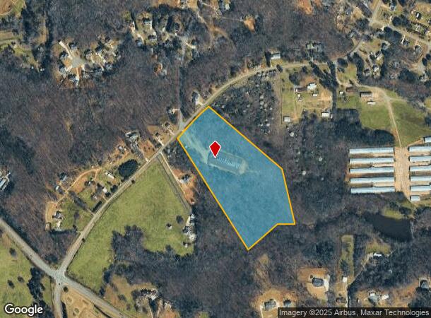
6590 Pea Ridge Rd, Gainesville, GA 30506

NEARBY LISTINGS FOR SALE OR LEASE
Property Detail
6590 Pea Ridge Rd
278-007
Chestatee
Agriculturalland
14-1 752-816-817 TRACT 2
A
Forsyth
13117C0070G
Georgia
2024
15.70 AC
2025
N Fulton/Forsyth County
130103
Atlanta
15,000 SF
Atlanta-Sandy Springs-Roswell, GA
DEMOGRAPHICS near 6590 Pea Ridge Rd
1 Mile
3 Mile
5 Mile
2024 Total Population
1,471
16,265
50,025
2029 Population
1,717
19,433
60,469
Pop Growth 2024-2029
+ 16.72%
+ 19.48%
+ 20.88%
Average Age
41
40
40
2024 Total Households
500
5,603
17,681
HH Growth 2024-2029
+ 16.80%
+ 19.90%
+ 21.16%
Median Household Inc
$83,333
$103,339
$101,831
Avg Household Size
2.90
2.80
2.80
2024 Avg HH Vehicles
3.00
2.00
2.00
Median Home Value
$346,739
$394,395
$386,857
Median Year Built
2000
2003
2002
Nearby Places
Map Layers
Map Styles
 Street
 Aerial
- Restaurants
- Banks
- Shops
- Fitness
- Groceries
SALE & LEASE HISTORY
LISTING DATE
SALE/LEASE

Sep 24, 2016
For Sale
Nearby Properties
Address
Land Use
TOTAL SIZE
Lot Size
Zoning
Address
Land Use
TOTAL SIZE
Lot Size
Zoning
12,090 SF
21.69 AC
C-PCD
Address
Land Use
TOTAL SIZE
Lot Size
Zoning
24,092 SF
40 AC
RA
Address
Land Use
TOTAL SIZE
Lot Size
Zoning
57,666 SF
19.39 AC
Address
Land Use
TOTAL SIZE
Lot Size
Zoning
50,875 SF
420.29 AC
A1
Address
Land Use
TOTAL SIZE
Lot Size
Zoning
6,086 SF
14.85 AC
O&I
Address
Land Use
TOTAL SIZE
Lot Size
Zoning
59,534 SF
16.93 AC
CBD
Address
Land Use
TOTAL SIZE
Lot Size
Zoning
54,674 SF
7.65 AC
UV
Address
Land Use
TOTAL SIZE
Lot Size
Zoning
229.24 AC
M1
Address
Land Use
TOTAL SIZE
Lot Size
Zoning
23,625 SF
6.31 AC
C-HB
Address
Land Use
TOTAL SIZE
Lot Size
Zoning
39,251 SF
109.39 AC
A1
Address
Land Use
TOTAL SIZE
Lot Size
Zoning
53,284 SF
1.43 AC
C-HB
Address
Land Use
TOTAL SIZE
Lot Size
Zoning
66,824 SF
11 AC
A1
Address
Land Use
TOTAL SIZE
Lot Size
Zoning
37,784 SF
8 AC
C-HB
Address
Land Use
TOTAL SIZE
Lot Size
Zoning
3.90 AC
M1
Address
Land Use
TOTAL SIZE
Lot Size
Zoning
54,090 SF
8.70 AC
CBD
Address
Land Use
TOTAL SIZE
Lot Size
Zoning
108,800 SF
7.44 AC
C-IR
Address
Land Use
TOTAL SIZE
Lot Size
Zoning
31,423 SF
4.30 AC
CBD
Address
Land Use
TOTAL SIZE
Lot Size
Zoning
3,200 SF
14.10 AC
C-HB
Address
Land Use
TOTAL SIZE
Lot Size
Zoning
5,253 SF
84.12 AC
A1
Address
Land Use
TOTAL SIZE
Lot Size
Zoning
18,900 SF
2.67 AC
CBD
Address
Land Use
TOTAL SIZE
Lot Size
Zoning
18,900 SF
2.23 AC
CBD
Address
Land Use
TOTAL SIZE
Lot Size
Zoning
41,536 SF
12.93 AC
C-IR
Address
Land Use
TOTAL SIZE
Lot Size
Zoning
34,751 SF
15.80 AC
CBD
Address
Land Use
TOTAL SIZE
Lot Size
Zoning
17,920 SF
1.55 AC
CBD
Address
Land Use
TOTAL SIZE
Lot Size
Zoning
88.95 AC
A1
Address
Land Use
TOTAL SIZE
Lot Size
Zoning
16,186 SF
32.27 AC
MP
Address
Land Use
TOTAL SIZE
Lot Size
Zoning
13,274 SF
2 AC
C-0I
Address
Land Use
TOTAL SIZE
Lot Size
Zoning
1,124 SF
110.41 AC
M2
Address
Land Use
TOTAL SIZE
Lot Size
Zoning
6,325 SF
3.70 AC
C-HB
Address
Land Use
TOTAL SIZE
Lot Size
Zoning
26,076 SF
3.14 AC
CBD
The World's #1 Commercial Real Estate Marketplace
Connect with us
© 2025 CoStar Group
The information above has been obtained from sources believed reliable. While we do not doubt its accuracy we have not verified it and make no guarantee, warranty or representation about it. It is your responsibility to independently confirm its accuracy and completeness. Any projections, opinions, assumptions, or estimates used are for example only and do not represent the current or future performance of the property. The value of this transaction to you depends on tax and other factors which should be evaluated by your tax, financial, and legal advisors. You and your advisors should conduct a careful, independent investigation of the property to determine to your satisfaction the suitability of the property for your needs.