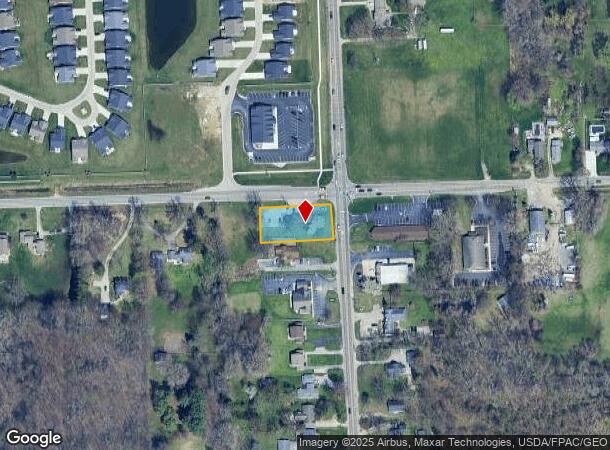
Property Record
6595 Secor Rd, Lambertville, MI 48144


NEARBY LISTINGS FOR SALE OR LEASE
Property Detail
6595 Secor Rd
02-106-016-00
SEC 6 T9S R7E .80 ACRE COM @ NE COR OF SD FRL SEC 6 TH S 133 FT TH N 88D 55M W 263.07 FT TH N 133 FT TH S 88D 55M E 263.07 FT
Officebuilding
Monroe
X
Michigan
39095C0057F
0.80 AC
2024
Monroe County
2025
Detroit
833300
Monroe, MI
2,180 SF
DEMOGRAPHICS near 6595 Secor Rd
1 Mile
3 Mile
5 Mile
2024 Total Population
6,538
58,414
143,623
2029 Population
6,441
57,678
141,562
Pop Growth 2024-2029
(1.48%)
(1.26%)
(1.44%)
Average Age
43
42
40
2024 Total Households
2,684
25,087
61,219
HH Growth 2024-2029
(1.53%)
(1.31%)
(1.48%)
Median Household Inc
$79,238
$66,851
$63,251
Avg Household Size
2.40
2.30
2.30
2024 Avg HH Vehicles
2.00
2.00
2.00
Median Home Value
$172,838
$163,527
$155,666
Median Year Built
1966
1966
1960
Nearby Places
Map Layers
Map Styles
 Street
 Aerial
- Restaurants
- Banks
- Shops
- Fitness
- Groceries
PUBLIC TRANSPORTATION
COMMUTER RAIL
DRIVE
WALK
Distance
17 min
9.3 mi
AIRPORT
Eugene F Kranz Toledo Express
DRIVE
WALK
Distance
Eugene F Kranz Toledo Express
40 min
22.9 mi
Freight Ports
DRIVE
WALK
Distance
28 min
14.4 mi
SALE & LEASE HISTORY
LISTING DATE
SALE/LEASE

Sep 25, 2016
For Lease
Nearby Properties
Address
Land Use
TOTAL SIZE
Lot Size
Zoning
Address
Land Use
TOTAL SIZE
Lot Size
Zoning
1,972,579 SF
76.32 AC
10-IG
Address
Land Use
TOTAL SIZE
Lot Size
Zoning
693,900 SF
76.32 AC
10-IG
Address
Land Use
TOTAL SIZE
Lot Size
Zoning
448,269 SF
29.52 AC
10-IC
Address
Land Use
TOTAL SIZE
Lot Size
Zoning
12.52 AC
10-CRSO
Address
Land Use
TOTAL SIZE
Lot Size
Zoning
253,662 SF
16.59 AC
10-MX
Address
Land Use
TOTAL SIZE
Lot Size
Zoning
7.71 AC
10-CRSO
Address
Land Use
TOTAL SIZE
Lot Size
Zoning
165,739 SF
17.77 AC
Address
Land Use
TOTAL SIZE
Lot Size
Zoning
76.32 AC
10-IG
Address
Land Use
TOTAL SIZE
Lot Size
Zoning
61.03 AC
PUD: PLANN
Address
Land Use
TOTAL SIZE
Lot Size
Zoning
293,770 SF
13.95 AC
10-RS6
Address
Land Use
TOTAL SIZE
Lot Size
Zoning
90,113 SF
11.83 AC
10-RS6
Address
Land Use
TOTAL SIZE
Lot Size
Zoning
166,837 SF
23.82 AC
10-MX
Address
Land Use
TOTAL SIZE
Lot Size
Zoning
222,493 SF
29.88 AC
10-IC
Address
Land Use
TOTAL SIZE
Lot Size
Zoning
49,960 SF
8.33 AC
10-CO
Address
Land Use
TOTAL SIZE
Lot Size
Zoning
154,003 SF
14 AC
10-MX
Address
Land Use
TOTAL SIZE
Lot Size
Zoning
61,718 SF
7 AC
Address
Land Use
TOTAL SIZE
Lot Size
Zoning
52,429 SF
3.79 AC
10-CO
Address
Land Use
TOTAL SIZE
Lot Size
Zoning
135,978 SF
14.01 AC
31-B2
Address
Land Use
TOTAL SIZE
Lot Size
Zoning
123,985 SF
9.74 AC
10-MX
Address
Land Use
TOTAL SIZE
Lot Size
Zoning
84,485 SF
8.41 AC
20-C2
Address
Land Use
TOTAL SIZE
Lot Size
Zoning
41,200 SF
9.45 AC
31-MX
Address
Land Use
TOTAL SIZE
Lot Size
Zoning
78,266 SF
13.57 AC
20-S1
Address
Land Use
TOTAL SIZE
Lot Size
Zoning
44,028 SF
3.92 AC
10-MX
Address
Land Use
TOTAL SIZE
Lot Size
Zoning
54,085 SF
0.81 AC
20-S1
Address
Land Use
TOTAL SIZE
Lot Size
Zoning
405,288 SF
12.52 AC
10-MX
Address
Land Use
TOTAL SIZE
Lot Size
Zoning
132,601 SF
14.41 AC
10-MX
Address
Land Use
TOTAL SIZE
Lot Size
Zoning
107,296 SF
6 AC
10-CR
Address
Land Use
TOTAL SIZE
Lot Size
Zoning
64,980 SF
5.80 AC
Address
Land Use
TOTAL SIZE
Lot Size
Zoning
234,068 SF
11.81 AC
10-CRSO
Address
Land Use
TOTAL SIZE
Lot Size
Zoning
99,366 SF
1.57 AC
10-RS12
The World's #1 Commercial Real Estate Marketplace
Connect with us
© 2025 CoStar Group
The information above has been obtained from sources believed reliable. While we do not doubt its accuracy we have not verified it and make no guarantee, warranty or representation about it. It is your responsibility to independently confirm its accuracy and completeness. Any projections, opinions, assumptions, or estimates used are for example only and do not represent the current or future performance of the property. The value of this transaction to you depends on tax and other factors which should be evaluated by your tax, financial, and legal advisors. You and your advisors should conduct a careful, independent investigation of the property to determine to your satisfaction the suitability of the property for your needs.