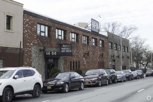
Property Record
66 Qn Midtown Ep Sr S, Maspeth, NY 11378
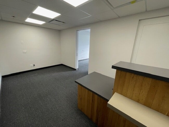
Current Lease Availabilities
NEARBY LISTINGS FOR SALE OR LEASE
Property Detail
66 Qn Midtown Ep Sr S
02724-0018
Queens
Officebuilding
New York
X
18
3604970207F
0.17 AC
2024
Central Queens
2025
Long Island (New York)
051700
New York-Jersey City-White Plains, NY-NJ
15,000 SF
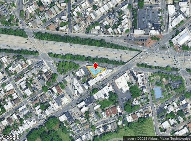
DEMOGRAPHICS near 66 Qn Midtown Ep Sr S
1 Mile
3 Mile
5 Mile
2024 Total Population
54,618
1,014,108
2,882,339
2029 Population
49,411
951,143
2,700,117
Pop Growth 2024-2029
(9.53%)
(6.21%)
(6.32%)
Average Age
42
39
40
2024 Total Households
18,586
375,946
1,146,425
HH Growth 2024-2029
(10.14%)
(6.29%)
(6.55%)
Median Household Inc
$78,550
$73,866
$75,681
Avg Household Size
2.80
2.60
2.40
2024 Avg HH Vehicles
1.00
1.00
1.00
Median Home Value
$761,466
$706,411
$768,165
Median Year Built
1951
1950
1952
Nearby Places
Map Layers
Map Styles
 Street
 Aerial
- Restaurants
- Banks
- Shops
- Fitness
- Groceries
PUBLIC TRANSPORTATION
COMMUTER RAIL
Woodside Station (Babylon Branch - Long Island Rail Road, Far Rockaway Branch - Long Island Rail Road, Hempstead Branch - Long Island Rail Road, Long Beach Branch - Long Island Rail Road, Montauk Branch - Long Island Rail Road, Port Jefferson Branch - Long Island Rail Road, Port Washington Branch - Long Island Rail Road, Ronkonkoma Branch - Long Island Rail Road)
DRIVE
WALK
Distance
Woodside Station (Babylon Branch - Long Island Rail Road, Far Rockaway Branch - Long Island Rail Road, Hempstead Branch - Long Island Rail Road, Long Beach Branch - Long Island Rail Road, Montauk Branch - Long Island Rail Road, Port Jefferson Branch - Long Island Rail Road, Port Washington Branch - Long Island Rail Road, Ronkonkoma Branch - Long Island Rail Road)
5 min
1.9 mi
Forest Hills Station (Babylon Branch - Long Island Rail Road, Hempstead Branch - Long Island Rail Road, Long Beach Branch - Long Island Rail Road, Port Jefferson Branch - Long Island Rail Road)
DRIVE
WALK
Distance
Forest Hills Station (Babylon Branch - Long Island Rail Road, Hempstead Branch - Long Island Rail Road, Long Beach Branch - Long Island Rail Road, Port Jefferson Branch - Long Island Rail Road)
9 min
3.4 mi
AIRPORT
LaGuardia
DRIVE
WALK
Distance
LaGuardia
10 min
4.5 mi
John F Kennedy International
DRIVE
WALK
Distance
John F Kennedy International
17 min
11.6 mi
Newark Liberty International
DRIVE
WALK
Distance
Newark Liberty International
30 min
19.6 mi
Freight Ports
NY - Red Hook Container Terminal
DRIVE
WALK
Distance
NY - Red Hook Container Terminal
15 min
7.9 mi
Nearby Properties
Address
Land Use
TOTAL SIZE
Lot Size
Zoning
Address
Land Use
TOTAL SIZE
Lot Size
Zoning
1,065,915 SF
2.13 AC
M16R10
Address
Land Use
TOTAL SIZE
Lot Size
Zoning
1,502,532 SF
6.35 AC
R7B
Address
Land Use
TOTAL SIZE
Lot Size
Zoning
772,163 SF
5.24 AC
C4-5X
Address
Land Use
TOTAL SIZE
Lot Size
Zoning
54,170 SF
229.57 AC
PARK
Address
Land Use
TOTAL SIZE
Lot Size
Zoning
1,359,110 SF
1.89 AC
C5-3
Address
Land Use
TOTAL SIZE
Lot Size
Zoning
1,292,074 SF
C4-2F
Address
Land Use
TOTAL SIZE
Lot Size
Zoning
835,231 SF
11.32 AC
R6
Address
Land Use
TOTAL SIZE
Lot Size
Zoning
234,891 SF
3.17 AC
C4-5X
Address
Land Use
TOTAL SIZE
Lot Size
Zoning
882,579 SF
0.51 AC
M16R10
Address
Land Use
TOTAL SIZE
Lot Size
Zoning
505,416 SF
M16R10
Address
Land Use
TOTAL SIZE
Lot Size
Zoning
710,860 SF
1.52 AC
M15R9
Address
Land Use
TOTAL SIZE
Lot Size
Zoning
1,516,458 SF
5.97 AC
R7-1
Address
Land Use
TOTAL SIZE
Lot Size
Zoning
777,258 SF
4.67 AC
M3-2
Address
Land Use
TOTAL SIZE
Lot Size
Zoning
863,800 SF
2.71 AC
M1-4
Address
Land Use
TOTAL SIZE
Lot Size
Zoning
682,549 SF
1.12 AC
M16R10
Address
Land Use
TOTAL SIZE
Lot Size
Zoning
519,182 SF
0.50 AC
M16R10
Address
Land Use
TOTAL SIZE
Lot Size
Zoning
524,716 SF
1.60 AC
M16R10
Address
Land Use
TOTAL SIZE
Lot Size
Zoning
264,691 SF
5.17 AC
M1-2
Address
Land Use
TOTAL SIZE
Lot Size
Zoning
1,119,826 SF
2.76 AC
M1-4
Address
Land Use
TOTAL SIZE
Lot Size
Zoning
1,000 SF
210.07 AC
R3-2
Address
Land Use
TOTAL SIZE
Lot Size
Zoning
1,572,198 SF
22.06 AC
M1-2
Address
Land Use
TOTAL SIZE
Lot Size
Zoning
512,815 SF
0.63 AC
M16R10
Address
Land Use
TOTAL SIZE
Lot Size
Zoning
344,116 SF
0.92 AC
R7-1
Address
Land Use
TOTAL SIZE
Lot Size
Zoning
948,188 SF
1.30 AC
M16R10
Address
Land Use
TOTAL SIZE
Lot Size
Zoning
826,915 SF
8.83 AC
M3-1
Address
Land Use
TOTAL SIZE
Lot Size
Zoning
446,763 SF
12.52 AC
R6
Address
Land Use
TOTAL SIZE
Lot Size
Zoning
1,150,500 SF
15.17 AC
R6
Address
Land Use
TOTAL SIZE
Lot Size
Zoning
360,000 SF
5.88 AC
C4-2
Address
Land Use
TOTAL SIZE
Lot Size
Zoning
307,038 SF
7.84 AC
M1-1
Address
Land Use
TOTAL SIZE
Lot Size
Zoning
363,205 SF
1.38 AC
M12R7A
The World's #1 Commercial Real Estate Marketplace
Connect with us
© 2025 CoStar Group
The information above has been obtained from sources believed reliable. While we do not doubt its accuracy we have not verified it and make no guarantee, warranty or representation about it. It is your responsibility to independently confirm its accuracy and completeness. Any projections, opinions, assumptions, or estimates used are for example only and do not represent the current or future performance of the property. The value of this transaction to you depends on tax and other factors which should be evaluated by your tax, financial, and legal advisors. You and your advisors should conduct a careful, independent investigation of the property to determine to your satisfaction the suitability of the property for your needs.