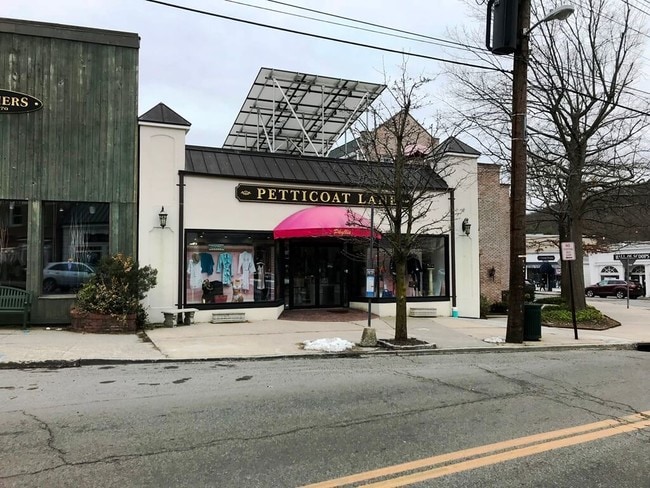
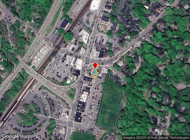
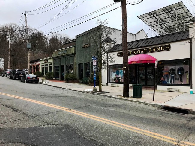
Property Record
66 King St, Chappaqua, NY 10514
NEARBY LISTINGS FOR SALE OR LEASE
Property Detail
66 King St
3600-100-011-00003-000-0062
Westchester
Officebuilding
New York
X
62.000
36119C0142F
0.08 AC
2025
Northwest
2024
Westchester/So Connecticut
013102
New York-Jersey City-White Plains, NY-NJ
3,254 SF
DEMOGRAPHICS near 66 King St
1 Mile
3 Mile
5 Mile
2024 Total Population
6,957
36,089
96,080
2029 Population
6,830
35,272
93,694
Pop Growth 2024-2029
(1.83%)
(2.26%)
(2.48%)
Average Age
41
41
41
2024 Total Households
2,389
11,536
32,622
HH Growth 2024-2029
(1.97%)
(2.59%)
(2.71%)
Median Household Inc
$204,184
$202,330
$145,908
Avg Household Size
2.90
2.90
2.80
2024 Avg HH Vehicles
2.00
2.00
2.00
Median Home Value
$773,591
$804,075
$721,035
Median Year Built
1961
1960
1961
Nearby Places
- Restaurants
- Banks
- Shops
- Fitness
- Groceries
PUBLIC TRANSPORTATION
COMMUTER RAIL
Chappaqua Station (Harlem Line - Metro-North Commuter Railroad Company (Metro-North))
DRIVE
WALK
Distance
Chappaqua Station (Harlem Line - Metro-North Commuter Railroad Company (Metro-North))
1 min
4 min
0.2 mi
Pleasantville Station (Harlem Line - Metro-North Commuter Railroad Company (Metro-North))
DRIVE
WALK
Distance
Pleasantville Station (Harlem Line - Metro-North Commuter Railroad Company (Metro-North))
5 min
2.3 mi
AIRPORT
Westchester County
DRIVE
WALK
Distance
Westchester County
16 min
8.6 mi
LaGuardia
DRIVE
WALK
Distance
LaGuardia
49 min
34.8 mi
New York Stewart International
DRIVE
WALK
Distance
New York Stewart International
70 min
41.7 mi
Freight Ports
NY - Red Hook Container Terminal
DRIVE
WALK
Distance
NY - Red Hook Container Terminal
62 min
42.9 mi
SALE & LEASE HISTORY
LISTING DATE
SALE/LEASE

Mar 09, 2018
For Sale
Nearby Properties
Address
Land Use
TOTAL SIZE
Lot Size
Zoning
Address
Land Use
TOTAL SIZE
Lot Size
Zoning
Address
Land Use
TOTAL SIZE
Lot Size
Zoning
11.11 AC
Address
Land Use
TOTAL SIZE
Lot Size
Zoning
Address
Land Use
TOTAL SIZE
Lot Size
Zoning
20.54 AC
Address
Land Use
TOTAL SIZE
Lot Size
Zoning
Address
Land Use
TOTAL SIZE
Lot Size
Zoning
Address
Land Use
TOTAL SIZE
Lot Size
Zoning
2,100 SF
1.50 AC
Address
Land Use
TOTAL SIZE
Lot Size
Zoning
Address
Land Use
TOTAL SIZE
Lot Size
Zoning
55.22 AC
Address
Land Use
TOTAL SIZE
Lot Size
Zoning
450,000 SF
59.25 AC
Address
Land Use
TOTAL SIZE
Lot Size
Zoning
Address
Land Use
TOTAL SIZE
Lot Size
Zoning
Address
Land Use
TOTAL SIZE
Lot Size
Zoning
147.27 AC
R1
Address
Land Use
TOTAL SIZE
Lot Size
Zoning
Address
Land Use
TOTAL SIZE
Lot Size
Zoning
Address
Land Use
TOTAL SIZE
Lot Size
Zoning
Address
Land Use
TOTAL SIZE
Lot Size
Zoning
Address
Land Use
TOTAL SIZE
Lot Size
Zoning
46.35 AC
R1
Address
Land Use
TOTAL SIZE
Lot Size
Zoning
7.18 AC
R2
Address
Land Use
TOTAL SIZE
Lot Size
Zoning
Address
Land Use
TOTAL SIZE
Lot Size
Zoning
Address
Land Use
TOTAL SIZE
Lot Size
Zoning
Address
Land Use
TOTAL SIZE
Lot Size
Zoning
Address
Land Use
TOTAL SIZE
Lot Size
Zoning
Address
Land Use
TOTAL SIZE
Lot Size
Zoning
53.90 AC
Address
Land Use
TOTAL SIZE
Lot Size
Zoning
Address
Land Use
TOTAL SIZE
Lot Size
Zoning
0.56 AC
Address
Land Use
TOTAL SIZE
Lot Size
Zoning
2.09 AC
Address
Land Use
TOTAL SIZE
Lot Size
Zoning
2,494 SF
1.75 AC
Address
Land Use
TOTAL SIZE
Lot Size
Zoning
The World's #1 Commercial Real Estate Marketplace
Connect with us
© 2025 CoStar Group
The information above has been obtained from sources believed reliable. While we do not doubt its accuracy we have not verified it and make no guarantee, warranty or representation about it. It is your responsibility to independently confirm its accuracy and completeness. Any projections, opinions, assumptions, or estimates used are for example only and do not represent the current or future performance of the property. The value of this transaction to you depends on tax and other factors which should be evaluated by your tax, financial, and legal advisors. You and your advisors should conduct a careful, independent investigation of the property to determine to your satisfaction the suitability of the property for your needs.