Property Record
State Highway 75, Oneonta, AL 35121
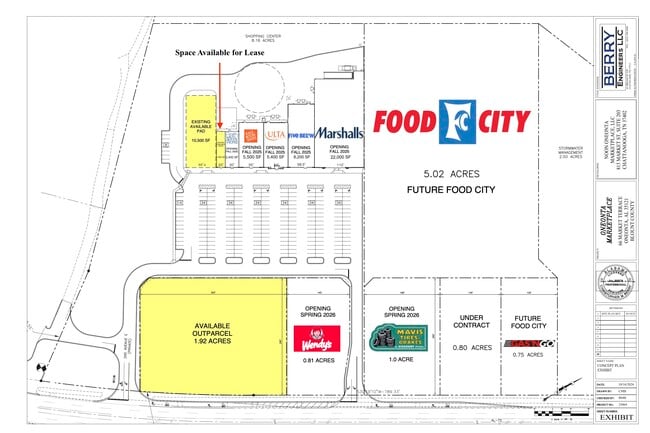
Current Lease Availabilities
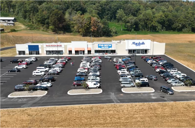
NEARBY LISTINGS FOR SALE OR LEASE
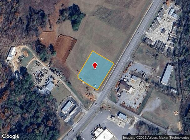
Property Detail
State Highway 75
16-04-20-4-000-001.000
BEG NE COR SE/4 S 595 TO NW R/W HWY 75 SW ALG SD R/W 250 NW 266 NW 860 TO N LN IN SE/4 E 880 TO POB--
Vacantlandnec
Blount
X
Alabama
01009C0330F
9 AC
0
Blount County
2024
Birmingham
050105
Birmingham-Hoover, AL
DEMOGRAPHICS near State Highway 75
1 Mile
3 Mile
5 Mile
2024 Total Population
542
6,632
11,355
2029 Population
564
6,894
11,796
Pop Growth 2024-2029
+ 4.06%
+ 3.95%
+ 3.88%
Average Age
43
42
41
2024 Total Households
209
2,506
4,278
HH Growth 2024-2029
+ 4.31%
+ 3.99%
+ 3.88%
Median Household Inc
$44,999
$54,508
$53,778
Avg Household Size
2.40
2.50
2.50
2024 Avg HH Vehicles
2.00
2.00
2.00
Median Home Value
$258,999
$224,249
$192,797
Median Year Built
1974
1972
1976
Nearby Places
Map Layers
Map Styles
 Street
 Aerial
- Restaurants
- Banks
- Shops
- Fitness
- Groceries
Nearby Properties
Address
Land Use
TOTAL SIZE
Lot Size
Zoning
Address
Land Use
TOTAL SIZE
Lot Size
Zoning
147,374 SF
11 AC
Address
Land Use
TOTAL SIZE
Lot Size
Zoning
27,944 SF
1.08 AC
Address
Land Use
TOTAL SIZE
Lot Size
Zoning
32,392 SF
1.34 AC
Address
Land Use
TOTAL SIZE
Lot Size
Zoning
23,245 SF
0.99 AC
Address
Land Use
TOTAL SIZE
Lot Size
Zoning
15,626 SF
0.36 AC
Address
Land Use
TOTAL SIZE
Lot Size
Zoning
99,004 SF
18 AC
Address
Land Use
TOTAL SIZE
Lot Size
Zoning
6,418 SF
8.10 AC
Address
Land Use
TOTAL SIZE
Lot Size
Zoning
45,000 SF
7.20 AC
Address
Land Use
TOTAL SIZE
Lot Size
Zoning
8,970 SF
0.65 AC
Address
Land Use
TOTAL SIZE
Lot Size
Zoning
11,921 SF
6.70 AC
Address
Land Use
TOTAL SIZE
Lot Size
Zoning
10,000 SF
1.02 AC
Address
Land Use
TOTAL SIZE
Lot Size
Zoning
9,238 SF
1.71 AC
Address
Land Use
TOTAL SIZE
Lot Size
Zoning
15,928 SF
0.96 AC
Address
Land Use
TOTAL SIZE
Lot Size
Zoning
20,930 SF
2.30 AC
Address
Land Use
TOTAL SIZE
Lot Size
Zoning
38,561 SF
3 AC
Address
Land Use
TOTAL SIZE
Lot Size
Zoning
14,560 SF
4 AC
Address
Land Use
TOTAL SIZE
Lot Size
Zoning
49,700 SF
6.90 AC
Address
Land Use
TOTAL SIZE
Lot Size
Zoning
10,004 SF
1.09 AC
Address
Land Use
TOTAL SIZE
Lot Size
Zoning
19,602 SF
4.70 AC
Address
Land Use
TOTAL SIZE
Lot Size
Zoning
14,800 SF
2.98 AC
Address
Land Use
TOTAL SIZE
Lot Size
Zoning
15,855 SF
1.22 AC
Address
Land Use
TOTAL SIZE
Lot Size
Zoning
10,841 SF
0.40 AC
Address
Land Use
TOTAL SIZE
Lot Size
Zoning
4,560 SF
0.90 AC
Address
Land Use
TOTAL SIZE
Lot Size
Zoning
11,040 SF
0.70 AC
Address
Land Use
TOTAL SIZE
Lot Size
Zoning
11,160 SF
0.62 AC
Address
Land Use
TOTAL SIZE
Lot Size
Zoning
12,152 SF
3 AC
Address
Land Use
TOTAL SIZE
Lot Size
Zoning
3,666 SF
1.20 AC
Address
Land Use
TOTAL SIZE
Lot Size
Zoning
5,651 SF
0.69 AC
The World's #1 Commercial Real Estate Marketplace
Connect with us
© 2025 CoStar Group
The information above has been obtained from sources believed reliable. While we do not doubt its accuracy we have not verified it and make no guarantee, warranty or representation about it. It is your responsibility to independently confirm its accuracy and completeness. Any projections, opinions, assumptions, or estimates used are for example only and do not represent the current or future performance of the property. The value of this transaction to you depends on tax and other factors which should be evaluated by your tax, financial, and legal advisors. You and your advisors should conduct a careful, independent investigation of the property to determine to your satisfaction the suitability of the property for your needs.