Property Record
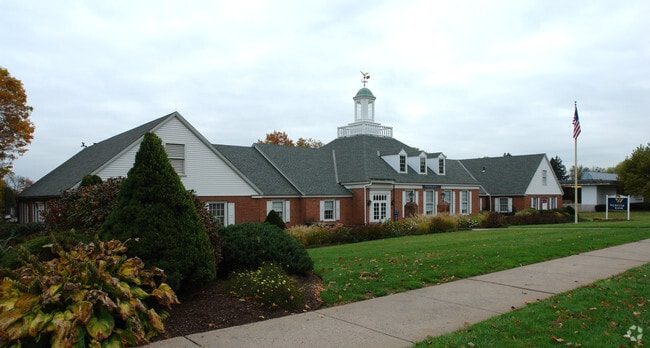
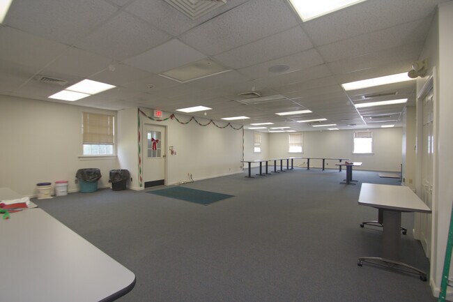
66 N Main St, Suffield, CT 06078

Property Detail
66 N Main St
SUFF-000043H-000045-000274
Capitol
Financialbuilding
Connecticut
TCV
274
B and X Area of moderate flood hazard, usually the area between the limits of the 100-year and 500-year floods.
1.18 AC
2025
Northwest Outlying
2025
Hartford
477103
Hartford-West Hartford-East Hartford, CT
7,980 SF
NEARBY LISTINGS FOR SALE OR LEASE
DEMOGRAPHICS near 66 N Main St
1 mile
3 mile
5 mile
2025 Total Population
2,847
22,026
60,750
2030 Population
2,922
22,656
61,968
Pop Growth 2025-2030
+ 2.63%
+ 2.86%
+ 2.00%
Average Age
45
42
43
2025 Total Households
1,003
8,246
24,685
HH Growth 2025-2030
+ 2.89%
+ 3.01%
+ 2.05%
Median Household Inc
$110,781
$91,149
$92,346
Avg Household Size
2.30
2.30
2.30
2025 Avg HH Vehicles
2.00
2.00
2.00
Median Home Value
$426,684
$384,464
$288,906
Median Year Built
1982
1969
1964
Nearby Places
Map Layers
Map Styles
 Street
 Aerial
Transit
 Traffic
 Biking
Places
Listings with unknown addresses are not visible on the map
- Restaurants
- Banks
- Shops
- Fitness
- Groceries
PUBLIC TRANSPORTATION
COMMUTER RAIL
Windsor Locks (Hartford Line - CT Rail (CTRail))
Drive
Walk
Distance
Windsor Locks (Hartford Line - CT Rail (CTRail))
13 min
6.8 mi
AIRPORT
Bradley International
Drive
Walk
Distance
Bradley International
14 min
4.1 mi
Freight Ports
Port of New Haven
Drive
Walk
Distance
Port of New Haven
77 min
56.3 mi
SALE & LEASE HISTORY
LISTING DATE
SALE/LEASE

Sep 04, 2019
For Lease
Nov 02, 2016
For Sale
Jul 22, 2024
For Lease
Nearby Properties
Address
Land Use
TOTAL SIZE
Lot Size
Zoning
Address
Land Use
TOTAL SIZE
Lot Size
Zoning
179,293 SF
51.07 AC
HR33
Address
Land Use
TOTAL SIZE
Lot Size
Zoning
30.30 AC
R25
Address
Land Use
TOTAL SIZE
Lot Size
Zoning
207,981 SF
60.48 AC
R45
Address
Land Use
TOTAL SIZE
Lot Size
Zoning
6,000 SF
62.78 AC
IND1
Address
Land Use
TOTAL SIZE
Lot Size
Zoning
64.41 AC
IND3
Address
Land Use
TOTAL SIZE
Lot Size
Zoning
32.40 AC
R90
Address
Land Use
TOTAL SIZE
Lot Size
Zoning
24.27 AC
SDD
Address
Land Use
TOTAL SIZE
Lot Size
Zoning
64.46 AC
R25
Address
Land Use
TOTAL SIZE
Lot Size
Zoning
12.14 AC
I
Address
Land Use
TOTAL SIZE
Lot Size
Zoning
135,228 SF
19.50 AC
R45
Address
Land Use
TOTAL SIZE
Lot Size
Zoning
21.50 AC
R25
Address
Land Use
TOTAL SIZE
Lot Size
Zoning
243,624 SF
12.16 AC
I
Address
Land Use
TOTAL SIZE
Lot Size
Zoning
106,851 SF
20.33 AC
R25
Address
Land Use
TOTAL SIZE
Lot Size
Zoning
10 AC
R45
Address
Land Use
TOTAL SIZE
Lot Size
Zoning
18.04 AC
R33
Address
Land Use
TOTAL SIZE
Lot Size
Zoning
35.52 AC
R25
Address
Land Use
TOTAL SIZE
Lot Size
Zoning
67,592 SF
7.70 AC
R25
Address
Land Use
TOTAL SIZE
Lot Size
Zoning
92,900 SF
20.84 AC
PDIP
Address
Land Use
TOTAL SIZE
Lot Size
Zoning
13 AC
I
Address
Land Use
TOTAL SIZE
Lot Size
Zoning
13.85 AC
HR33
Address
Land Use
TOTAL SIZE
Lot Size
Zoning
99.10 AC
R25
Address
Land Use
TOTAL SIZE
Lot Size
Zoning
7.11 AC
R33
Address
Land Use
TOTAL SIZE
Lot Size
Zoning
25.91 AC
R45
Address
Land Use
TOTAL SIZE
Lot Size
Zoning
93,331 SF
2.93 AC
I
Address
Land Use
TOTAL SIZE
Lot Size
Zoning
17,950 SF
1.30 AC
TCV
Address
Land Use
TOTAL SIZE
Lot Size
Zoning
90,925 SF
5.81 AC
PDIP
Address
Land Use
TOTAL SIZE
Lot Size
Zoning
3.13 AC
PDIP
Address
Land Use
TOTAL SIZE
Lot Size
Zoning
1.88 AC
PDIP
Address
Land Use
TOTAL SIZE
Lot Size
Zoning
4,044 SF
17.18 AC
PDIP
Address
Land Use
TOTAL SIZE
Lot Size
Zoning
3.49 AC
TCV
The World's #1 Commercial Real Estate Marketplace
Connect with us
© 2026 CoStar Group
The information above has been obtained from sources believed reliable. While we do not doubt its accuracy we have not verified it and make no guarantee, warranty or representation about it. It is your responsibility to independently confirm its accuracy and completeness. Any projections, opinions, assumptions, or estimates used are for example only and do not represent the current or future performance of the property. The value of this transaction to you depends on tax and other factors which should be evaluated by your tax, financial, and legal advisors. You and your advisors should conduct a careful, independent investigation of the property to determine to your satisfaction the suitability of the property for your needs.