Property Record
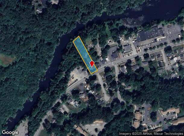
66 Powder Mill Rd, Maynard, MA 01754
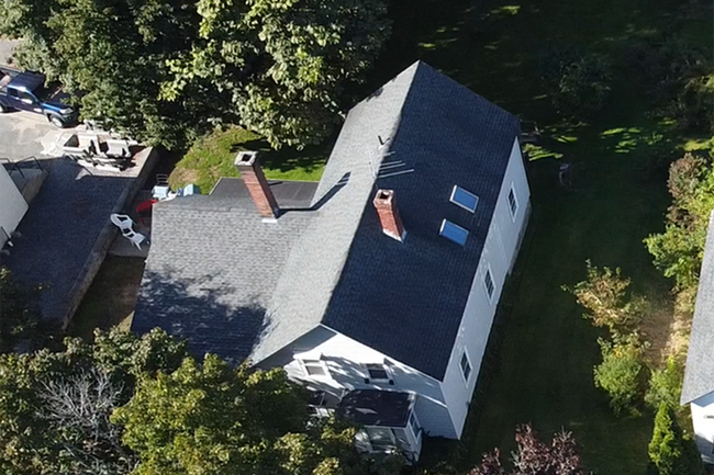
This Property Is For Sale
NEARBY LISTINGS FOR SALE OR LEASE
Property Detail
66 Powder Mill Rd
Boston-Cambridge-Newton, MA-NH
Middlesex
MAYN-000010-000000-000103
Massachusetts
Duplex
0.56 AC
AE
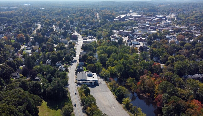
Maynard
25017C0362F
Boston
2,260 SF
DEMOGRAPHICS near 66 Powder Mill Rd
1 Mile
3 Mile
5 Mile
2024 Total Population
8,415
34,037
70,645
2029 Population
8,295
33,866
70,316
Pop Growth 2024-2029
(1.43%)
(0.50%)
(0.47%)
Average Age
42
42
43
2024 Total Households
3,597
12,981
26,267
HH Growth 2024-2029
(1.64%)
(0.62%)
(0.56%)
Median Household Inc
$112,638
$154,154
$168,434
Avg Household Size
2.30
2.60
2.60
2024 Avg HH Vehicles
2.00
2.00
2.00
Median Home Value
$458,623
$678,315
$748,842
Median Year Built
1962
1970
1972
Nearby Places
Map Layers
Map Styles
 Street
 Aerial
- Restaurants
- Banks
- Shops
- Fitness
- Groceries
PUBLIC TRANSPORTATION
COMMUTER RAIL
South Acton (Fitchburg/South Acton Line - Massachusetts Bay Transportation Authority Commuter Rail (Purple Line))
DRIVE
WALK
Distance
South Acton (Fitchburg/South Acton Line - Massachusetts Bay Transportation Authority Commuter Rail (Purple Line))
7 min
2.8 mi
West Concord (Fitchburg/South Acton Line - Massachusetts Bay Transportation Authority Commuter Rail (Purple Line))
DRIVE
WALK
Distance
West Concord (Fitchburg/South Acton Line - Massachusetts Bay Transportation Authority Commuter Rail (Purple Line))
7 min
3.2 mi
AIRPORT
General Edward Lawrence Logan International
DRIVE
WALK
Distance
General Edward Lawrence Logan International
43 min
26.6 mi
Worcester Regional
DRIVE
WALK
Distance
Worcester Regional
49 min
30.1 mi
Manchester Boston Regional
DRIVE
WALK
Distance
Manchester Boston Regional
69 min
44.4 mi
Nearby Properties
Address
Land Use
TOTAL SIZE
Lot Size
Zoning
Address
Land Use
TOTAL SIZE
Lot Size
Zoning
30.39 AC
I
Address
Land Use
TOTAL SIZE
Lot Size
Zoning
160 SF
R1
Address
Land Use
TOTAL SIZE
Lot Size
Zoning
326,464 SF
19.52 AC
I
Address
Land Use
TOTAL SIZE
Lot Size
Zoning
116,968 SF
3.44 AC
WCI
Address
Land Use
TOTAL SIZE
Lot Size
Zoning
25.15 AC
R2
Address
Land Use
TOTAL SIZE
Lot Size
Zoning
77,323 SF
18 AC
C
Address
Land Use
TOTAL SIZE
Lot Size
Zoning
51,504 SF
18.87 AC
C
Address
Land Use
TOTAL SIZE
Lot Size
Zoning
31.29 AC
AA
Address
Land Use
TOTAL SIZE
Lot Size
Zoning
7.88 AC
B
Address
Land Use
TOTAL SIZE
Lot Size
Zoning
155,339 SF
24 AC
R1
Address
Land Use
TOTAL SIZE
Lot Size
Zoning
35.99 AC
HI
Address
Land Use
TOTAL SIZE
Lot Size
Zoning
9.56 AC
PM
Address
Land Use
TOTAL SIZE
Lot Size
Zoning
815 AC
OS
Address
Land Use
TOTAL SIZE
Lot Size
Zoning
13.19 AC
B
Address
Land Use
TOTAL SIZE
Lot Size
Zoning
54,892 SF
7.99 AC
AA
Address
Land Use
TOTAL SIZE
Lot Size
Zoning
13.07 AC
RD
Address
Land Use
TOTAL SIZE
Lot Size
Zoning
105,036 SF
6.84 AC
KC
Address
Land Use
TOTAL SIZE
Lot Size
Zoning
4,621 SF
64.80 AC
RD
Address
Land Use
TOTAL SIZE
Lot Size
Zoning
76,623 SF
16.59 AC
R2
Address
Land Use
TOTAL SIZE
Lot Size
Zoning
990.40 AC
RC
Address
Land Use
TOTAL SIZE
Lot Size
Zoning
40 AC
R2
Address
Land Use
TOTAL SIZE
Lot Size
Zoning
33.05 AC
I
Address
Land Use
TOTAL SIZE
Lot Size
Zoning
26.16 AC
R2
Address
Land Use
TOTAL SIZE
Lot Size
Zoning
56,036 SF
17.13 AC
R2
Address
Land Use
TOTAL SIZE
Lot Size
Zoning
105,163 SF
10.65 AC
OP2
Address
Land Use
TOTAL SIZE
Lot Size
Zoning
85,000 SF
18.77 AC
R1
Address
Land Use
TOTAL SIZE
Lot Size
Zoning
98,750 SF
15.48 AC
OP2
Address
Land Use
TOTAL SIZE
Lot Size
Zoning
124,668 SF
9.89 AC
I
Address
Land Use
TOTAL SIZE
Lot Size
Zoning
63,098 SF
1.98 AC
WCI
Address
Land Use
TOTAL SIZE
Lot Size
Zoning
5,002 SF
34.80 AC
PM
The World's #1 Commercial Real Estate Marketplace
Connect with us
© 2026 CoStar Group
The information above has been obtained from sources believed reliable. While we do not doubt its accuracy we have not verified it and make no guarantee, warranty or representation about it. It is your responsibility to independently confirm its accuracy and completeness. Any projections, opinions, assumptions, or estimates used are for example only and do not represent the current or future performance of the property. The value of this transaction to you depends on tax and other factors which should be evaluated by your tax, financial, and legal advisors. You and your advisors should conduct a careful, independent investigation of the property to determine to your satisfaction the suitability of the property for your needs.