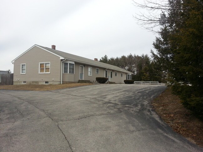
Property Record
66 Route 125, Brentwood, NH 03833


NEARBY LISTINGS FOR SALE OR LEASE
Property Detail
66 Route 125
Commercialofficeresidentialmixeduse
Rockingham
X
New Hampshire
33015C0379E
10.57 AC
2024
Rockingham
2024
Boston
060000
Boston-Cambridge-Newton, MA-NH
6,313 SF
BREN-000224-000101
DEMOGRAPHICS near 66 Route 125
1 Mile
3 Mile
5 Mile
2024 Total Population
1,015
7,836
23,120
2029 Population
1,029
8,014
23,839
Pop Growth 2024-2029
+ 1.38%
+ 2.27%
+ 3.11%
Average Age
42
44
44
2024 Total Households
344
2,869
8,770
HH Growth 2024-2029
+ 1.16%
+ 2.23%
+ 3.10%
Median Household Inc
$147,221
$124,243
$113,091
Avg Household Size
2.90
2.70
2.50
2024 Avg HH Vehicles
2.00
2.00
2.00
Median Home Value
$488,234
$426,633
$409,036
Median Year Built
1990
1984
1987
Nearby Places
Map Layers
Map Styles
 Street
 Aerial
- Restaurants
- Banks
- Shops
- Fitness
- Groceries
PUBLIC TRANSPORTATION
COMMUTER RAIL
Exeter (Downeaster - Amtrak)
DRIVE
WALK
Distance
Exeter (Downeaster - Amtrak)
16 min
7.6 mi
AIRPORT
Portsmouth International at Pease
DRIVE
WALK
Distance
Portsmouth International at Pease
41 min
24.3 mi
Manchester Boston Regional
DRIVE
WALK
Distance
Manchester Boston Regional
46 min
30.9 mi
Freight Ports
Port of Boston
DRIVE
WALK
Distance
Port of Boston
76 min
51.6 mi
SALE & LEASE HISTORY
LISTING DATE
SALE/LEASE

Sep 24, 2016
For Sale
Nearby Properties
Address
Land Use
TOTAL SIZE
Lot Size
Zoning
Address
Land Use
TOTAL SIZE
Lot Size
Zoning
71,798 SF
23 AC
C/I
Address
Land Use
TOTAL SIZE
Lot Size
Zoning
125,120 SF
20.93 AC
C2AQC2
Address
Land Use
TOTAL SIZE
Lot Size
Zoning
63,041 SF
11.21 AC
HD1AQ
Address
Land Use
TOTAL SIZE
Lot Size
Zoning
57,899 SF
32.94 AC
R/A
Address
Land Use
TOTAL SIZE
Lot Size
Zoning
44,944 SF
29 AC
HD1AQ
Address
Land Use
TOTAL SIZE
Lot Size
Zoning
29,959 SF
11.16 AC
RRAQ R
Address
Land Use
TOTAL SIZE
Lot Size
Zoning
1,296 SF
14.03 AC
RRAQ R
Address
Land Use
TOTAL SIZE
Lot Size
Zoning
55,275 SF
9.45 AC
C/I
Address
Land Use
TOTAL SIZE
Lot Size
Zoning
62,500 SF
27.86 AC
C/I
Address
Land Use
TOTAL SIZE
Lot Size
Zoning
13,986 SF
5.20 AC
C/I
Address
Land Use
TOTAL SIZE
Lot Size
Zoning
4,491 SF
3.21 AC
HD1AQ
Address
Land Use
TOTAL SIZE
Lot Size
Zoning
60,047 SF
9.14 AC
C/I
Address
Land Use
TOTAL SIZE
Lot Size
Zoning
10,965 SF
31.12 AC
RRAQ R
Address
Land Use
TOTAL SIZE
Lot Size
Zoning
33,760 SF
22.25 AC
C/I
Address
Land Use
TOTAL SIZE
Lot Size
Zoning
2,216 SF
16.98 AC
C2AQC2
Address
Land Use
TOTAL SIZE
Lot Size
Zoning
19,493 SF
4.60 AC
C/I
Address
Land Use
TOTAL SIZE
Lot Size
Zoning
4,887 SF
141.26 AC
RES
Address
Land Use
TOTAL SIZE
Lot Size
Zoning
25,080 SF
11.15 AC
C/I
Address
Land Use
TOTAL SIZE
Lot Size
Zoning
12,020 SF
2.70 AC
C/I
Address
Land Use
TOTAL SIZE
Lot Size
Zoning
2,275 SF
2.76 AC
HD1AQ
Address
Land Use
TOTAL SIZE
Lot Size
Zoning
30,512 SF
8.45 AC
C/I
Address
Land Use
TOTAL SIZE
Lot Size
Zoning
1,456 SF
65 AC
SFRAQ
Address
Land Use
TOTAL SIZE
Lot Size
Zoning
19,571 SF
73.60 AC
Address
Land Use
TOTAL SIZE
Lot Size
Zoning
18,150 SF
7.41 AC
C/I
Address
Land Use
TOTAL SIZE
Lot Size
Zoning
23,420 SF
6.50 AC
C2AQC2
Address
Land Use
TOTAL SIZE
Lot Size
Zoning
24,300 SF
8.63 AC
C/I
Address
Land Use
TOTAL SIZE
Lot Size
Zoning
19,200 SF
8.54 AC
C/I
Address
Land Use
TOTAL SIZE
Lot Size
Zoning
32,300 SF
2.78 AC
C/I
Address
Land Use
TOTAL SIZE
Lot Size
Zoning
11,041 SF
3.43 AC
RRAQ R
Address
Land Use
TOTAL SIZE
Lot Size
Zoning
7,200 SF
3 AC
RRAQ R
The World's #1 Commercial Real Estate Marketplace
Connect with us
© 2026 CoStar Group
The information above has been obtained from sources believed reliable. While we do not doubt its accuracy we have not verified it and make no guarantee, warranty or representation about it. It is your responsibility to independently confirm its accuracy and completeness. Any projections, opinions, assumptions, or estimates used are for example only and do not represent the current or future performance of the property. The value of this transaction to you depends on tax and other factors which should be evaluated by your tax, financial, and legal advisors. You and your advisors should conduct a careful, independent investigation of the property to determine to your satisfaction the suitability of the property for your needs.