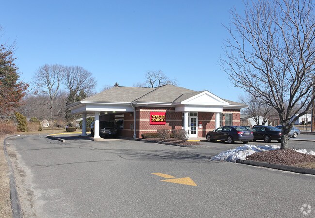
Property Record
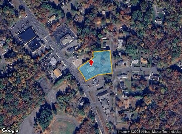
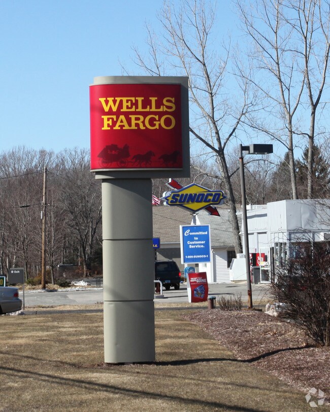
66 Waterbury Rd, Prospect, CT 06712
NEARBY LISTINGS FOR SALE OR LEASE
Property Detail
66 Waterbury Rd
PROS-000109-000160-000066
New Haven
Financialbuilding
Connecticut
X
66
09009C0138H
1.47 AC
2025
Cheshire
2025
Westchester/So Connecticut
347100
New Haven-Milford, CT
2,480 SF
DEMOGRAPHICS near 66 Waterbury Rd
1 Mile
3 Mile
5 Mile
2024 Total Population
2,704
43,668
149,180
2029 Population
2,693
43,460
148,641
Pop Growth 2024-2029
(0.41%)
(0.48%)
(0.36%)
Average Age
45
41
39
2024 Total Households
1,067
16,948
58,074
HH Growth 2024-2029
(0.37%)
(0.51%)
(0.38%)
Median Household Inc
$117,139
$76,205
$62,461
Avg Household Size
2.50
2.50
2.50
2024 Avg HH Vehicles
2.00
2.00
2.00
Median Home Value
$303,885
$218,808
$217,120
Median Year Built
1977
1968
1962
Nearby Places
Map Layers
Map Styles
 Street
 Aerial
- Restaurants
- Banks
- Shops
- Fitness
- Groceries
PUBLIC TRANSPORTATION
COMMUTER RAIL
Waterbury Station (New Haven Line - Metro-North Commuter Railroad Company (Metro-North))
DRIVE
WALK
Distance
Waterbury Station (New Haven Line - Metro-North Commuter Railroad Company (Metro-North))
10 min
4.8 mi
Naugatuck Station (New Haven Line - Metro-North Commuter Railroad Company (Metro-North))
DRIVE
WALK
Distance
Naugatuck Station (New Haven Line - Metro-North Commuter Railroad Company (Metro-North))
11 min
5.4 mi
AIRPORT
Tweed/New Haven
DRIVE
WALK
Distance
Tweed/New Haven
38 min
21.6 mi
Bradley International
DRIVE
WALK
Distance
Bradley International
69 min
44.7 mi
Nearby Properties
Address
Land Use
TOTAL SIZE
Lot Size
Zoning
Address
Land Use
TOTAL SIZE
Lot Size
Zoning
77.50 AC
RS
Address
Land Use
TOTAL SIZE
Lot Size
Zoning
88,350 SF
9.50 AC
RS
Address
Land Use
TOTAL SIZE
Lot Size
Zoning
87,221 SF
46.28 AC
RA-1
Address
Land Use
TOTAL SIZE
Lot Size
Zoning
97,386 SF
53.20 AC
RS
Address
Land Use
TOTAL SIZE
Lot Size
Zoning
12.49 AC
CA
Address
Land Use
TOTAL SIZE
Lot Size
Zoning
91,324 SF
22.27 AC
RM
Address
Land Use
TOTAL SIZE
Lot Size
Zoning
25,474 SF
20.35 AC
RM
Address
Land Use
TOTAL SIZE
Lot Size
Zoning
25,844 SF
22.20 AC
R-80
Address
Land Use
TOTAL SIZE
Lot Size
Zoning
152,704 SF
17.09 AC
CA
Address
Land Use
TOTAL SIZE
Lot Size
Zoning
95,030 SF
14.30 AC
RA-1
Address
Land Use
TOTAL SIZE
Lot Size
Zoning
115,996 SF
19.57 AC
CA
Address
Land Use
TOTAL SIZE
Lot Size
Zoning
35,200 SF
8.55 AC
B
Address
Land Use
TOTAL SIZE
Lot Size
Zoning
4,368 SF
13.97 AC
RM
Address
Land Use
TOTAL SIZE
Lot Size
Zoning
59,531 SF
2.70 AC
CA
Address
Land Use
TOTAL SIZE
Lot Size
Zoning
6.39 AC
RM
Address
Land Use
TOTAL SIZE
Lot Size
Zoning
61,173 SF
3.60 AC
RL
Address
Land Use
TOTAL SIZE
Lot Size
Zoning
90,198 SF
21.32 AC
CA
Address
Land Use
TOTAL SIZE
Lot Size
Zoning
45,768 SF
2.59 AC
RL
Address
Land Use
TOTAL SIZE
Lot Size
Zoning
62,889 SF
10.97 AC
CA
Address
Land Use
TOTAL SIZE
Lot Size
Zoning
8.02 AC
CA
Address
Land Use
TOTAL SIZE
Lot Size
Zoning
4.76 AC
RM
Address
Land Use
TOTAL SIZE
Lot Size
Zoning
91,173 SF
1.95 AC
CG
Address
Land Use
TOTAL SIZE
Lot Size
Zoning
12.71 AC
RM
Address
Land Use
TOTAL SIZE
Lot Size
Zoning
45,193 SF
12.92 AC
B
Address
Land Use
TOTAL SIZE
Lot Size
Zoning
13,114 SF
7.70 AC
Address
Land Use
TOTAL SIZE
Lot Size
Zoning
3.11 AC
RL
Address
Land Use
TOTAL SIZE
Lot Size
Zoning
52,250 SF
14.32 AC
RA1
Address
Land Use
TOTAL SIZE
Lot Size
Zoning
9.75 AC
RM
Address
Land Use
TOTAL SIZE
Lot Size
Zoning
28.89 AC
IP
Address
Land Use
TOTAL SIZE
Lot Size
Zoning
209,186 SF
20.50 AC
IP
The World's #1 Commercial Real Estate Marketplace
Connect with us
© 2025 CoStar Group
The information above has been obtained from sources believed reliable. While we do not doubt its accuracy we have not verified it and make no guarantee, warranty or representation about it. It is your responsibility to independently confirm its accuracy and completeness. Any projections, opinions, assumptions, or estimates used are for example only and do not represent the current or future performance of the property. The value of this transaction to you depends on tax and other factors which should be evaluated by your tax, financial, and legal advisors. You and your advisors should conduct a careful, independent investigation of the property to determine to your satisfaction the suitability of the property for your needs.