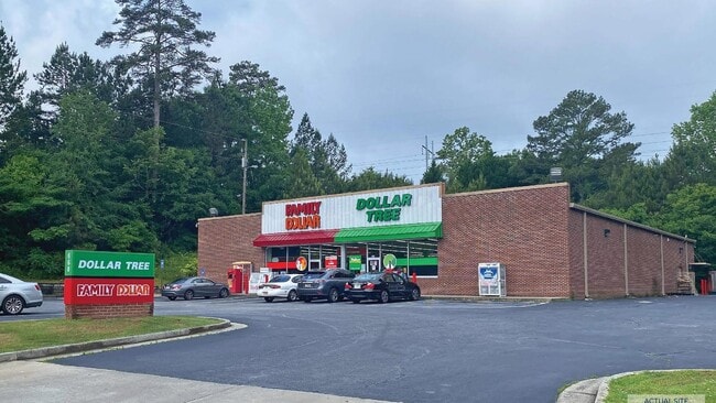
Property Record
660 Crowell Rd, Porterdale, GA 30014


NEARBY LISTINGS FOR SALE OR LEASE
Property Detail
660 Crowell Rd
Atlanta-Sandy Springs-Roswell, GA
Porterdale Commercial Corridor
P045000000028000
1.70AC LL99 GOLF CRS RD
Wholesaleoutletdiscountstore
Newton
A
Georgia
13217C0109D
99
2025
1.70 AC
2025
Lithonia/Conyers
100507
Atlanta
9,000 SF
DEMOGRAPHICS near 660 Crowell Rd
1 Mile
3 Mile
5 Mile
2024 Total Population
3,567
30,607
78,669
2029 Population
3,955
34,058
87,208
Pop Growth 2024-2029
+ 10.88%
+ 11.28%
+ 10.85%
Average Age
37
37
37
2024 Total Households
1,278
10,898
27,825
HH Growth 2024-2029
+ 10.95%
+ 11.56%
+ 11.17%
Median Household Inc
$64,923
$69,090
$71,718
Avg Household Size
2.80
2.70
2.70
2024 Avg HH Vehicles
2.00
2.00
2.00
Median Home Value
$142,144
$158,221
$176,197
Median Year Built
1994
1999
1997
Nearby Places
Map Layers
Map Styles
 Street
 Aerial
- Restaurants
- Banks
- Shops
- Fitness
- Groceries
SALE & LEASE HISTORY
LISTING DATE
SALE/LEASE

Sep 23, 2016
For Sale
May 30, 2024
For Sale
Nearby Properties
Address
Land Use
TOTAL SIZE
Lot Size
Zoning
Address
Land Use
TOTAL SIZE
Lot Size
Zoning
306,886 SF
118.50 AC
R2
Address
Land Use
TOTAL SIZE
Lot Size
Zoning
14,624 SF
26.09 AC
C1
Address
Land Use
TOTAL SIZE
Lot Size
Zoning
19,292 SF
8.20 AC
H1
Address
Land Use
TOTAL SIZE
Lot Size
Zoning
92,162 SF
11.21 AC
R2
Address
Land Use
TOTAL SIZE
Lot Size
Zoning
5,160 SF
45.17 AC
C1
Address
Land Use
TOTAL SIZE
Lot Size
Zoning
1,627 SF
16.62 AC
C1
Address
Land Use
TOTAL SIZE
Lot Size
Zoning
14,080 SF
10 AC
C1
Address
Land Use
TOTAL SIZE
Lot Size
Zoning
82,716 SF
21.04 AC
R2
Address
Land Use
TOTAL SIZE
Lot Size
Zoning
222,056 SF
13.35 AC
Address
Land Use
TOTAL SIZE
Lot Size
Zoning
3,888 SF
7.17 AC
C1
Address
Land Use
TOTAL SIZE
Lot Size
Zoning
65,008 SF
23.81 AC
R2
Address
Land Use
TOTAL SIZE
Lot Size
Zoning
64,799 SF
19.10 AC
E6
Address
Land Use
TOTAL SIZE
Lot Size
Zoning
4,768 SF
263.26 AC
C1
Address
Land Use
TOTAL SIZE
Lot Size
Zoning
28,512 SF
0.52 AC
Address
Land Use
TOTAL SIZE
Lot Size
Zoning
38,120 SF
155.15 AC
E1
Address
Land Use
TOTAL SIZE
Lot Size
Zoning
54,712 SF
54.54 AC
E6
Address
Land Use
TOTAL SIZE
Lot Size
Zoning
27,492 SF
0.47 AC
Address
Land Use
TOTAL SIZE
Lot Size
Zoning
101,010 SF
42.72 AC
E6
Address
Land Use
TOTAL SIZE
Lot Size
Zoning
150,006 SF
8.89 AC
Address
Land Use
TOTAL SIZE
Lot Size
Zoning
5,226 SF
8.13 AC
C1
Address
Land Use
TOTAL SIZE
Lot Size
Zoning
85,560 SF
10.26 AC
C1
Address
Land Use
TOTAL SIZE
Lot Size
Zoning
73,624 SF
15.25 AC
C1
Address
Land Use
TOTAL SIZE
Lot Size
Zoning
65,360 SF
20 AC
E6
Address
Land Use
TOTAL SIZE
Lot Size
Zoning
36,615 SF
9.78 AC
E2
Address
Land Use
TOTAL SIZE
Lot Size
Zoning
311,423 SF
20.78 AC
I1
Address
Land Use
TOTAL SIZE
Lot Size
Zoning
2,556 SF
5.15 AC
C1
Address
Land Use
TOTAL SIZE
Lot Size
Zoning
15,732 SF
1.70 AC
C1
Address
Land Use
TOTAL SIZE
Lot Size
Zoning
20,163 SF
7.94 AC
E1
Address
Land Use
TOTAL SIZE
Lot Size
Zoning
331.12 AC
AR
Address
Land Use
TOTAL SIZE
Lot Size
Zoning
10,714 SF
1.87 AC
The World's #1 Commercial Real Estate Marketplace
Connect with us
© 2025 CoStar Group
The information above has been obtained from sources believed reliable. While we do not doubt its accuracy we have not verified it and make no guarantee, warranty or representation about it. It is your responsibility to independently confirm its accuracy and completeness. Any projections, opinions, assumptions, or estimates used are for example only and do not represent the current or future performance of the property. The value of this transaction to you depends on tax and other factors which should be evaluated by your tax, financial, and legal advisors. You and your advisors should conduct a careful, independent investigation of the property to determine to your satisfaction the suitability of the property for your needs.