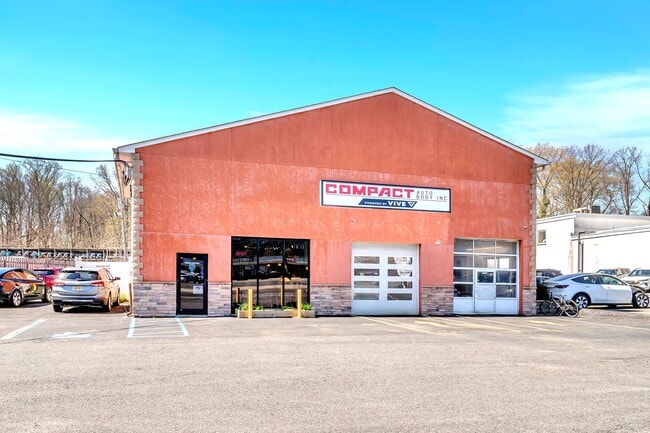
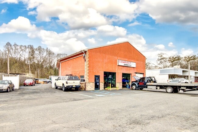
Property Record
660 State Route 35, Middletown, NJ 07748

Property Detail
660 State Route 35
32-00869-0000-00108
MONMOUTH
Commercialnec
New Jersey
MU15
108
B and X Area of moderate flood hazard, usually the area between the limits of the 100-year and 500-year floods.
0.78 AC
2024
Eastern Monmouth
2025
Northern New Jersey
801000
Lakewood-New Brunswick, NJ
6,696 SF
NEARBY LISTINGS FOR SALE OR LEASE
DEMOGRAPHICS near 660 State Route 35
1 mile
3 mile
5 mile
2025 Total Population
6,165
48,103
132,461
2030 Population
6,143
47,602
131,608
Pop Growth 2025-2030
(0.36%)
(1.04%)
(0.64%)
Average Age
43
43
42
2025 Total Households
2,438
17,811
48,745
HH Growth 2025-2030
(0.49%)
(1.19%)
(0.81%)
Median Household Inc
$140,689
$139,263
$132,171
Avg Household Size
2.50
2.60
2.60
2025 Avg HH Vehicles
2.00
2.00
2.00
Median Home Value
$696,540
$682,187
$674,322
Median Year Built
1974
1968
1966
Nearby Places
Map Layers
Map Styles
 Street
 Aerial
Layers
 Traffic
 Biking
Places
Listings with unknown addresses are not visible on the map
- Restaurants
- Banks
- Shops
- Fitness
- Groceries
PUBLIC TRANSPORTATION
COMMUTER RAIL
Red Bank (North Jersey Coast Line - NJ Transit Commuter Rail (NJ Transit))
Drive
Walk
Distance
Red Bank (North Jersey Coast Line - NJ Transit Commuter Rail (NJ Transit))
4 min
2.9 mi
Middletown Nj (North Jersey Coast Line - NJ TRANSIT RAIL)
Drive
Walk
Distance
Middletown Nj (North Jersey Coast Line - NJ TRANSIT RAIL)
6 min
3.4 mi
AIRPORT
Newark Liberty International
Drive
Walk
Distance
Newark Liberty International
47 min
35.0 mi
Freight Ports
New York Container Terminal
Drive
Walk
Distance
New York Container Terminal
40 min
30.1 mi
SALE & LEASE HISTORY
LISTING DATE
SALE/LEASE

Apr 16, 2025
For Sale
Nearby Properties
Address
Land Use
TOTAL SIZE
Lot Size
Zoning
Address
Land Use
TOTAL SIZE
Lot Size
Zoning
838,137 SF
253 AC
R45
Address
Land Use
TOTAL SIZE
Lot Size
Zoning
596.51 AC
CONREC
Address
Land Use
TOTAL SIZE
Lot Size
Zoning
427,320 SF
5.58 AC
MS
Address
Land Use
TOTAL SIZE
Lot Size
Zoning
199,680 SF
44 SF
MU08
Address
Land Use
TOTAL SIZE
Lot Size
Zoning
22,980 SF
5.27 AC
MU0
Address
Land Use
TOTAL SIZE
Lot Size
Zoning
128,279 SF
1.92 AC
WD
Address
Land Use
TOTAL SIZE
Lot Size
Zoning
Address
Land Use
TOTAL SIZE
Lot Size
Zoning
231,505 SF
21.75 AC
MU15
Address
Land Use
TOTAL SIZE
Lot Size
Zoning
147,236 SF
20.01 AC
MU15
Address
Land Use
TOTAL SIZE
Lot Size
Zoning
22.51 AC
MF08
Address
Land Use
TOTAL SIZE
Lot Size
Zoning
118,375 SF
18.20 AC
MU15
Address
Land Use
TOTAL SIZE
Lot Size
Zoning
154,970 SF
1.83 AC
BR-1
Address
Land Use
TOTAL SIZE
Lot Size
Zoning
1,685 SF
89.85 AC
MU15
Address
Land Use
TOTAL SIZE
Lot Size
Zoning
241,154 SF
84 AC
SF20
Address
Land Use
TOTAL SIZE
Lot Size
Zoning
77,396 SF
11.47 AC
SF20
Address
Land Use
TOTAL SIZE
Lot Size
Zoning
97,572 SF
2.57 AC
MU08
Address
Land Use
TOTAL SIZE
Lot Size
Zoning
237,821 SF
38.92 AC
SF20
Address
Land Use
TOTAL SIZE
Lot Size
Zoning
133,184 SF
14.10 AC
MU15
Address
Land Use
TOTAL SIZE
Lot Size
Zoning
91,564 SF
2.45 AC
BR-1
Address
Land Use
TOTAL SIZE
Lot Size
Zoning
127,410 SF
6.02 AC
MF15
Address
Land Use
TOTAL SIZE
Lot Size
Zoning
83.83 AC
BR-1
Address
Land Use
TOTAL SIZE
Lot Size
Zoning
74,870 SF
2.34 AC
MS
Address
Land Use
TOTAL SIZE
Lot Size
Zoning
91,520 SF
21.37 AC
MF08
Address
Land Use
TOTAL SIZE
Lot Size
Zoning
96.54 AC
I10
Address
Land Use
TOTAL SIZE
Lot Size
Zoning
83,416 SF
44.01 AC
R22
Address
Land Use
TOTAL SIZE
Lot Size
Zoning
141,313 SF
23.19 AC
SF20
Address
Land Use
TOTAL SIZE
Lot Size
Zoning
8,610 SF
169.16 AC
R30
Address
Land Use
TOTAL SIZE
Lot Size
Zoning
5,014 SF
153.81 AC
R30
Address
Land Use
TOTAL SIZE
Lot Size
Zoning
0.58 AC
BR-2
Address
Land Use
TOTAL SIZE
Lot Size
Zoning
43.97 AC
PD
The World's #1 Commercial Real Estate Marketplace
Connect with us
© 2026 CoStar Group
The information above has been obtained from sources believed reliable. While we do not doubt its accuracy we have not verified it and make no guarantee, warranty or representation about it. It is your responsibility to independently confirm its accuracy and completeness. Any projections, opinions, assumptions, or estimates used are for example only and do not represent the current or future performance of the property. The value of this transaction to you depends on tax and other factors which should be evaluated by your tax, financial, and legal advisors. You and your advisors should conduct a careful, independent investigation of the property to determine to your satisfaction the suitability of the property for your needs.