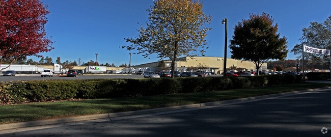
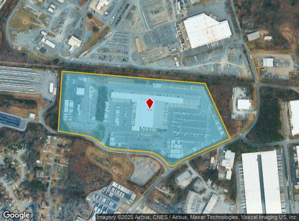
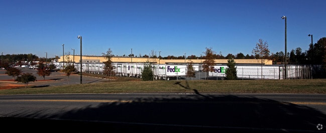
Property Record
6600 Csx Way, Charlotte, NC 28214
NEARBY LISTINGS FOR SALE OR LEASE
Property Detail
6600 Csx Way
Charlotte-Concord-Gastonia, NC-SC
Csx Indust Park 01
057-141-02
TR1 M24-924
Industrialgeneral
Mecklenburg
X
North Carolina
3710452500K
2
2024
43.63 AC
2025
I-85/Beatties Ford Rd
004304
Charlotte
273,455 SF
DEMOGRAPHICS near 6600 Csx Way
1 Mile
3 Mile
5 Mile
2024 Total Population
5,060
57,384
143,477
2029 Population
5,352
60,942
152,923
Pop Growth 2024-2029
+ 5.77%
+ 6.20%
+ 6.58%
Average Age
36
37
37
2024 Total Households
1,783
20,428
54,583
HH Growth 2024-2029
+ 5.78%
+ 6.30%
+ 6.80%
Median Household Inc
$46,479
$53,965
$57,543
Avg Household Size
2.80
2.70
2.50
2024 Avg HH Vehicles
2.00
2.00
2.00
Median Home Value
$160,819
$177,415
$218,877
Median Year Built
1988
1986
1994
Nearby Places
Map Layers
Map Styles
 Street
 Aerial
- Restaurants
- Banks
- Shops
- Fitness
- Groceries
PUBLIC TRANSPORTATION
COMMUTER RAIL
Charlotte Amtrak Station (Carolinian - Amtrak, Crescent - Amtrak, Piedmont - Amtrak)
DRIVE
WALK
Distance
Charlotte Amtrak Station (Carolinian - Amtrak, Crescent - Amtrak, Piedmont - Amtrak)
18 min
8.9 mi
AIRPORT
Charlotte/Douglas International
DRIVE
WALK
Distance
Charlotte/Douglas International
22 min
8.5 mi
Concord-Padgett Regional
DRIVE
WALK
Distance
Concord-Padgett Regional
33 min
20.4 mi
Freight Ports
North Charleston Terminal
DRIVE
WALK
Distance
North Charleston Terminal
238 min
203.9 mi
Nearby Properties
Address
Land Use
TOTAL SIZE
Lot Size
Zoning
Address
Land Use
TOTAL SIZE
Lot Size
Zoning
416,720 SF
81 AC
I2
Address
Land Use
TOTAL SIZE
Lot Size
Zoning
15.94 AC
Address
Land Use
TOTAL SIZE
Lot Size
Zoning
375,318 SF
37.31 AC
B2
Address
Land Use
TOTAL SIZE
Lot Size
Zoning
311,541 SF
40.41 AC
INST
Address
Land Use
TOTAL SIZE
Lot Size
Zoning
242,699 SF
20.50 AC
R17MF
Address
Land Use
TOTAL SIZE
Lot Size
Zoning
892,468 SF
14.48 AC
I2
Address
Land Use
TOTAL SIZE
Lot Size
Zoning
394,084 SF
29.35 AC
Address
Land Use
TOTAL SIZE
Lot Size
Zoning
238,075 SF
9.52 AC
Address
Land Use
TOTAL SIZE
Lot Size
Zoning
250,079 SF
52.97 AC
R3
Address
Land Use
TOTAL SIZE
Lot Size
Zoning
536,042 SF
37.24 AC
R-22MF
Address
Land Use
TOTAL SIZE
Lot Size
Zoning
450,580 SF
36.74 AC
I-2(CD)
Address
Land Use
TOTAL SIZE
Lot Size
Zoning
627,355 SF
45.41 AC
I2
Address
Land Use
TOTAL SIZE
Lot Size
Zoning
154,799 SF
6.09 AC
R12MF
Address
Land Use
TOTAL SIZE
Lot Size
Zoning
351,253 SF
27.85 AC
I-1(CD)
Address
Land Use
TOTAL SIZE
Lot Size
Zoning
170,968 SF
18.52 AC
I-2
Address
Land Use
TOTAL SIZE
Lot Size
Zoning
227,235 SF
44 AC
R12MF
Address
Land Use
TOTAL SIZE
Lot Size
Zoning
164,140 SF
11.81 AC
I-1
Address
Land Use
TOTAL SIZE
Lot Size
Zoning
346,795 SF
110.06 AC
I2
Address
Land Use
TOTAL SIZE
Lot Size
Zoning
89,113 SF
14.56 AC
R-3
Address
Land Use
TOTAL SIZE
Lot Size
Zoning
116,515 SF
4.59 AC
I1
Address
Land Use
TOTAL SIZE
Lot Size
Zoning
2,967 SF
9.01 AC
R-17MF
Address
Land Use
TOTAL SIZE
Lot Size
Zoning
401,879 SF
20.57 AC
I-1
Address
Land Use
TOTAL SIZE
Lot Size
Zoning
61,665 SF
49.40 AC
R3
Address
Land Use
TOTAL SIZE
Lot Size
Zoning
361,253 SF
30.87 AC
I2
Address
Land Use
TOTAL SIZE
Lot Size
Zoning
154,986 SF
13.22 AC
R-3
Address
Land Use
TOTAL SIZE
Lot Size
Zoning
38,352 SF
142 AC
R3
Address
Land Use
TOTAL SIZE
Lot Size
Zoning
232,212 SF
10.96 AC
I-2
Address
Land Use
TOTAL SIZE
Lot Size
Zoning
116,587 SF
12.80 AC
R17MF
Address
Land Use
TOTAL SIZE
Lot Size
Zoning
82,918 SF
4.70 AC
I1
The World's #1 Commercial Real Estate Marketplace
Connect with us
© 2025 CoStar Group
The information above has been obtained from sources believed reliable. While we do not doubt its accuracy we have not verified it and make no guarantee, warranty or representation about it. It is your responsibility to independently confirm its accuracy and completeness. Any projections, opinions, assumptions, or estimates used are for example only and do not represent the current or future performance of the property. The value of this transaction to you depends on tax and other factors which should be evaluated by your tax, financial, and legal advisors. You and your advisors should conduct a careful, independent investigation of the property to determine to your satisfaction the suitability of the property for your needs.