Property Record
6600 E 12 Mile Rd, Warren, MI 48092


Property Detail
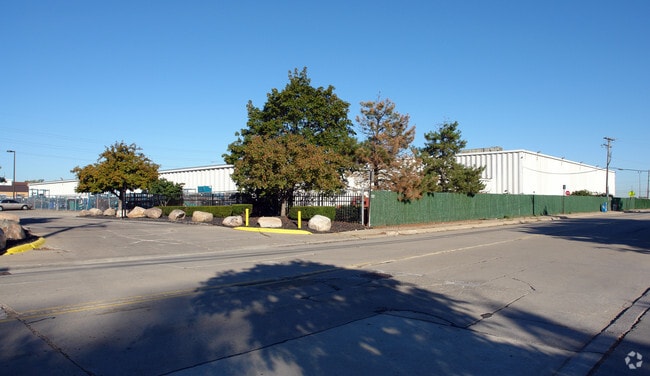
6600 E 12 Mile Rd
12-13-16-201-020
N 430A7BTOA9BINCL,A10A & A10B2TO A12A &A12B2INCL& N 13 TO N 19 INCL $T1N,R12E SEC 16 COMM AT NE COR SEC 16; TH S86*39'W
Industrialgeneral
Macomb
M-2
Michigan
B and X Area of moderate flood hazard, usually the area between the limits of the 100-year and 500-year floods.
7-19
2025
7.75 AC
2025
W of Van Dyke/Macomb
262100
Detroit
151,438 SF
Detroit-Warren-Dearborn, MI
NEARBY LISTINGS FOR SALE OR LEASE
DEMOGRAPHICS near 6600 E 12 Mile Rd
1 mile
3 mile
5 mile
2025 Total Population
7,247
110,787
331,833
2030 Population
7,362
111,503
335,801
Pop Growth 2025-2030
+ 1.59%
+ 0.65%
+ 1.20%
Average Age
41
42
41
2025 Total Households
3,061
44,981
135,493
HH Growth 2025-2030
+ 1.80%
+ 0.73%
+ 1.32%
Median Household Inc
$66,853
$65,848
$64,346
Avg Household Size
2.30
2.40
2.40
2025 Avg HH Vehicles
2.00
2.00
2.00
Median Home Value
$158,164
$195,029
$189,662
Median Year Built
1963
1964
1963
Nearby Places
Map Layers
Map Styles
 Street
 Aerial
Layers
 Traffic
 Biking
Places
Listings with unknown addresses are not visible on the map
- Restaurants
- Banks
- Shops
- Fitness
- Groceries
PUBLIC TRANSPORTATION
COMMUTER RAIL
Drive
Walk
Distance
14 min
8.6 mi
AIRPORT
Windsor International
Drive
Walk
Distance
Windsor International
46 min
26.6 mi
Detroit Metro Wayne County
Drive
Walk
Distance
Detroit Metro Wayne County
51 min
36.2 mi
Nearby Properties
Address
Land Use
TOTAL SIZE
Lot Size
Zoning
Address
Land Use
TOTAL SIZE
Lot Size
Zoning
3,988,890 SF
223.80 AC
M-3
Address
Land Use
TOTAL SIZE
Lot Size
Zoning
1,727,664 SF
167.66 AC
M-3
Address
Land Use
TOTAL SIZE
Lot Size
Zoning
1,177,879 SF
104 AC
MZ
Address
Land Use
TOTAL SIZE
Lot Size
Zoning
1,596,307 SF
Address
Land Use
TOTAL SIZE
Lot Size
Zoning
1,107,643 SF
173.73 AC
MZ
Address
Land Use
TOTAL SIZE
Lot Size
Zoning
322,580 SF
Address
Land Use
TOTAL SIZE
Lot Size
Zoning
983,373 SF
60.16 AC
M-2
Address
Land Use
TOTAL SIZE
Lot Size
Zoning
419,600 SF
Address
Land Use
TOTAL SIZE
Lot Size
Zoning
569,813 SF
62.54 AC
M-2
Address
Land Use
TOTAL SIZE
Lot Size
Zoning
207,605 SF
20.56 AC
PUD
Address
Land Use
TOTAL SIZE
Lot Size
Zoning
1,150,792 SF
53.17 AC
AD
Address
Land Use
TOTAL SIZE
Lot Size
Zoning
674,395 SF
33.13 AC
M-3
Address
Land Use
TOTAL SIZE
Lot Size
Zoning
226,380 SF
46.45 AC
M-1
Address
Land Use
TOTAL SIZE
Lot Size
Zoning
303,770 SF
23.62 AC
R-3
Address
Land Use
TOTAL SIZE
Lot Size
Zoning
283,685 SF
19.90 AC
R-3
Address
Land Use
TOTAL SIZE
Lot Size
Zoning
348,256 SF
46.10 AC
MZ
Address
Land Use
TOTAL SIZE
Lot Size
Zoning
146,981 SF
4.11 AC
Address
Land Use
TOTAL SIZE
Lot Size
Zoning
207,605 SF
19.39 AC
RETAIL5KSF
Address
Land Use
TOTAL SIZE
Lot Size
Zoning
198,064 SF
11.11 AC
MZ
Address
Land Use
TOTAL SIZE
Lot Size
Zoning
1,261,658 SF
71.94 AC
M-2
Address
Land Use
TOTAL SIZE
Lot Size
Zoning
205,993 SF
19.90 AC
MZ
Address
Land Use
TOTAL SIZE
Lot Size
Zoning
243,132 SF
7.06 AC
C-2
Address
Land Use
TOTAL SIZE
Lot Size
Zoning
219,437 SF
18.80 AC
PCD
Address
Land Use
TOTAL SIZE
Lot Size
Zoning
162,597 SF
17.94 AC
C-2
Address
Land Use
TOTAL SIZE
Lot Size
Zoning
233,900 SF
15.56 AC
M-2
Address
Land Use
TOTAL SIZE
Lot Size
Zoning
Address
Land Use
TOTAL SIZE
Lot Size
Zoning
272,046 SF
17.63 AC
M-2
Address
Land Use
TOTAL SIZE
Lot Size
Zoning
126,450 SF
17.25 AC
RM-2
Address
Land Use
TOTAL SIZE
Lot Size
Zoning
362,895 SF
14.85 AC
M-2
Address
Land Use
TOTAL SIZE
Lot Size
Zoning
442,148 SF
11.22 AC
AD
The World's #1 Commercial Real Estate Marketplace
Connect with us
© 2026 CoStar Group
The information above has been obtained from sources believed reliable. While we do not doubt its accuracy we have not verified it and make no guarantee, warranty or representation about it. It is your responsibility to independently confirm its accuracy and completeness. Any projections, opinions, assumptions, or estimates used are for example only and do not represent the current or future performance of the property. The value of this transaction to you depends on tax and other factors which should be evaluated by your tax, financial, and legal advisors. You and your advisors should conduct a careful, independent investigation of the property to determine to your satisfaction the suitability of the property for your needs.