Property Record
6600 N Socrum Loop Rd, Lakeland, FL 33809


NEARBY LISTINGS FOR SALE OR LEASE
Property Detail
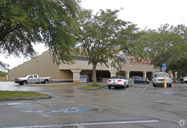
6600 N Socrum Loop Rd
24-27-19-000000-031040
High Point (Formerly Valencia)
Supermarket
COMM NE COR OF NE1/4 OF NW1/4 RUN W 71.75 FT S 35 FT S 44 DEG 50 MIN 44 SEC E 34.84 FT FOR POB CONT S 44 DEG 50 MIN 44 SEC E 15.93 FT S 517.39 FT W 89.38 FT SWLY ALONG CURVE 91.2 FT SWLY ALONG REVERSE CURVE 157.11 FT W 403.51 FT N 630.06 FT TO SLY R/
X
Polk
12105C0165G
Florida
2024
9.83 AC
2025
Polk County
012208
Tampa/St Petersburg
50,460 SF
Lakeland-Winter Haven, FL
DEMOGRAPHICS near 6600 N Socrum Loop Rd
1 Mile
3 Mile
5 Mile
2024 Total Population
9,093
50,574
94,636
2029 Population
10,763
60,363
112,871
Pop Growth 2024-2029
+ 18.37%
+ 19.36%
+ 19.27%
Average Age
44
42
41
2024 Total Households
3,685
20,247
36,417
HH Growth 2024-2029
+ 18.37%
+ 19.28%
+ 19.20%
Median Household Inc
$59,774
$61,148
$58,264
Avg Household Size
2.50
2.40
2.50
2024 Avg HH Vehicles
2.00
2.00
2.00
Median Home Value
$177,788
$220,059
$211,665
Median Year Built
1989
1992
1992
Nearby Places
Map Layers
Map Styles
 Street
 Aerial
- Restaurants
- Banks
- Shops
- Fitness
- Groceries
PUBLIC TRANSPORTATION
COMMUTER RAIL
DRIVE
WALK
Distance
12 min
6.0 mi
Nearby Properties
Address
Land Use
TOTAL SIZE
Lot Size
Zoning
Address
Land Use
TOTAL SIZE
Lot Size
Zoning
1,013,375 SF
59.99 AC
Address
Land Use
TOTAL SIZE
Lot Size
Zoning
493,501 SF
39.01 AC
MF12
Address
Land Use
TOTAL SIZE
Lot Size
Zoning
470,032 SF
23.21 AC
Address
Land Use
TOTAL SIZE
Lot Size
Zoning
586,592 SF
30.87 AC
Address
Land Use
TOTAL SIZE
Lot Size
Zoning
1,091,160 SF
133.41 AC
PUD
Address
Land Use
TOTAL SIZE
Lot Size
Zoning
363,693 SF
22.54 AC
R2
Address
Land Use
TOTAL SIZE
Lot Size
Zoning
358,929 SF
65.46 AC
XX
Address
Land Use
TOTAL SIZE
Lot Size
Zoning
361,669 SF
12.73 AC
Address
Land Use
TOTAL SIZE
Lot Size
Zoning
245,853 SF
20.09 AC
Address
Land Use
TOTAL SIZE
Lot Size
Zoning
246,838 SF
24.57 AC
PUD
Address
Land Use
TOTAL SIZE
Lot Size
Zoning
762,259 SF
24.95 AC
PUD
Address
Land Use
TOTAL SIZE
Lot Size
Zoning
400,000 SF
34.91 AC
Address
Land Use
TOTAL SIZE
Lot Size
Zoning
400,000 SF
18.51 AC
Address
Land Use
TOTAL SIZE
Lot Size
Zoning
338,930 SF
24.33 AC
Address
Land Use
TOTAL SIZE
Lot Size
Zoning
208,898 SF
17.62 AC
PUD
Address
Land Use
TOTAL SIZE
Lot Size
Zoning
359,142 SF
22.39 AC
Address
Land Use
TOTAL SIZE
Lot Size
Zoning
324,191 SF
23.37 AC
PUD
Address
Land Use
TOTAL SIZE
Lot Size
Zoning
169,546 SF
14.40 AC
PUD
Address
Land Use
TOTAL SIZE
Lot Size
Zoning
275,184 SF
16.32 AC
Address
Land Use
TOTAL SIZE
Lot Size
Zoning
226,953 SF
34.42 AC
Address
Land Use
TOTAL SIZE
Lot Size
Zoning
115,608 SF
11.44 AC
RC
Address
Land Use
TOTAL SIZE
Lot Size
Zoning
142,936 SF
26.38 AC
Address
Land Use
TOTAL SIZE
Lot Size
Zoning
101,501 SF
16.54 AC
Address
Land Use
TOTAL SIZE
Lot Size
Zoning
226,634 SF
27.21 AC
C3
Address
Land Use
TOTAL SIZE
Lot Size
Zoning
183,800 SF
19.26 AC
Address
Land Use
TOTAL SIZE
Lot Size
Zoning
206,724 SF
66.04 AC
RC
Address
Land Use
TOTAL SIZE
Lot Size
Zoning
139,302 SF
16.50 AC
RC
Address
Land Use
TOTAL SIZE
Lot Size
Zoning
118,250 SF
23.12 AC
Address
Land Use
TOTAL SIZE
Lot Size
Zoning
152,004 SF
15.81 AC
PUD
Address
Land Use
TOTAL SIZE
Lot Size
Zoning
149,871 SF
7.45 AC
PUD
The World's #1 Commercial Real Estate Marketplace
Connect with us
© 2025 CoStar Group
The information above has been obtained from sources believed reliable. While we do not doubt its accuracy we have not verified it and make no guarantee, warranty or representation about it. It is your responsibility to independently confirm its accuracy and completeness. Any projections, opinions, assumptions, or estimates used are for example only and do not represent the current or future performance of the property. The value of this transaction to you depends on tax and other factors which should be evaluated by your tax, financial, and legal advisors. You and your advisors should conduct a careful, independent investigation of the property to determine to your satisfaction the suitability of the property for your needs.