Property Record
6603 N Interstate 35, Austin, TX 78752
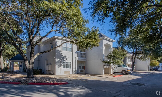

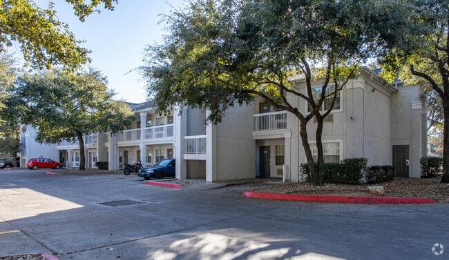

Property Detail
6603 N Interstate 35
Austin-Round Rock-San Marcos, TX
LOT 5 BLK A LA COSTA PHS 2 SEC 1-D AMENDED PLAT LT 1B & LA COSTA PHS 3 RESUB LTS 4&5 PHS 2 SEC 1-A & LTS 1A&1C PHS 2 SEC 1-D (COMMERCIAL PERSONAL PROPERTY)
229000
Travis
Motel
Texas
B and X Area of moderate flood hazard, usually the area between the limits of the 100-year and 500-year floods.
5
2025
3.71 AC
2025
Austin US-290/I-35 Area
043400
Austin
44,100 SF
NEARBY LISTINGS FOR SALE OR LEASE
-
-
View all Austin listings for sale on LoopNet.com
DEMOGRAPHICS near 6603 N Interstate 35
1 mile
3 mile
5 mile
2025 Total Population
20,514
161,740
376,169
2030 Population
21,785
169,791
395,742
Pop Growth 2025-2030
+ 6.20%
+ 4.98%
+ 5.20%
Average Age
36
37
36
2025 Total Households
8,673
71,861
161,359
HH Growth 2025-2030
+ 7.09%
+ 5.74%
+ 6.04%
Median Household Inc
$64,930
$79,001
$83,015
Avg Household Size
2.20
2.20
2.20
2025 Avg HH Vehicles
1.00
2.00
2.00
Median Home Value
$518,366
$666,283
$680,000
Median Year Built
1984
1982
1987
Nearby Places
Map Layers
Map Styles
 Street
 Aerial
Transit
 Traffic
 Biking
Places
Listings with unknown addresses are not visible on the map
- Restaurants
- Banks
- Shops
- Fitness
- Groceries
PUBLIC TRANSPORTATION
COMMUTER RAIL
Drive
Walk
Distance
14 min
7.3 mi
AIRPORT
Austin-Bergstrom International
Drive
Walk
Distance
Austin-Bergstrom International
28 min
16.9 mi
Nearby Properties
Address
Land Use
TOTAL SIZE
Lot Size
Zoning
Address
Land Use
TOTAL SIZE
Lot Size
Zoning
74.69 AC
Address
Land Use
TOTAL SIZE
Lot Size
Zoning
548,399 SF
23.82 AC
Address
Land Use
TOTAL SIZE
Lot Size
Zoning
623,000 SF
11.78 AC
Address
Land Use
TOTAL SIZE
Lot Size
Zoning
614,532 SF
66.07 AC
Address
Land Use
TOTAL SIZE
Lot Size
Zoning
1,234 SF
96.75 AC
Address
Land Use
TOTAL SIZE
Lot Size
Zoning
973,370 SF
11.26 AC
Address
Land Use
TOTAL SIZE
Lot Size
Zoning
19,284 SF
178.26 AC
Address
Land Use
TOTAL SIZE
Lot Size
Zoning
241,998 SF
2.42 AC
Address
Land Use
TOTAL SIZE
Lot Size
Zoning
480,823 SF
18.46 AC
Address
Land Use
TOTAL SIZE
Lot Size
Zoning
322,150 SF
3.83 AC
Address
Land Use
TOTAL SIZE
Lot Size
Zoning
432,032 SF
6.70 AC
Address
Land Use
TOTAL SIZE
Lot Size
Zoning
609,823 SF
3.33 AC
Address
Land Use
TOTAL SIZE
Lot Size
Zoning
372,075 SF
4.97 AC
Address
Land Use
TOTAL SIZE
Lot Size
Zoning
265,000 SF
1.57 AC
Address
Land Use
TOTAL SIZE
Lot Size
Zoning
346,319 SF
6.53 AC
Address
Land Use
TOTAL SIZE
Lot Size
Zoning
297,356 SF
4.32 AC
Address
Land Use
TOTAL SIZE
Lot Size
Zoning
288,750 SF
4.81 AC
Address
Land Use
TOTAL SIZE
Lot Size
Zoning
425,200 SF
2.49 AC
Address
Land Use
TOTAL SIZE
Lot Size
Zoning
296,378 SF
3.72 AC
Address
Land Use
TOTAL SIZE
Lot Size
Zoning
274,228 SF
4.95 AC
Address
Land Use
TOTAL SIZE
Lot Size
Zoning
126.15 AC
Address
Land Use
TOTAL SIZE
Lot Size
Zoning
276,772 SF
4.68 AC
Address
Land Use
TOTAL SIZE
Lot Size
Zoning
292,431 SF
2.33 AC
Address
Land Use
TOTAL SIZE
Lot Size
Zoning
32.82 AC
Address
Land Use
TOTAL SIZE
Lot Size
Zoning
274,943 SF
42.35 AC
Address
Land Use
TOTAL SIZE
Lot Size
Zoning
467,647 SF
3.54 AC
Address
Land Use
TOTAL SIZE
Lot Size
Zoning
16.79 AC
Address
Land Use
TOTAL SIZE
Lot Size
Zoning
18.45 AC
Address
Land Use
TOTAL SIZE
Lot Size
Zoning
236,688 SF
3.64 AC
Address
Land Use
TOTAL SIZE
Lot Size
Zoning
248,325 SF
2.46 AC
The World's #1 Commercial Real Estate Marketplace
Connect with us
© 2026 CoStar Group
The information above has been obtained from sources believed reliable. While we do not doubt its accuracy we have not verified it and make no guarantee, warranty or representation about it. It is your responsibility to independently confirm its accuracy and completeness. Any projections, opinions, assumptions, or estimates used are for example only and do not represent the current or future performance of the property. The value of this transaction to you depends on tax and other factors which should be evaluated by your tax, financial, and legal advisors. You and your advisors should conduct a careful, independent investigation of the property to determine to your satisfaction the suitability of the property for your needs.