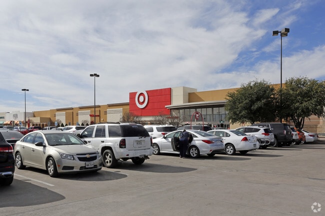
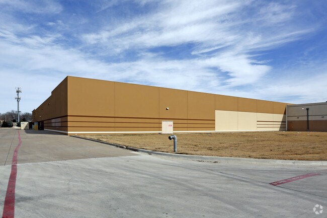
Property Record
6605 Azle Ave, Fort Worth, TX 76135
NEARBY LISTINGS FOR SALE OR LEASE
Property Detail
6605 Azle Ave
Dallas-Fort Worth-Arlington, TX
Lake Worth Towne Crossing Addn
42094621
LAKE WORTH TOWNE CROSSING ADDN BLOCK 1 LOT 1R
Commercialnec
Tarrant
X
Texas
48439C0160K
1r
2024
13.26 AC
2025
White Settlement
100601
Dallas/Ft Worth
123,735 SF
DEMOGRAPHICS near 6605 Azle Ave
1 Mile
3 Mile
5 Mile
2024 Total Population
7,852
49,115
164,244
2029 Population
8,315
51,720
173,797
Pop Growth 2024-2029
+ 5.90%
+ 5.30%
+ 5.82%
Average Age
37
36
36
2024 Total Households
3,008
16,192
55,266
HH Growth 2024-2029
+ 5.88%
+ 5.47%
+ 5.98%
Median Household Inc
$55,802
$63,802
$68,923
Avg Household Size
2.60
2.90
2.90
2024 Avg HH Vehicles
2.00
2.00
2.00
Median Home Value
$214,081
$225,931
$231,549
Median Year Built
1986
1993
1989
Nearby Places
Map Layers
Map Styles
 Street
 Aerial
- Restaurants
- Banks
- Shops
- Fitness
- Groceries
PUBLIC TRANSPORTATION
COMMUTER RAIL
Fort Worth (Heartland Flyer - Amtrak, Texas Eagle - Amtrak)
DRIVE
WALK
Distance
Fort Worth (Heartland Flyer - Amtrak, Texas Eagle - Amtrak)
16 min
8.2 mi
Fort Worth Intermodal Transportation Center (Itc) (TRINITY RAILWAY - Dallas Area Rapid Transit (DART), Trinity Railway Express - Dallas Area Rapid Transit (DART))
DRIVE
WALK
Distance
Fort Worth Intermodal Transportation Center (Itc) (TRINITY RAILWAY - Dallas Area Rapid Transit (DART), Trinity Railway Express - Dallas Area Rapid Transit (DART))
16 min
8.2 mi
AIRPORT
Dallas-Fort Worth International
DRIVE
WALK
Distance
Dallas-Fort Worth International
37 min
28.7 mi
Freight Ports
Port of Shreveport
DRIVE
WALK
Distance
Port of Shreveport
258 min
236.6 mi
Nearby Properties
Address
Land Use
TOTAL SIZE
Lot Size
Zoning
Address
Land Use
TOTAL SIZE
Lot Size
Zoning
431,028 SF
126.62 AC
Address
Land Use
TOTAL SIZE
Lot Size
Zoning
342,456 SF
15.56 AC
Address
Land Use
TOTAL SIZE
Lot Size
Zoning
531,597 SF
31.71 AC
Address
Land Use
TOTAL SIZE
Lot Size
Zoning
293,830 SF
14.90 AC
Address
Land Use
TOTAL SIZE
Lot Size
Zoning
341,646 SF
17.63 AC
Address
Land Use
TOTAL SIZE
Lot Size
Zoning
225,140 SF
11.68 AC
Address
Land Use
TOTAL SIZE
Lot Size
Zoning
254,610 SF
15.92 AC
Address
Land Use
TOTAL SIZE
Lot Size
Zoning
319,219 SF
13.43 AC
Address
Land Use
TOTAL SIZE
Lot Size
Zoning
284,422 SF
119.90 AC
Address
Land Use
TOTAL SIZE
Lot Size
Zoning
219,007 SF
10.91 AC
Address
Land Use
TOTAL SIZE
Lot Size
Zoning
184,765 SF
18.92 AC
Address
Land Use
TOTAL SIZE
Lot Size
Zoning
210,576 SF
10 AC
Address
Land Use
TOTAL SIZE
Lot Size
Zoning
132,210 SF
26.77 AC
Address
Land Use
TOTAL SIZE
Lot Size
Zoning
153,000 SF
27.52 AC
Address
Land Use
TOTAL SIZE
Lot Size
Zoning
264,125 SF
16.25 AC
Address
Land Use
TOTAL SIZE
Lot Size
Zoning
258,600 SF
18.78 AC
Address
Land Use
TOTAL SIZE
Lot Size
Zoning
182,063 SF
10.73 AC
Address
Land Use
TOTAL SIZE
Lot Size
Zoning
105,255 SF
8.10 AC
Address
Land Use
TOTAL SIZE
Lot Size
Zoning
72,872 SF
14.39 AC
Address
Land Use
TOTAL SIZE
Lot Size
Zoning
344,640 SF
24.92 AC
Address
Land Use
TOTAL SIZE
Lot Size
Zoning
315,710 SF
29.95 AC
Address
Land Use
TOTAL SIZE
Lot Size
Zoning
283,579 SF
1.42 AC
Address
Land Use
TOTAL SIZE
Lot Size
Zoning
73,521 SF
14.76 AC
Address
Land Use
TOTAL SIZE
Lot Size
Zoning
347.33 AC
Address
Land Use
TOTAL SIZE
Lot Size
Zoning
101,728 SF
5.95 AC
Address
Land Use
TOTAL SIZE
Lot Size
Zoning
97,765 SF
10.48 AC
Address
Land Use
TOTAL SIZE
Lot Size
Zoning
192,912 SF
5.46 AC
Address
Land Use
TOTAL SIZE
Lot Size
Zoning
214.93 AC
Address
Land Use
TOTAL SIZE
Lot Size
Zoning
244,930 SF
11 AC
Address
Land Use
TOTAL SIZE
Lot Size
Zoning
141,340 SF
39.72 AC
The World's #1 Commercial Real Estate Marketplace
Connect with us
© 2025 CoStar Group
The information above has been obtained from sources believed reliable. While we do not doubt its accuracy we have not verified it and make no guarantee, warranty or representation about it. It is your responsibility to independently confirm its accuracy and completeness. Any projections, opinions, assumptions, or estimates used are for example only and do not represent the current or future performance of the property. The value of this transaction to you depends on tax and other factors which should be evaluated by your tax, financial, and legal advisors. You and your advisors should conduct a careful, independent investigation of the property to determine to your satisfaction the suitability of the property for your needs.