Property Record
6605 E Hillsborough Ave, Tampa, FL 33610


NEARBY LISTINGS FOR SALE OR LEASE
Property Detail
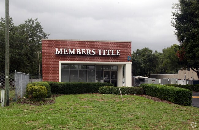
6605 E Hillsborough Ave
Tampa-St. Petersburg-Clearwater, FL
East Lake Park Commercial Lots
U-02-29-19-1MM-B00000-00146.0
EAST LAKE PARK COMMERCIAL LOTS E 50 FT OF LOT 138 AND LOTS 139 THRU 152 INCL BLOCK B
Financialbuilding
Hillsborough
X
Florida
12057C0360H
146
2024
9.83 AC
2024
Northeast Tampa
012001
Tampa/St Petersburg
114,080 SF
DEMOGRAPHICS near 6605 E Hillsborough Ave
1 Mile
3 Mile
5 Mile
2024 Total Population
3,538
66,652
214,542
2029 Population
3,844
72,868
234,506
Pop Growth 2024-2029
+ 8.65%
+ 9.33%
+ 9.31%
Average Age
36
36
37
2024 Total Households
1,250
24,636
80,373
HH Growth 2024-2029
+ 8.88%
+ 9.51%
+ 9.64%
Median Household Inc
$47,016
$44,244
$45,947
Avg Household Size
2.80
2.60
2.50
2024 Avg HH Vehicles
2.00
1.00
2.00
Median Home Value
$174,999
$186,650
$221,225
Median Year Built
1975
1980
1980
Nearby Places
Map Layers
Map Styles
 Street
 Aerial
- Restaurants
- Banks
- Shops
- Fitness
- Groceries
PUBLIC TRANSPORTATION
AIRPORT
Tampa International
DRIVE
WALK
Distance
Tampa International
23 min
14.0 mi
St Pete-Clearwater International
DRIVE
WALK
Distance
St Pete-Clearwater International
40 min
24.1 mi
Nearby Properties
Address
Land Use
TOTAL SIZE
Lot Size
Zoning
Address
Land Use
TOTAL SIZE
Lot Size
Zoning
1,236,718 SF
38.67 AC
CI
Address
Land Use
TOTAL SIZE
Lot Size
Zoning
2,604,100 SF
83.27 AC
PD
Address
Land Use
TOTAL SIZE
Lot Size
Zoning
611,108 SF
32.19 AC
IH
Address
Land Use
TOTAL SIZE
Lot Size
Zoning
671,677 SF
72.27 AC
RMFA
Address
Land Use
TOTAL SIZE
Lot Size
Zoning
472,855 SF
34.23 AC
PD
Address
Land Use
TOTAL SIZE
Lot Size
Zoning
491,498 SF
35.60 AC
PD
Address
Land Use
TOTAL SIZE
Lot Size
Zoning
665,455 SF
298.65 AC
PD
Address
Land Use
TOTAL SIZE
Lot Size
Zoning
149,490 SF
207.85 AC
PD
Address
Land Use
TOTAL SIZE
Lot Size
Zoning
959,394 SF
97.56 AC
PD
Address
Land Use
TOTAL SIZE
Lot Size
Zoning
264,202 SF
12.86 AC
PD
Address
Land Use
TOTAL SIZE
Lot Size
Zoning
598,043 SF
48.18 AC
PD
Address
Land Use
TOTAL SIZE
Lot Size
Zoning
250,958 SF
28.28 AC
CI
Address
Land Use
TOTAL SIZE
Lot Size
Zoning
193,509 SF
4.67 AC
DMU-35
Address
Land Use
TOTAL SIZE
Lot Size
Zoning
303,325 SF
17.01 AC
P
Address
Land Use
TOTAL SIZE
Lot Size
Zoning
443,460 SF
16.73 AC
M
Address
Land Use
TOTAL SIZE
Lot Size
Zoning
155,769 SF
18.53 AC
CMU-12
Address
Land Use
TOTAL SIZE
Lot Size
Zoning
209,328 SF
27.49 AC
RS-50
Address
Land Use
TOTAL SIZE
Lot Size
Zoning
388,082 SF
30.28 AC
PD
Address
Land Use
TOTAL SIZE
Lot Size
Zoning
342,040 SF
17.74 AC
PD
Address
Land Use
TOTAL SIZE
Lot Size
Zoning
271,402 SF
15.93 AC
PD
Address
Land Use
TOTAL SIZE
Lot Size
Zoning
331,265 SF
18.75 AC
RMC-20
Address
Land Use
TOTAL SIZE
Lot Size
Zoning
185,966 SF
14.96 AC
PD
Address
Land Use
TOTAL SIZE
Lot Size
Zoning
336,772 SF
50.01 AC
PD
Address
Land Use
TOTAL SIZE
Lot Size
Zoning
437,388 SF
30.53 AC
M
Address
Land Use
TOTAL SIZE
Lot Size
Zoning
297,399 SF
34.96 AC
PD
Address
Land Use
TOTAL SIZE
Lot Size
Zoning
331,506 SF
30.38 AC
PD
Address
Land Use
TOTAL SIZE
Lot Size
Zoning
186,586 SF
13.12 AC
RMC-20
Address
Land Use
TOTAL SIZE
Lot Size
Zoning
204,073 SF
18.31 AC
RM-16
Address
Land Use
TOTAL SIZE
Lot Size
Zoning
163,245 SF
10.33 AC
RMC-12
Address
Land Use
TOTAL SIZE
Lot Size
Zoning
326,765 SF
14.87 AC
RM-24
The World's #1 Commercial Real Estate Marketplace
Connect with us
© 2026 CoStar Group
The information above has been obtained from sources believed reliable. While we do not doubt its accuracy we have not verified it and make no guarantee, warranty or representation about it. It is your responsibility to independently confirm its accuracy and completeness. Any projections, opinions, assumptions, or estimates used are for example only and do not represent the current or future performance of the property. The value of this transaction to you depends on tax and other factors which should be evaluated by your tax, financial, and legal advisors. You and your advisors should conduct a careful, independent investigation of the property to determine to your satisfaction the suitability of the property for your needs.