Property Record
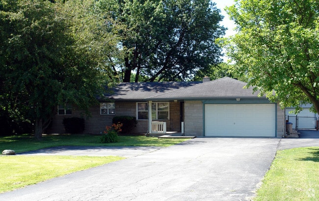
6609 E Southport Rd, Indianapolis, IN 46237


NEARBY LISTINGS FOR SALE OR LEASE
Property Detail
6609 E Southport Rd
Indianapolis-Carmel-Greenwood, IN
Marion
49-15-14-125-017.000-300
Indiana
Sfr
0.41 AC
A
Beech Grove/SE County
18097C0270G
Indianapolis
1,215 SF
DEMOGRAPHICS near 6609 E Southport Rd
1 Mile
3 Mile
5 Mile
2024 Total Population
7,686
56,633
151,956
2029 Population
7,555
55,798
151,698
Pop Growth 2024-2029
(1.70%)
(1.47%)
(0.17%)
Average Age
38
38
37
2024 Total Households
2,601
20,961
58,574
HH Growth 2024-2029
(1.81%)
(1.51%)
(0.05%)
Median Household Inc
$103,065
$87,449
$69,859
Avg Household Size
2.90
2.70
2.50
2024 Avg HH Vehicles
2.00
2.00
2.00
Median Home Value
$238,316
$225,363
$200,685
Median Year Built
1993
1996
1985
Nearby Places
Map Layers
Map Styles
 Street
 Aerial
- Restaurants
- Banks
- Shops
- Fitness
- Groceries
PUBLIC TRANSPORTATION
AIRPORT
Indianapolis International
DRIVE
WALK
Distance
Indianapolis International
37 min
21.2 mi
SALE & LEASE HISTORY
LISTING DATE
SALE/LEASE

Sep 24, 2016
For Sale
Nearby Properties
Address
Land Use
TOTAL SIZE
Lot Size
Zoning
Address
Land Use
TOTAL SIZE
Lot Size
Zoning
31,217 SF
105.06 AC
ZO01
Address
Land Use
TOTAL SIZE
Lot Size
Zoning
10,540 SF
49.19 AC
ZO01
Address
Land Use
TOTAL SIZE
Lot Size
Zoning
5,846 SF
43.64 AC
ZO01
Address
Land Use
TOTAL SIZE
Lot Size
Zoning
420,084 SF
23.83 AC
Address
Land Use
TOTAL SIZE
Lot Size
Zoning
3,586 SF
30.28 AC
ZO01
Address
Land Use
TOTAL SIZE
Lot Size
Zoning
493,560 SF
31.39 AC
Address
Land Use
TOTAL SIZE
Lot Size
Zoning
667,500 SF
33.46 AC
Address
Land Use
TOTAL SIZE
Lot Size
Zoning
5,576 SF
14.15 AC
ZO01
Address
Land Use
TOTAL SIZE
Lot Size
Zoning
81,996 SF
8.56 AC
Address
Land Use
TOTAL SIZE
Lot Size
Zoning
6,786 SF
45.81 AC
Address
Land Use
TOTAL SIZE
Lot Size
Zoning
273,000 SF
22.28 AC
Address
Land Use
TOTAL SIZE
Lot Size
Zoning
1,362 SF
6.66 AC
ZO01
Address
Land Use
TOTAL SIZE
Lot Size
Zoning
5,401 SF
21.94 AC
ZO01
Address
Land Use
TOTAL SIZE
Lot Size
Zoning
11,868 SF
15.48 AC
ZO01
Address
Land Use
TOTAL SIZE
Lot Size
Zoning
110,598 SF
22.82 AC
ZO01
Address
Land Use
TOTAL SIZE
Lot Size
Zoning
352,000 SF
22.72 AC
ZO01
Address
Land Use
TOTAL SIZE
Lot Size
Zoning
99,178 SF
18.04 AC
Address
Land Use
TOTAL SIZE
Lot Size
Zoning
155,088 SF
20.85 AC
ZO01
Address
Land Use
TOTAL SIZE
Lot Size
Zoning
37,718 SF
11.77 AC
ZO01
Address
Land Use
TOTAL SIZE
Lot Size
Zoning
168,560 SF
14.49 AC
Address
Land Use
TOTAL SIZE
Lot Size
Zoning
88,694 SF
11.81 AC
ZO01
Address
Land Use
TOTAL SIZE
Lot Size
Zoning
101,208 SF
8.74 AC
Address
Land Use
TOTAL SIZE
Lot Size
Zoning
95,987 SF
7.54 AC
ZO01
Address
Land Use
TOTAL SIZE
Lot Size
Zoning
44,294 SF
11.05 AC
ZO01
Address
Land Use
TOTAL SIZE
Lot Size
Zoning
2,486 SF
13.75 AC
ZO01
Address
Land Use
TOTAL SIZE
Lot Size
Zoning
233,818 SF
26.42 AC
ZO01
Address
Land Use
TOTAL SIZE
Lot Size
Zoning
41,675 SF
8.94 AC
ZO01
Address
Land Use
TOTAL SIZE
Lot Size
Zoning
218,614 SF
20.11 AC
Address
Land Use
TOTAL SIZE
Lot Size
Zoning
45,791 SF
11.39 AC
ZO01
Address
Land Use
TOTAL SIZE
Lot Size
Zoning
6,459 SF
11.06 AC
ZO01
The World's #1 Commercial Real Estate Marketplace
Connect with us
© 2026 CoStar Group
The information above has been obtained from sources believed reliable. While we do not doubt its accuracy we have not verified it and make no guarantee, warranty or representation about it. It is your responsibility to independently confirm its accuracy and completeness. Any projections, opinions, assumptions, or estimates used are for example only and do not represent the current or future performance of the property. The value of this transaction to you depends on tax and other factors which should be evaluated by your tax, financial, and legal advisors. You and your advisors should conduct a careful, independent investigation of the property to determine to your satisfaction the suitability of the property for your needs.