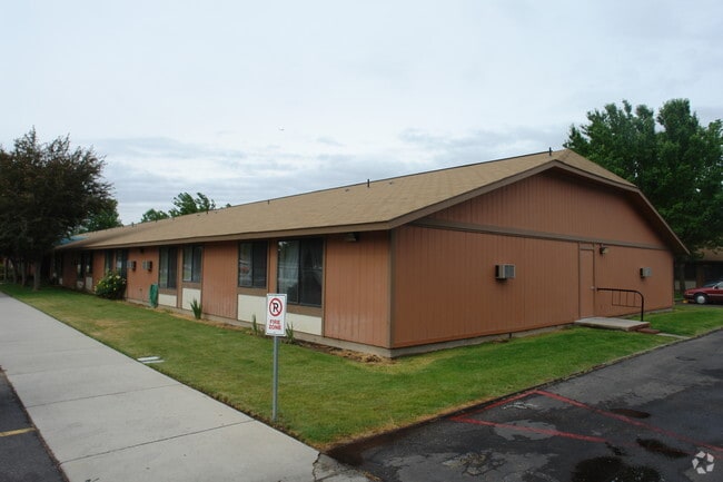
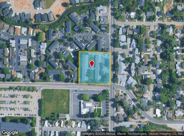
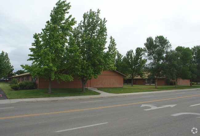
Property Record
661 S Curtis Rd, Boise, ID 83705
NEARBY LISTINGS FOR SALE OR LEASE
Property Detail
661 S Curtis Rd
S1018142350
PAR #2350 OF SE4NE4 SEC 18 3N 2E #1780-R #8717175 77
Commercialbuilding
Ada
X
Idaho
16001C0260G
2.07 AC
2024
Franklin-Randolph
2025
Boise City/Nampa
002000
Boise City, ID
27,094 SF
DEMOGRAPHICS near 661 S Curtis Rd
1 Mile
3 Mile
5 Mile
2024 Total Population
16,200
103,396
243,853
2029 Population
18,283
117,376
276,042
Pop Growth 2024-2029
+ 12.86%
+ 13.52%
+ 13.20%
Average Age
39
38
40
2024 Total Households
6,611
44,082
101,512
HH Growth 2024-2029
+ 13.19%
+ 14.00%
+ 13.59%
Median Household Inc
$50,071
$56,866
$68,189
Avg Household Size
2.20
2.20
2.30
2024 Avg HH Vehicles
2.00
2.00
2.00
Median Home Value
$340,699
$400,519
$440,050
Median Year Built
1977
1979
1986
Nearby Places
Map Layers
Map Styles
 Street
 Aerial
- Restaurants
- Banks
- Shops
- Fitness
- Groceries
PUBLIC TRANSPORTATION
AIRPORT
Boise Air Trml/Gowen Field
DRIVE
WALK
Distance
Boise Air Trml/Gowen Field
12 min
4.9 mi
Nearby Properties
Address
Land Use
TOTAL SIZE
Lot Size
Zoning
Address
Land Use
TOTAL SIZE
Lot Size
Zoning
369,584 SF
1 AC
ZC-259
Address
Land Use
TOTAL SIZE
Lot Size
Zoning
646,787 SF
27.37 AC
ZC-243
Address
Land Use
TOTAL SIZE
Lot Size
Zoning
434,370 SF
0.56 AC
ZC-259
Address
Land Use
TOTAL SIZE
Lot Size
Zoning
129,663 SF
0.92 AC
ZC-259
Address
Land Use
TOTAL SIZE
Lot Size
Zoning
240,481 SF
1.79 AC
ZC-264
Address
Land Use
TOTAL SIZE
Lot Size
Zoning
13.90 AC
R-2
Address
Land Use
TOTAL SIZE
Lot Size
Zoning
4.02 AC
C-2/DA
Address
Land Use
TOTAL SIZE
Lot Size
Zoning
279,694 SF
2.09 AC
ZC-264
Address
Land Use
TOTAL SIZE
Lot Size
Zoning
258,747 SF
3.30 AC
ZC-266
Address
Land Use
TOTAL SIZE
Lot Size
Zoning
402,504 SF
5.78 AC
ZC-259
Address
Land Use
TOTAL SIZE
Lot Size
Zoning
334,334 SF
3.21 AC
ZC-259
Address
Land Use
TOTAL SIZE
Lot Size
Zoning
207,033 SF
10.67 AC
ZC-243
Address
Land Use
TOTAL SIZE
Lot Size
Zoning
204,396 SF
0.82 AC
ZC-261
Address
Land Use
TOTAL SIZE
Lot Size
Zoning
203,503 SF
7.93 AC
ZC-243
Address
Land Use
TOTAL SIZE
Lot Size
Zoning
366,126 SF
0.82 AC
ZC-259
Address
Land Use
TOTAL SIZE
Lot Size
Zoning
223,171 SF
0.85 AC
ZC-264
Address
Land Use
TOTAL SIZE
Lot Size
Zoning
225,032 SF
12.75 AC
R-3
Address
Land Use
TOTAL SIZE
Lot Size
Zoning
359,820 SF
1.79 AC
ZC-259
Address
Land Use
TOTAL SIZE
Lot Size
Zoning
159,859 SF
0.80 AC
ZC-264
Address
Land Use
TOTAL SIZE
Lot Size
Zoning
249,800 SF
12.99 AC
ZC-243
Address
Land Use
TOTAL SIZE
Lot Size
Zoning
205,522 SF
0.82 AC
ZC-259
Address
Land Use
TOTAL SIZE
Lot Size
Zoning
276,099 SF
8.70 AC
ZC-261
Address
Land Use
TOTAL SIZE
Lot Size
Zoning
319,052 SF
24.33 AC
ZC-243
Address
Land Use
TOTAL SIZE
Lot Size
Zoning
216,371 SF
0.78 AC
ZC-261
Address
Land Use
TOTAL SIZE
Lot Size
Zoning
189,100 SF
0.60 AC
ZC-259
Address
Land Use
TOTAL SIZE
Lot Size
Zoning
222,379 SF
1.37 AC
M
Address
Land Use
TOTAL SIZE
Lot Size
Zoning
182,950 SF
0.41 AC
ZC-259
Address
Land Use
TOTAL SIZE
Lot Size
Zoning
211,039 SF
12.21 AC
ZC-243
Address
Land Use
TOTAL SIZE
Lot Size
Zoning
259,231 SF
1.72 AC
ZC-259
Address
Land Use
TOTAL SIZE
Lot Size
Zoning
247,435 SF
2.90 AC
ZC-261
The World's #1 Commercial Real Estate Marketplace
Connect with us
© 2025 CoStar Group
The information above has been obtained from sources believed reliable. While we do not doubt its accuracy we have not verified it and make no guarantee, warranty or representation about it. It is your responsibility to independently confirm its accuracy and completeness. Any projections, opinions, assumptions, or estimates used are for example only and do not represent the current or future performance of the property. The value of this transaction to you depends on tax and other factors which should be evaluated by your tax, financial, and legal advisors. You and your advisors should conduct a careful, independent investigation of the property to determine to your satisfaction the suitability of the property for your needs.