Property Record
661 Us Highway 22 E, Whitehouse Station, NJ 08889


NEARBY LISTINGS FOR SALE OR LEASE
Property Detail
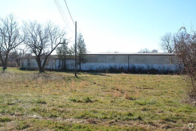
661 Us Highway 22 E
22-00036-0000-00048
Hunterdon
Vacantlandnec
New Jersey
X
48
34019C0276F
5.72 AC
2024
Hunterdon
2025
Northern New Jersey
011203
Newark, NJ-PA
3,840 SF
DEMOGRAPHICS near 661 Us Highway 22 E
1 Mile
3 Mile
5 Mile
2024 Total Population
1,851
12,320
39,613
2029 Population
1,885
12,467
39,783
Pop Growth 2024-2029
+ 1.84%
+ 1.19%
+ 0.43%
Average Age
48
46
44
2024 Total Households
793
5,035
14,960
HH Growth 2024-2029
+ 1.89%
+ 1.15%
+ 0.38%
Median Household Inc
$96,701
$123,356
$145,465
Avg Household Size
2.20
2.40
2.60
2024 Avg HH Vehicles
2.00
2.00
2.00
Median Home Value
$456,999
$473,766
$526,419
Median Year Built
1980
1983
1984
Nearby Places
Map Layers
Map Styles
 Street
 Aerial
- Restaurants
- Banks
- Shops
- Fitness
- Groceries
PUBLIC TRANSPORTATION
COMMUTER RAIL
White House (Raritan Valley Line - NJ Transit Commuter Rail (NJ Transit))
DRIVE
WALK
Distance
White House (Raritan Valley Line - NJ Transit Commuter Rail (NJ Transit))
5 min
2.5 mi
North Branch (Raritan Valley Line - NJ Transit Commuter Rail (NJ Transit))
DRIVE
WALK
Distance
North Branch (Raritan Valley Line - NJ Transit Commuter Rail (NJ Transit))
7 min
4.1 mi
AIRPORT
Trenton Mercer
DRIVE
WALK
Distance
Trenton Mercer
58 min
36.0 mi
Freight Ports
New York Container Terminal
DRIVE
WALK
Distance
New York Container Terminal
50 min
39.2 mi
Nearby Properties
Address
Land Use
TOTAL SIZE
Lot Size
Zoning
Address
Land Use
TOTAL SIZE
Lot Size
Zoning
236.88 AC
CF
Address
Land Use
TOTAL SIZE
Lot Size
Zoning
187,596 SF
54.59 AC
RO
Address
Land Use
TOTAL SIZE
Lot Size
Zoning
61.69 AC
RO
Address
Land Use
TOTAL SIZE
Lot Size
Zoning
8,000 SF
17.12 AC
RO
Address
Land Use
TOTAL SIZE
Lot Size
Zoning
18.46 AC
I
Address
Land Use
TOTAL SIZE
Lot Size
Zoning
38.79 AC
I-1
Address
Land Use
TOTAL SIZE
Lot Size
Zoning
13.48 AC
I2
Address
Land Use
TOTAL SIZE
Lot Size
Zoning
14,182 SF
77.17 AC
ROMX
Address
Land Use
TOTAL SIZE
Lot Size
Zoning
118.92 AC
R10
Address
Land Use
TOTAL SIZE
Lot Size
Zoning
25.08 AC
I-1
Address
Land Use
TOTAL SIZE
Lot Size
Zoning
10.34 AC
RS-1
Address
Land Use
TOTAL SIZE
Lot Size
Zoning
12.05 AC
I-IP
Address
Land Use
TOTAL SIZE
Lot Size
Zoning
18.81 AC
O
Address
Land Use
TOTAL SIZE
Lot Size
Zoning
25.75 AC
I-1
Address
Land Use
TOTAL SIZE
Lot Size
Zoning
5.98 AC
I-IP
Address
Land Use
TOTAL SIZE
Lot Size
Zoning
22.84 AC
I-1
Address
Land Use
TOTAL SIZE
Lot Size
Zoning
12.18 AC
I-IP
Address
Land Use
TOTAL SIZE
Lot Size
Zoning
18,288 SF
3.78 AC
I-IP
Address
Land Use
TOTAL SIZE
Lot Size
Zoning
12.83 AC
I-1
Address
Land Use
TOTAL SIZE
Lot Size
Zoning
7.81 AC
I-Z
Address
Land Use
TOTAL SIZE
Lot Size
Zoning
8.30 AC
I
Address
Land Use
TOTAL SIZE
Lot Size
Zoning
6.32 AC
I-IP
Address
Land Use
TOTAL SIZE
Lot Size
Zoning
46.18 AC
RR
Address
Land Use
TOTAL SIZE
Lot Size
Zoning
58,471 SF
8.69 AC
B
Address
Land Use
TOTAL SIZE
Lot Size
Zoning
6.56 AC
I-1
Address
Land Use
TOTAL SIZE
Lot Size
Zoning
8.40 AC
I&IP
Address
Land Use
TOTAL SIZE
Lot Size
Zoning
20,048 SF
3 AC
AR
Address
Land Use
TOTAL SIZE
Lot Size
Zoning
720 SF
5.17 AC
I-IP
Address
Land Use
TOTAL SIZE
Lot Size
Zoning
4.28 AC
I-IP
Address
Land Use
TOTAL SIZE
Lot Size
Zoning
4.90 AC
IP
The World's #1 Commercial Real Estate Marketplace
Connect with us
© 2026 CoStar Group
The information above has been obtained from sources believed reliable. While we do not doubt its accuracy we have not verified it and make no guarantee, warranty or representation about it. It is your responsibility to independently confirm its accuracy and completeness. Any projections, opinions, assumptions, or estimates used are for example only and do not represent the current or future performance of the property. The value of this transaction to you depends on tax and other factors which should be evaluated by your tax, financial, and legal advisors. You and your advisors should conduct a careful, independent investigation of the property to determine to your satisfaction the suitability of the property for your needs.