Property Record
661 W Highway 290, Dripping Springs, TX 78620
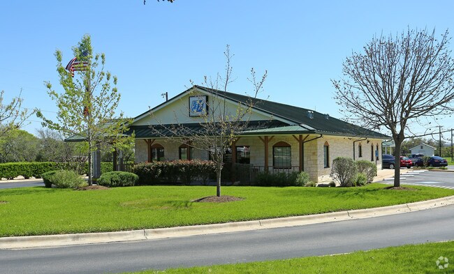

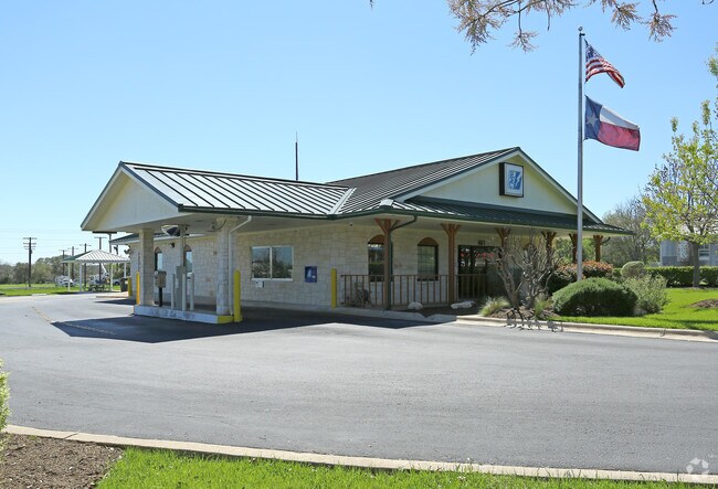
Property Detail
661 W Highway 290
R18029
A0415 PHILIP A SMITH SURVEY, ACRES 0.799*EX % 03-24-2024*
Privateutilityelectricwatergasnuclearsolarwindetc
Hays
B and X Area of moderate flood hazard, usually the area between the limits of the 100-year and 500-year floods.
Texas
2024
0.80 AC
2025
Hays County
010807
Austin
2,904 SF
Austin-Round Rock-San Marcos, TX
NEARBY LISTINGS FOR SALE OR LEASE
DEMOGRAPHICS near 661 W Highway 290
1 mile
3 mile
5 mile
2025 Total Population
1,909
12,461
18,503
2030 Population
2,257
14,733
21,873
Pop Growth 2025-2030
+ 18.23%
+ 18.23%
+ 18.21%
Average Age
42
42
42
2025 Total Households
689
4,505
6,723
HH Growth 2025-2030
+ 19.16%
+ 19.27%
+ 19.23%
Median Household Inc
$134,042
$138,860
$145,208
Avg Household Size
2.70
2.70
2.70
2025 Avg HH Vehicles
2.00
2.00
2.00
Median Home Value
$791,666
$803,857
$810,176
Median Year Built
2010
2010
2010
Nearby Places
Map Layers
Map Styles
 Street
 Aerial
Transit
 Traffic
 Biking
Places
Listings with unknown addresses are not visible on the map
- Restaurants
- Banks
- Shops
- Fitness
- Groceries
PUBLIC TRANSPORTATION
AIRPORT
Austin-Bergstrom International
Drive
Walk
Distance
Austin-Bergstrom International
47 min
30.0 mi
Nearby Properties
Address
Land Use
TOTAL SIZE
Lot Size
Zoning
Address
Land Use
TOTAL SIZE
Lot Size
Zoning
144,374 SF
2.51 AC
Address
Land Use
TOTAL SIZE
Lot Size
Zoning
109,839 SF
21.13 AC
Address
Land Use
TOTAL SIZE
Lot Size
Zoning
79,769 SF
35.70 AC
Address
Land Use
TOTAL SIZE
Lot Size
Zoning
103,275 SF
16.53 AC
Address
Land Use
TOTAL SIZE
Lot Size
Zoning
56,828 SF
5.23 AC
Address
Land Use
TOTAL SIZE
Lot Size
Zoning
40,588 SF
5.09 AC
Address
Land Use
TOTAL SIZE
Lot Size
Zoning
204,400 SF
1.34 AC
Address
Land Use
TOTAL SIZE
Lot Size
Zoning
76,930 SF
23.87 AC
Address
Land Use
TOTAL SIZE
Lot Size
Zoning
56.63 AC
Address
Land Use
TOTAL SIZE
Lot Size
Zoning
94.05 AC
Address
Land Use
TOTAL SIZE
Lot Size
Zoning
38.01 AC
Address
Land Use
TOTAL SIZE
Lot Size
Zoning
Address
Land Use
TOTAL SIZE
Lot Size
Zoning
59,572 SF
1.56 AC
Address
Land Use
TOTAL SIZE
Lot Size
Zoning
70,096 SF
6.82 AC
Address
Land Use
TOTAL SIZE
Lot Size
Zoning
27,828 SF
2.18 AC
Address
Land Use
TOTAL SIZE
Lot Size
Zoning
Address
Land Use
TOTAL SIZE
Lot Size
Zoning
Address
Land Use
TOTAL SIZE
Lot Size
Zoning
Address
Land Use
TOTAL SIZE
Lot Size
Zoning
Address
Land Use
TOTAL SIZE
Lot Size
Zoning
2,280 SF
9.05 AC
Address
Land Use
TOTAL SIZE
Lot Size
Zoning
Address
Land Use
TOTAL SIZE
Lot Size
Zoning
4,500 SF
5.31 AC
Address
Land Use
TOTAL SIZE
Lot Size
Zoning
16,500 SF
10 AC
Address
Land Use
TOTAL SIZE
Lot Size
Zoning
106,783 SF
5.79 AC
Address
Land Use
TOTAL SIZE
Lot Size
Zoning
Address
Land Use
TOTAL SIZE
Lot Size
Zoning
1,781 SF
63.13 AC
Address
Land Use
TOTAL SIZE
Lot Size
Zoning
1,944 SF
5 AC
Address
Land Use
TOTAL SIZE
Lot Size
Zoning
13,064 SF
3.02 AC
Address
Land Use
TOTAL SIZE
Lot Size
Zoning
24,336 SF
2.72 AC
Address
Land Use
TOTAL SIZE
Lot Size
Zoning
53,908 SF
11.72 AC
The World's #1 Commercial Real Estate Marketplace
Connect with us
© 2026 CoStar Group
The information above has been obtained from sources believed reliable. While we do not doubt its accuracy we have not verified it and make no guarantee, warranty or representation about it. It is your responsibility to independently confirm its accuracy and completeness. Any projections, opinions, assumptions, or estimates used are for example only and do not represent the current or future performance of the property. The value of this transaction to you depends on tax and other factors which should be evaluated by your tax, financial, and legal advisors. You and your advisors should conduct a careful, independent investigation of the property to determine to your satisfaction the suitability of the property for your needs.