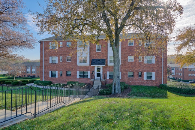
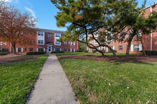
Property Record
6610 Greig St, Capitol Heights, MD 20743
NEARBY LISTINGS FOR SALE OR LEASE
Property Detail
6610 Greig St
Washington-Arlington-Alexandria, DC-VA-MD-WV
Gregory Estates
18-1998343
PAR X EQ 5.161 AC
Apartment
Prince George's
X
Maryland
24033C0144E
4.97 AC
2024
Seat Pleasant
2025
Washington, DC
802901
DEMOGRAPHICS near 6610 Greig St
1 Mile
3 Mile
5 Mile
2024 Total Population
16,185
157,354
446,337
2029 Population
15,728
150,779
426,977
Pop Growth 2024-2029
(2.82%)
(4.18%)
(4.34%)
Average Age
40
38
39
2024 Total Households
5,829
59,262
170,039
HH Growth 2024-2029
(3.16%)
(4.67%)
(4.92%)
Median Household Inc
$62,178
$62,378
$72,048
Avg Household Size
2.70
2.60
2.50
2024 Avg HH Vehicles
1.00
1.00
1.00
Median Home Value
$269,240
$318,992
$371,747
Median Year Built
1963
1966
1965
Nearby Places
Map Layers
Map Styles
 Street
 Aerial
- Restaurants
- Banks
- Shops
- Fitness
- Groceries
PUBLIC TRANSPORTATION
COMMUTER RAIL
New Carrollton Marc Nb (PENN - WASHINGTON - Maryland Transit Administration)
DRIVE
WALK
Distance
New Carrollton Marc Nb (PENN - WASHINGTON - Maryland Transit Administration)
12 min
6.7 mi
New Carrollton (PENN - WASHINGTON - Maryland Area Regional Commuter Trains (The MARC), Penn Line - Maryland Area Regional Commuter Trains (The MARC))
DRIVE
WALK
Distance
New Carrollton (PENN - WASHINGTON - Maryland Area Regional Commuter Trains (The MARC), Penn Line - Maryland Area Regional Commuter Trains (The MARC))
12 min
6.7 mi
AIRPORT
Ronald Reagan Washington Ntl
DRIVE
WALK
Distance
Ronald Reagan Washington Ntl
22 min
12.5 mi
Baltimore/Washington International Thurgood Marshall
DRIVE
WALK
Distance
Baltimore/Washington International Thurgood Marshall
42 min
28.8 mi
Washington Dulles International
DRIVE
WALK
Distance
Washington Dulles International
56 min
35.2 mi
Freight Ports
Port of Baltimore
DRIVE
WALK
Distance
Port of Baltimore
52 min
35.4 mi
Nearby Properties
Address
Land Use
TOTAL SIZE
Lot Size
Zoning
Address
Land Use
TOTAL SIZE
Lot Size
Zoning
35.03 AC
LTOE
Address
Land Use
TOTAL SIZE
Lot Size
Zoning
236,535 SF
12.54 AC
R-2
Address
Land Use
TOTAL SIZE
Lot Size
Zoning
177,081 SF
23.22 AC
LCD
Address
Land Use
TOTAL SIZE
Lot Size
Zoning
944,105 SF
23.09 AC
CGO
Address
Land Use
TOTAL SIZE
Lot Size
Zoning
241,725 SF
4.71 AC
MU-7B;PDR-
Address
Land Use
TOTAL SIZE
Lot Size
Zoning
62.03 AC
UNZONED
Address
Land Use
TOTAL SIZE
Lot Size
Zoning
229,238 SF
1.51 AC
MU-7B
Address
Land Use
TOTAL SIZE
Lot Size
Zoning
12.60 AC
LTOC
Address
Land Use
TOTAL SIZE
Lot Size
Zoning
821,240 SF
48.32 AC
IH
Address
Land Use
TOTAL SIZE
Lot Size
Zoning
192,440 SF
7.67 AC
R-2;RA-1
Address
Land Use
TOTAL SIZE
Lot Size
Zoning
107,130 SF
2.98 AC
R-2;RA-1
Address
Land Use
TOTAL SIZE
Lot Size
Zoning
419,689 SF
66.84 AC
PDR-1;PDR-
Address
Land Use
TOTAL SIZE
Lot Size
Zoning
132,000 SF
RA-1
Address
Land Use
TOTAL SIZE
Lot Size
Zoning
262,236 SF
15.26 AC
MU-8B
Address
Land Use
TOTAL SIZE
Lot Size
Zoning
379,168 SF
18.94 AC
RMF20
Address
Land Use
TOTAL SIZE
Lot Size
Zoning
181,530 SF
4.72 AC
R-2
Address
Land Use
TOTAL SIZE
Lot Size
Zoning
10.63 AC
RMF20
Address
Land Use
TOTAL SIZE
Lot Size
Zoning
123,950 SF
4.65 AC
R-2
Address
Land Use
TOTAL SIZE
Lot Size
Zoning
368,038 SF
12.87 AC
IE
Address
Land Use
TOTAL SIZE
Lot Size
Zoning
206,118 SF
0.82 AC
RA-1
Address
Land Use
TOTAL SIZE
Lot Size
Zoning
99,269 SF
4.73 AC
RA-1
Address
Land Use
TOTAL SIZE
Lot Size
Zoning
142,636 SF
3.69 AC
RA-1
Address
Land Use
TOTAL SIZE
Lot Size
Zoning
115,788 SF
1.77 AC
MU-4;RA-1
Address
Land Use
TOTAL SIZE
Lot Size
Zoning
162,221 SF
1.12 AC
R-2
Address
Land Use
TOTAL SIZE
Lot Size
Zoning
194,850 SF
8.90 AC
LTOE
Address
Land Use
TOTAL SIZE
Lot Size
Zoning
67,763 SF
1.66 AC
R-2
Address
Land Use
TOTAL SIZE
Lot Size
Zoning
18.35 AC
UNZONED
Address
Land Use
TOTAL SIZE
Lot Size
Zoning
63,000 SF
5.60 AC
RA-1
Address
Land Use
TOTAL SIZE
Lot Size
Zoning
586,115 SF
22 AC
RA-1
Address
Land Use
TOTAL SIZE
Lot Size
Zoning
169,431 SF
43.81 AC
CGO
The World's #1 Commercial Real Estate Marketplace
Connect with us
© 2025 CoStar Group
The information above has been obtained from sources believed reliable. While we do not doubt its accuracy we have not verified it and make no guarantee, warranty or representation about it. It is your responsibility to independently confirm its accuracy and completeness. Any projections, opinions, assumptions, or estimates used are for example only and do not represent the current or future performance of the property. The value of this transaction to you depends on tax and other factors which should be evaluated by your tax, financial, and legal advisors. You and your advisors should conduct a careful, independent investigation of the property to determine to your satisfaction the suitability of the property for your needs.