Property Record
6612 Harborside Dr, Galveston, TX 77554


NEARBY LISTINGS FOR SALE OR LEASE
Property Detail
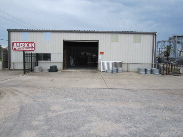
6612 Harborside Dr
Houston-Pasadena-The Woodlands, TX
West Cove
7455-0000-0015-000
ABST 121 HALL & JONES SUR LOTS 18 THRU 39 (15-0) WEST COVE
Commercialnec
Galveston
AE
Texas
48167C0436G
18-39
2024
2.09 AC
2025
NASA/Clear Lake
724000
Houston
9,436 SF
DEMOGRAPHICS near 6612 Harborside Dr
1 Mile
3 Mile
5 Mile
2024 Total Population
996
37,256
59,352
2029 Population
1,058
39,706
63,766
Pop Growth 2024-2029
+ 6.22%
+ 6.58%
+ 7.44%
Average Age
46
41
42
2024 Total Households
239
14,997
25,989
HH Growth 2024-2029
+ 6.69%
+ 7.07%
+ 7.98%
Median Household Inc
$51,667
$50,611
$52,479
Avg Household Size
2.40
2.20
2.10
2024 Avg HH Vehicles
2.00
2.00
1.00
Median Home Value
$478,571
$243,481
$284,173
Median Year Built
1982
1972
1971
Nearby Places
Map Layers
Map Styles
 Street
 Aerial
- Restaurants
- Banks
- Shops
- Fitness
- Groceries
PUBLIC TRANSPORTATION
AIRPORT
William P Hobby
DRIVE
WALK
Distance
William P Hobby
53 min
38.1 mi
SALE & LEASE HISTORY
LISTING DATE
SALE/LEASE

Jul 15, 2020
For Sale
Nearby Properties
Address
Land Use
TOTAL SIZE
Lot Size
Zoning
Address
Land Use
TOTAL SIZE
Lot Size
Zoning
566,062 SF
40.20 AC
Address
Land Use
TOTAL SIZE
Lot Size
Zoning
1,459,569 SF
11.51 AC
MF1
Address
Land Use
TOTAL SIZE
Lot Size
Zoning
678,840 SF
3.54 AC
R
Address
Land Use
TOTAL SIZE
Lot Size
Zoning
226,301 SF
5.93 AC
I
Address
Land Use
TOTAL SIZE
Lot Size
Zoning
157,959 SF
1.79 AC
Address
Land Use
TOTAL SIZE
Lot Size
Zoning
382,106 SF
24.02 AC
PD
Address
Land Use
TOTAL SIZE
Lot Size
Zoning
228,895 SF
11.41 AC
R
Address
Land Use
TOTAL SIZE
Lot Size
Zoning
153,637 SF
4.52 AC
R
Address
Land Use
TOTAL SIZE
Lot Size
Zoning
169,384 SF
709.59 AC
PD
Address
Land Use
TOTAL SIZE
Lot Size
Zoning
182,000 SF
41.90 AC
Address
Land Use
TOTAL SIZE
Lot Size
Zoning
Address
Land Use
TOTAL SIZE
Lot Size
Zoning
165,091 SF
Address
Land Use
TOTAL SIZE
Lot Size
Zoning
450,048 SF
Address
Land Use
TOTAL SIZE
Lot Size
Zoning
144,000 SF
Address
Land Use
TOTAL SIZE
Lot Size
Zoning
128,906 SF
Address
Land Use
TOTAL SIZE
Lot Size
Zoning
88,994 SF
3.03 AC
R
Address
Land Use
TOTAL SIZE
Lot Size
Zoning
193,003 SF
7.08 AC
C
Address
Land Use
TOTAL SIZE
Lot Size
Zoning
119,996 SF
2.86 AC
Address
Land Use
TOTAL SIZE
Lot Size
Zoning
174,713 SF
6.54 AC
C
Address
Land Use
TOTAL SIZE
Lot Size
Zoning
169,404 SF
7.50 AC
R
Address
Land Use
TOTAL SIZE
Lot Size
Zoning
153,210 SF
13.27 AC
R
Address
Land Use
TOTAL SIZE
Lot Size
Zoning
121,734 SF
12.27 AC
IF1
Address
Land Use
TOTAL SIZE
Lot Size
Zoning
136,712 SF
6 AC
C
Address
Land Use
TOTAL SIZE
Lot Size
Zoning
105,544 SF
13.27 AC
PD
Address
Land Use
TOTAL SIZE
Lot Size
Zoning
47,010 SF
2.32 AC
LI
Address
Land Use
TOTAL SIZE
Lot Size
Zoning
200,856 SF
5.93 AC
I
Address
Land Use
TOTAL SIZE
Lot Size
Zoning
182,942 SF
Address
Land Use
TOTAL SIZE
Lot Size
Zoning
198,207 SF
19.54 AC
R
Address
Land Use
TOTAL SIZE
Lot Size
Zoning
79,506 SF
9.55 AC
GR
Address
Land Use
TOTAL SIZE
Lot Size
Zoning
179,193 SF
9.55 AC
C
The World's #1 Commercial Real Estate Marketplace
Connect with us
© 2026 CoStar Group
The information above has been obtained from sources believed reliable. While we do not doubt its accuracy we have not verified it and make no guarantee, warranty or representation about it. It is your responsibility to independently confirm its accuracy and completeness. Any projections, opinions, assumptions, or estimates used are for example only and do not represent the current or future performance of the property. The value of this transaction to you depends on tax and other factors which should be evaluated by your tax, financial, and legal advisors. You and your advisors should conduct a careful, independent investigation of the property to determine to your satisfaction the suitability of the property for your needs.