Property Record
6615 Maumee Western Rd, Maumee, OH 43537


NEARBY LISTINGS FOR SALE OR LEASE
Property Detail
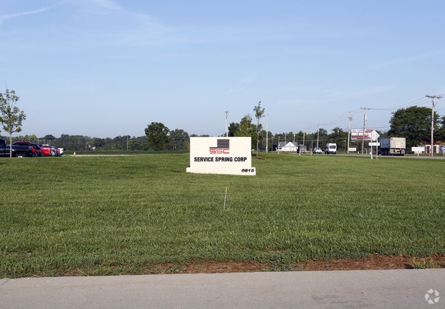
6615 Maumee Western Rd
Toledo, OH
Rapids Of The Miami Of Lake Erie
38-27933
2 34 SW 1/4 IRREG PCE LYING SWLY CEN MAUMEE WESTERN RD MEA
Lightindustrial
Lucas
2024
Ohio
2024
20.83 AC
009002
South/Southwest
342,566 SF
Toledo
DEMOGRAPHICS near 6615 Maumee Western Rd
1 Mile
3 Mile
5 Mile
2024 Total Population
2,369
38,040
109,418
2029 Population
2,305
37,454
108,160
Pop Growth 2024-2029
(2.70%)
(1.54%)
(1.15%)
Average Age
49
42
41
2024 Total Households
994
16,341
46,084
HH Growth 2024-2029
(2.82%)
(1.65%)
(1.30%)
Median Household Inc
$108,035
$81,407
$72,520
Avg Household Size
2.30
2.30
2.30
2024 Avg HH Vehicles
2.00
2.00
2.00
Median Home Value
$278,239
$242,284
$209,047
Median Year Built
2003
1983
1979
Nearby Places
Map Layers
Map Styles
 Street
 Aerial
- Restaurants
- Banks
- Shops
- Fitness
- Groceries
PUBLIC TRANSPORTATION
AIRPORT
Eugene F Kranz Toledo Express
DRIVE
WALK
Distance
Eugene F Kranz Toledo Express
14 min
7.2 mi
Freight Ports
Port of Baltimore
DRIVE
WALK
Distance
Port of Baltimore
1 min
406.0 mi
Nearby Properties
Address
Land Use
TOTAL SIZE
Lot Size
Zoning
Address
Land Use
TOTAL SIZE
Lot Size
Zoning
541,518 SF
21.30 AC
16-R1
Address
Land Use
TOTAL SIZE
Lot Size
Zoning
275,990 SF
49.65 AC
16-CM
Address
Land Use
TOTAL SIZE
Lot Size
Zoning
56,660 SF
1.62 AC
16-M1
Address
Land Use
TOTAL SIZE
Lot Size
Zoning
67,264 SF
6.95 AC
16-CM
Address
Land Use
TOTAL SIZE
Lot Size
Zoning
35.94 AC
17-C3
Address
Land Use
TOTAL SIZE
Lot Size
Zoning
211,140 SF
28.92 AC
10-IC
Address
Land Use
TOTAL SIZE
Lot Size
Zoning
231,756 SF
31.37 AC
16-M1
Address
Land Use
TOTAL SIZE
Lot Size
Zoning
178,915 SF
13 AC
19-R3
Address
Land Use
TOTAL SIZE
Lot Size
Zoning
606,883 SF
119.87 AC
16-M2
Address
Land Use
TOTAL SIZE
Lot Size
Zoning
352,382 SF
62.93 AC
16-M1
Address
Land Use
TOTAL SIZE
Lot Size
Zoning
148,680 SF
8.50 AC
19-M3
Address
Land Use
TOTAL SIZE
Lot Size
Zoning
8.57 AC
16-M1
Address
Land Use
TOTAL SIZE
Lot Size
Zoning
608,280 SF
48.86 AC
16-M2
Address
Land Use
TOTAL SIZE
Lot Size
Zoning
139,741 SF
30.48 AC
19-RA3
Address
Land Use
TOTAL SIZE
Lot Size
Zoning
212,672 SF
15.98 AC
17-R1
Address
Land Use
TOTAL SIZE
Lot Size
Zoning
156,420 SF
12 AC
19-R3
Address
Land Use
TOTAL SIZE
Lot Size
Zoning
238,148 SF
18.20 AC
24-B3
Address
Land Use
TOTAL SIZE
Lot Size
Zoning
214,986 SF
17.55 AC
19-R1
Address
Land Use
TOTAL SIZE
Lot Size
Zoning
119.87 AC
16-M2
Address
Land Use
TOTAL SIZE
Lot Size
Zoning
77,030 SF
4.41 AC
16-M1
Address
Land Use
TOTAL SIZE
Lot Size
Zoning
78,166 SF
2.08 AC
16-CM
Address
Land Use
TOTAL SIZE
Lot Size
Zoning
120,077 SF
9.53 AC
24-B3
Address
Land Use
TOTAL SIZE
Lot Size
Zoning
32.75 AC
16-M2
Address
Land Use
TOTAL SIZE
Lot Size
Zoning
337,990 SF
17.75 AC
16-M1
Address
Land Use
TOTAL SIZE
Lot Size
Zoning
58.33 AC
10-IL
Address
Land Use
TOTAL SIZE
Lot Size
Zoning
160,811 SF
10.83 AC
10-MX
Address
Land Use
TOTAL SIZE
Lot Size
Zoning
133,079 SF
15.45 AC
10-CR
Address
Land Use
TOTAL SIZE
Lot Size
Zoning
86,450 SF
6.33 AC
17-R3
Address
Land Use
TOTAL SIZE
Lot Size
Zoning
55,124 SF
0.12 AC
16-C3
The World's #1 Commercial Real Estate Marketplace
Connect with us
© 2025 CoStar Group
The information above has been obtained from sources believed reliable. While we do not doubt its accuracy we have not verified it and make no guarantee, warranty or representation about it. It is your responsibility to independently confirm its accuracy and completeness. Any projections, opinions, assumptions, or estimates used are for example only and do not represent the current or future performance of the property. The value of this transaction to you depends on tax and other factors which should be evaluated by your tax, financial, and legal advisors. You and your advisors should conduct a careful, independent investigation of the property to determine to your satisfaction the suitability of the property for your needs.