Property Record
6618 E State Highway 71, Spicewood, TX 78669

Property Detail
6618 E State Highway 71
55328
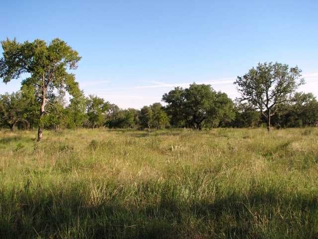
ABS A0714 WM. ROBERTS, 35.871 ACRES, (INCLUDES .80 AC G HERRICK AB 425)
Agriculturalland
BURNET
B and X Area of moderate flood hazard, usually the area between the limits of the 100-year and 500-year floods.
Texas
2024
35.87 AC
2025
Spicewood
960802
Other Market Areas
NEARBY LISTINGS FOR SALE OR LEASE
DEMOGRAPHICS near 6618 E State Highway 71
1 mile
3 mile
5 mile
2025 Total Population
413
1,047
3,368
2030 Population
462
1,170
3,744
Pop Growth 2025-2030
+ 11.86%
+ 11.75%
+ 11.16%
Average Age
48
48
48
2025 Total Households
170
432
1,422
HH Growth 2025-2030
+ 11.76%
+ 11.81%
+ 11.25%
Median Household Inc
$86,388
$85,315
$81,944
Avg Household Size
2.40
2.40
2.30
2025 Avg HH Vehicles
2.00
2.00
2.00
Median Home Value
$632,530
$596,154
$405,851
Median Year Built
2010
2010
2005
Nearby Places
Map Layers
Map Styles
 Street
 Aerial
Layers
 Traffic
 Biking
Places
Listings with unknown addresses are not visible on the map
- Restaurants
- Banks
- Shops
- Fitness
- Groceries
Nearby Properties
Address
Land Use
TOTAL SIZE
Lot Size
Zoning
Address
Land Use
TOTAL SIZE
Lot Size
Zoning
64,709 SF
33.62 AC
Address
Land Use
TOTAL SIZE
Lot Size
Zoning
122,238 SF
52 AC
Address
Land Use
TOTAL SIZE
Lot Size
Zoning
117,727 SF
5.89 AC
Address
Land Use
TOTAL SIZE
Lot Size
Zoning
4,660 SF
180.52 AC
Address
Land Use
TOTAL SIZE
Lot Size
Zoning
15,844 SF
2.36 AC
Address
Land Use
TOTAL SIZE
Lot Size
Zoning
19,087 SF
1.38 AC
Address
Land Use
TOTAL SIZE
Lot Size
Zoning
133,560 SF
9.72 AC
Address
Land Use
TOTAL SIZE
Lot Size
Zoning
9,507 SF
3 AC
Address
Land Use
TOTAL SIZE
Lot Size
Zoning
7,178 SF
4.45 AC
Address
Land Use
TOTAL SIZE
Lot Size
Zoning
75,860 SF
9.99 AC
Address
Land Use
TOTAL SIZE
Lot Size
Zoning
5,160 SF
2.40 AC
Address
Land Use
TOTAL SIZE
Lot Size
Zoning
1,840 SF
22.34 AC
Address
Land Use
TOTAL SIZE
Lot Size
Zoning
8,150 SF
14.50 AC
Address
Land Use
TOTAL SIZE
Lot Size
Zoning
37,140 SF
8.81 AC
Address
Land Use
TOTAL SIZE
Lot Size
Zoning
29.30 AC
Address
Land Use
TOTAL SIZE
Lot Size
Zoning
3,812 SF
7.76 AC
Address
Land Use
TOTAL SIZE
Lot Size
Zoning
8,468 SF
0.98 AC
Address
Land Use
TOTAL SIZE
Lot Size
Zoning
7,470 SF
1 AC
Address
Land Use
TOTAL SIZE
Lot Size
Zoning
4,358 SF
1.21 AC
Address
Land Use
TOTAL SIZE
Lot Size
Zoning
13,225 SF
0.87 AC
Address
Land Use
TOTAL SIZE
Lot Size
Zoning
12,610 SF
2.34 AC
Address
Land Use
TOTAL SIZE
Lot Size
Zoning
10,200 SF
2.04 AC
Address
Land Use
TOTAL SIZE
Lot Size
Zoning
6,476 SF
17.85 AC
Address
Land Use
TOTAL SIZE
Lot Size
Zoning
6,138 SF
12.55 AC
Address
Land Use
TOTAL SIZE
Lot Size
Zoning
5,220 SF
1.50 AC
Address
Land Use
TOTAL SIZE
Lot Size
Zoning
4,808 SF
3 AC
Address
Land Use
TOTAL SIZE
Lot Size
Zoning
5,136 SF
22.69 AC
Address
Land Use
TOTAL SIZE
Lot Size
Zoning
3,894 SF
1 AC
Address
Land Use
TOTAL SIZE
Lot Size
Zoning
2,855 SF
13.59 AC
The World's #1 Commercial Real Estate Marketplace
Connect with us
© 2026 CoStar Group
The information above has been obtained from sources believed reliable. While we do not doubt its accuracy we have not verified it and make no guarantee, warranty or representation about it. It is your responsibility to independently confirm its accuracy and completeness. Any projections, opinions, assumptions, or estimates used are for example only and do not represent the current or future performance of the property. The value of this transaction to you depends on tax and other factors which should be evaluated by your tax, financial, and legal advisors. You and your advisors should conduct a careful, independent investigation of the property to determine to your satisfaction the suitability of the property for your needs.