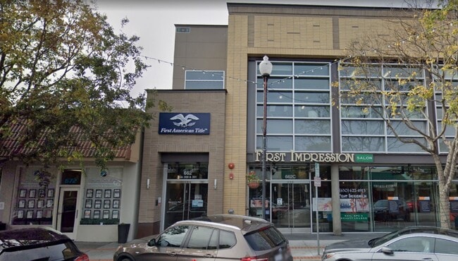
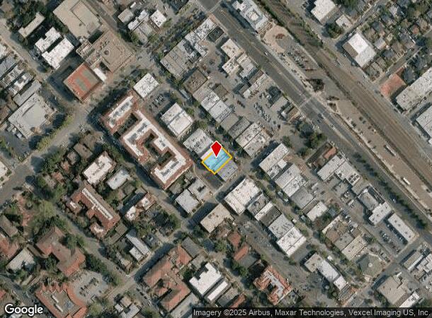
Property Record
662 Laurel St, San Carlos, CA 94070
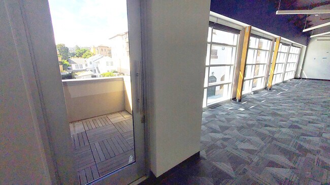
Current Lease Availabilities
NEARBY LISTINGS FOR SALE OR LEASE
Property Detail
662 Laurel St
San Francisco-Redwood City-South San Francisco, CA
Town Of San Carlos
050-132-250
75 FT ON LAUREL ST X 105 FT X 108 FT SIDE MEAS COM 75 FT FR CHERRY ST BEING PTN OF LOTS 5 & 6 BLK 17 AMEND MAP TOWN OF SAN CARLOS
Storebuilding
San Mateo
X
California
06081C0169G
5
2024
0.18 AC
2025
Belmont/San Carlos
609202
San Francisco
12,655 SF
DEMOGRAPHICS near 662 Laurel St
1 Mile
3 Mile
5 Mile
2024 Total Population
16,439
132,866
267,880
2029 Population
15,744
126,764
255,827
Pop Growth 2024-2029
(4.23%)
(4.59%)
(4.50%)
Average Age
41
41
41
2024 Total Households
6,551
50,138
98,877
HH Growth 2024-2029
(4.21%)
(4.72%)
(4.65%)
Median Household Inc
$175,471
$162,020
$156,616
Avg Household Size
2.50
2.60
2.60
2024 Avg HH Vehicles
2.00
2.00
2.00
Median Home Value
$1,141,779
$1,134,257
$1,130,674
Median Year Built
1958
1968
1968
Nearby Places
- Restaurants
- Banks
- Shops
- Fitness
- Groceries
PUBLIC TRANSPORTATION
COMMUTER RAIL
San Carlos (Caltrain - Caltrain (Caltrain))
DRIVE
WALK
Distance
San Carlos (Caltrain - Caltrain (Caltrain))
2 min
4 min
0.3 mi
Belmont (Caltrain - Caltrain (Caltrain))
DRIVE
WALK
Distance
Belmont (Caltrain - Caltrain (Caltrain))
5 min
1.5 mi
AIRPORT
San Francisco International
DRIVE
WALK
Distance
San Francisco International
17 min
12.4 mi
Norman Y Mineta San Jose International
DRIVE
WALK
Distance
Norman Y Mineta San Jose International
26 min
21.9 mi
Metro Oakland International
DRIVE
WALK
Distance
Metro Oakland International
34 min
28.0 mi
Freight Ports
Port of Redwood City
DRIVE
WALK
Distance
Port of Redwood City
1 min
2.8 mi
Nearby Properties
Address
Land Use
TOTAL SIZE
Lot Size
Zoning
Address
Land Use
TOTAL SIZE
Lot Size
Zoning
738,000 SF
56.46 AC
TP0000
Address
Land Use
TOTAL SIZE
Lot Size
Zoning
8.31 AC
EA00CA
Address
Land Use
TOTAL SIZE
Lot Size
Zoning
491,030 SF
2.74 AC
Address
Land Use
TOTAL SIZE
Lot Size
Zoning
330,071 SF
1.64 AC
Address
Land Use
TOTAL SIZE
Lot Size
Zoning
Address
Land Use
TOTAL SIZE
Lot Size
Zoning
223,321 SF
8.39 AC
M10000
Address
Land Use
TOTAL SIZE
Lot Size
Zoning
Address
Land Use
TOTAL SIZE
Lot Size
Zoning
378,534 SF
2.24 AC
Address
Land Use
TOTAL SIZE
Lot Size
Zoning
40,000 SF
1.60 AC
Address
Land Use
TOTAL SIZE
Lot Size
Zoning
190,245 SF
16.88 AC
M10000
Address
Land Use
TOTAL SIZE
Lot Size
Zoning
2,024 SF
2.07 AC
Address
Land Use
TOTAL SIZE
Lot Size
Zoning
395,625 SF
5.08 AC
Address
Land Use
TOTAL SIZE
Lot Size
Zoning
458,111 SF
2.26 AC
Address
Land Use
TOTAL SIZE
Lot Size
Zoning
1,849 SF
4.72 AC
CB0000
Address
Land Use
TOTAL SIZE
Lot Size
Zoning
2.69 AC
ML001R
Address
Land Use
TOTAL SIZE
Lot Size
Zoning
12,944 SF
12.37 AC
Address
Land Use
TOTAL SIZE
Lot Size
Zoning
366,384 SF
3.63 AC
Address
Land Use
TOTAL SIZE
Lot Size
Zoning
249,198 SF
1.14 AC
Address
Land Use
TOTAL SIZE
Lot Size
Zoning
2,023 SF
1.31 AC
Address
Land Use
TOTAL SIZE
Lot Size
Zoning
262,189 SF
1.16 AC
Address
Land Use
TOTAL SIZE
Lot Size
Zoning
187,781 SF
6.67 AC
CP0000
Address
Land Use
TOTAL SIZE
Lot Size
Zoning
12.14 AC
Address
Land Use
TOTAL SIZE
Lot Size
Zoning
55,422 SF
2.41 AC
PM0002
Address
Land Use
TOTAL SIZE
Lot Size
Zoning
239,430 SF
17.78 AC
CB0000
Address
Land Use
TOTAL SIZE
Lot Size
Zoning
Address
Land Use
TOTAL SIZE
Lot Size
Zoning
204,006 SF
9.02 AC
TP0000
Address
Land Use
TOTAL SIZE
Lot Size
Zoning
147,022 SF
7.17 AC
Address
Land Use
TOTAL SIZE
Lot Size
Zoning
221,200 SF
0.77 AC
Address
Land Use
TOTAL SIZE
Lot Size
Zoning
80,363 SF
2.62 AC
Address
Land Use
TOTAL SIZE
Lot Size
Zoning
282,273 SF
6.16 AC
CB0000
The World's #1 Commercial Real Estate Marketplace
Connect with us
© 2025 CoStar Group
The information above has been obtained from sources believed reliable. While we do not doubt its accuracy we have not verified it and make no guarantee, warranty or representation about it. It is your responsibility to independently confirm its accuracy and completeness. Any projections, opinions, assumptions, or estimates used are for example only and do not represent the current or future performance of the property. The value of this transaction to you depends on tax and other factors which should be evaluated by your tax, financial, and legal advisors. You and your advisors should conduct a careful, independent investigation of the property to determine to your satisfaction the suitability of the property for your needs.