Property Record
662 S Old Highway 141, Fenton, MO 63026
NEARBY LISTINGS FOR SALE OR LEASE
-
-
View all Fenton listings for sale on LoopNet.com
Property Detail
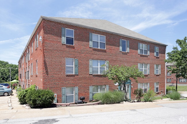
662 S Old Highway 141
St. Louis, MO-IL
Shangri La Estates D
02-1.0-02.0-2-003-004
PT US SURVEY 2014 (AKA PT LOT D SHANGRI LA ESTS)
Apartment
Jefferson
X
Missouri
29099C0106F
d
2024
0.59 AC
2025
Fenton
700212
St. Louis
24,375 SF
DEMOGRAPHICS near 662 S Old Highway 141
1 Mile
3 Mile
5 Mile
2024 Total Population
5,927
41,507
124,378
2029 Population
6,045
41,839
123,796
Pop Growth 2024-2029
+ 1.99%
+ 0.80%
(0.47%)
Average Age
39
44
43
2024 Total Households
2,430
16,694
50,407
HH Growth 2024-2029
+ 2.14%
+ 0.89%
(0.47%)
Median Household Inc
$89,236
$80,133
$81,303
Avg Household Size
2.40
2.40
2.40
2024 Avg HH Vehicles
2.00
2.00
2.00
Median Home Value
$232,985
$282,946
$272,027
Median Year Built
1990
1986
1977
Nearby Places
Map Layers
Map Styles
 Street
 Aerial
- Restaurants
- Banks
- Shops
- Fitness
- Groceries
PUBLIC TRANSPORTATION
COMMUTER RAIL
Kirkwood Amtrak Station (Lincoln Service Missouri River Runner - Amtrak, Missouri River Runner - Amtrak)
DRIVE
WALK
Distance
Kirkwood Amtrak Station (Lincoln Service Missouri River Runner - Amtrak, Missouri River Runner - Amtrak)
17 min
9.5 mi
AIRPORT
St Louis Lambert International
DRIVE
WALK
Distance
St Louis Lambert International
38 min
24.9 mi
Freight Ports
Tulsa Port of Inola
DRIVE
WALK
Distance
Tulsa Port of Inola
410 min
371.0 mi
Nearby Properties
Address
Land Use
TOTAL SIZE
Lot Size
Zoning
Address
Land Use
TOTAL SIZE
Lot Size
Zoning
31.45 AC
Address
Land Use
TOTAL SIZE
Lot Size
Zoning
31.42 AC
R2
Address
Land Use
TOTAL SIZE
Lot Size
Zoning
93,822 SF
33.97 AC
C-8
Address
Land Use
TOTAL SIZE
Lot Size
Zoning
851,923 SF
32.28 AC
101PDMXD
Address
Land Use
TOTAL SIZE
Lot Size
Zoning
460,421 SF
34.91 AC
21BP-2
Address
Land Use
TOTAL SIZE
Lot Size
Zoning
139,212 SF
15.58 AC
21C-1
Address
Land Use
TOTAL SIZE
Lot Size
Zoning
224,872 SF
34.78 AC
21BP-2
Address
Land Use
TOTAL SIZE
Lot Size
Zoning
154,844 SF
13.29 AC
21OT-3
Address
Land Use
TOTAL SIZE
Lot Size
Zoning
129,090 SF
17.78 AC
21C-1
Address
Land Use
TOTAL SIZE
Lot Size
Zoning
211,612 SF
41.36 AC
PB
Address
Land Use
TOTAL SIZE
Lot Size
Zoning
103,204 SF
1.47 AC
C-8
Address
Land Use
TOTAL SIZE
Lot Size
Zoning
117,399 SF
0.81 AC
Address
Land Use
TOTAL SIZE
Lot Size
Zoning
221,724 SF
21.98 AC
21OT-4
Address
Land Use
TOTAL SIZE
Lot Size
Zoning
21.55 AC
C-8
Address
Land Use
TOTAL SIZE
Lot Size
Zoning
265,291 SF
14.91 AC
PR2
Address
Land Use
TOTAL SIZE
Lot Size
Zoning
164,166 SF
16.88 AC
21C-1
Address
Land Use
TOTAL SIZE
Lot Size
Zoning
118,820 SF
13.30 AC
Address
Land Use
TOTAL SIZE
Lot Size
Zoning
499,003 SF
99.34 AC
C-8
Address
Land Use
TOTAL SIZE
Lot Size
Zoning
156,592 SF
9.80 AC
PR2
Address
Land Use
TOTAL SIZE
Lot Size
Zoning
396 SF
61.20 AC
A
Address
Land Use
TOTAL SIZE
Lot Size
Zoning
250,500 SF
12 AC
J-1
Address
Land Use
TOTAL SIZE
Lot Size
Zoning
99,230 SF
17.56 AC
HP1
Address
Land Use
TOTAL SIZE
Lot Size
Zoning
90,300 SF
9.42 AC
21OT-3
Address
Land Use
TOTAL SIZE
Lot Size
Zoning
20.85 AC
AFP
Address
Land Use
TOTAL SIZE
Lot Size
Zoning
183,528 SF
20.63 AC
R6A
Address
Land Use
TOTAL SIZE
Lot Size
Zoning
150,857 SF
7.73 AC
R6A
Address
Land Use
TOTAL SIZE
Lot Size
Zoning
112,128 SF
6.07 AC
101PDLCC
Address
Land Use
TOTAL SIZE
Lot Size
Zoning
94,421 SF
10.94 AC
21OT-2
Address
Land Use
TOTAL SIZE
Lot Size
Zoning
75,885 SF
7.75 AC
J1
Address
Land Use
TOTAL SIZE
Lot Size
Zoning
134,885 SF
16.91 AC
21C-1
The World's #1 Commercial Real Estate Marketplace
Connect with us
© 2025 CoStar Group
The information above has been obtained from sources believed reliable. While we do not doubt its accuracy we have not verified it and make no guarantee, warranty or representation about it. It is your responsibility to independently confirm its accuracy and completeness. Any projections, opinions, assumptions, or estimates used are for example only and do not represent the current or future performance of the property. The value of this transaction to you depends on tax and other factors which should be evaluated by your tax, financial, and legal advisors. You and your advisors should conduct a careful, independent investigation of the property to determine to your satisfaction the suitability of the property for your needs.