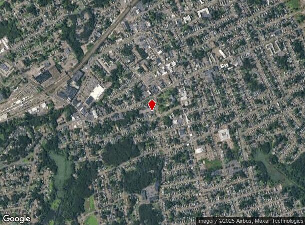
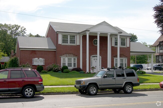
Property Record
662 Savin Ave, West Haven, CT 06516

NEARBY LISTINGS FOR SALE OR LEASE
Property Detail
662 Savin Ave
Funeralhome
New Haven
X
Connecticut
09009C0439J
0.39 AC
2025
West Haven
2025
Westchester/So Connecticut
154900
New Haven, CT
7,888 SF
WHAV-000035-000069
DEMOGRAPHICS near 662 Savin Ave
1 Mile
3 Mile
5 Mile
2024 Total Population
19,833
90,207
218,284
2029 Population
19,330
89,329
216,071
Pop Growth 2024-2029
(2.54%)
(0.97%)
(1.01%)
Average Age
40
38
38
2024 Total Households
8,372
35,650
84,687
HH Growth 2024-2029
(2.47%)
(0.89%)
(1.00%)
Median Household Inc
$61,813
$59,516
$61,965
Avg Household Size
2.20
2.30
2.30
2024 Avg HH Vehicles
1.00
1.00
1.00
Median Home Value
$206,145
$229,028
$260,135
Median Year Built
1952
1958
1956
Nearby Places
Map Layers
Map Styles
 Street
 Aerial
- Restaurants
- Banks
- Shops
- Fitness
- Groceries
PUBLIC TRANSPORTATION
COMMUTER RAIL
West Haven (New Haven - Metro-North Railroad)
DRIVE
WALK
Distance
West Haven (New Haven - Metro-North Railroad)
2 min
16 min
0.8 mi
New Haven (New Haven - Metro-North Railroad)
DRIVE
WALK
Distance
New Haven (New Haven - Metro-North Railroad)
5 min
2.7 mi
AIRPORT
Tweed/New Haven
DRIVE
WALK
Distance
Tweed/New Haven
16 min
7.7 mi
Freight Ports
Port of New Haven
DRIVE
WALK
Distance
Port of New Haven
10 min
4.9 mi
Nearby Properties
Address
Land Use
TOTAL SIZE
Lot Size
Zoning
Address
Land Use
TOTAL SIZE
Lot Size
Zoning
289,886 SF
2.21 AC
BD2
Address
Land Use
TOTAL SIZE
Lot Size
Zoning
56,359 SF
17.09 AC
RCPD
Address
Land Use
TOTAL SIZE
Lot Size
Zoning
83,314 SF
2.14 AC
BA
Address
Land Use
TOTAL SIZE
Lot Size
Zoning
50.14 AC
PRD
Address
Land Use
TOTAL SIZE
Lot Size
Zoning
81,870 SF
3.86 AC
RM2
Address
Land Use
TOTAL SIZE
Lot Size
Zoning
132,345 SF
3.48 AC
RH2
Address
Land Use
TOTAL SIZE
Lot Size
Zoning
302,262 SF
10.40 AC
RM1
Address
Land Use
TOTAL SIZE
Lot Size
Zoning
446,320 SF
BD1
Address
Land Use
TOTAL SIZE
Lot Size
Zoning
133,767 SF
1.25 AC
BD2
Address
Land Use
TOTAL SIZE
Lot Size
Zoning
486,703 SF
2.12 AC
BD
Address
Land Use
TOTAL SIZE
Lot Size
Zoning
72,708 SF
1.91 AC
PDU 87
Address
Land Use
TOTAL SIZE
Lot Size
Zoning
117,902 SF
1.41 AC
BD
Address
Land Use
TOTAL SIZE
Lot Size
Zoning
318,210 SF
2.73 AC
BA
Address
Land Use
TOTAL SIZE
Lot Size
Zoning
123,166 SF
2.33 AC
RH2
Address
Land Use
TOTAL SIZE
Lot Size
Zoning
42.52 AC
PF
Address
Land Use
TOTAL SIZE
Lot Size
Zoning
123,518 SF
2.88 AC
RH2
Address
Land Use
TOTAL SIZE
Lot Size
Zoning
117,066 SF
71.34 AC
IH
Address
Land Use
TOTAL SIZE
Lot Size
Zoning
287,844 SF
2.11 AC
IL
Address
Land Use
TOTAL SIZE
Lot Size
Zoning
158,622 SF
2.09 AC
BA/RM2
Address
Land Use
TOTAL SIZE
Lot Size
Zoning
29.78 AC
PRD
Address
Land Use
TOTAL SIZE
Lot Size
Zoning
76,945 SF
8.52 AC
RM2
Address
Land Use
TOTAL SIZE
Lot Size
Zoning
35.05 AC
LI-2
Address
Land Use
TOTAL SIZE
Lot Size
Zoning
125,577 SF
0.90 AC
RH2
Address
Land Use
TOTAL SIZE
Lot Size
Zoning
205,756 SF
1.27 AC
PDD 15
Address
Land Use
TOTAL SIZE
Lot Size
Zoning
88,578 SF
0.42 AC
PDD 98
Address
Land Use
TOTAL SIZE
Lot Size
Zoning
88,689 SF
0.98 AC
BD
Address
Land Use
TOTAL SIZE
Lot Size
Zoning
840,277 SF
4.28 AC
BD2
Address
Land Use
TOTAL SIZE
Lot Size
Zoning
495,934 SF
0.61 AC
BD
Address
Land Use
TOTAL SIZE
Lot Size
Zoning
119,187 SF
1.38 AC
RO
Address
Land Use
TOTAL SIZE
Lot Size
Zoning
54,372 SF
2.42 AC
BD2
The World's #1 Commercial Real Estate Marketplace
Connect with us
© 2026 CoStar Group
The information above has been obtained from sources believed reliable. While we do not doubt its accuracy we have not verified it and make no guarantee, warranty or representation about it. It is your responsibility to independently confirm its accuracy and completeness. Any projections, opinions, assumptions, or estimates used are for example only and do not represent the current or future performance of the property. The value of this transaction to you depends on tax and other factors which should be evaluated by your tax, financial, and legal advisors. You and your advisors should conduct a careful, independent investigation of the property to determine to your satisfaction the suitability of the property for your needs.