Property Record
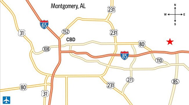
662 Sprott Dr, Montgomery, AL 36117


Property Detail
662 Sprott Dr
Montgomery, AL
0803060000007021
08-03-06-0-000-007.021
MONTGOMERY
Vacantlandnec
Alabama
AGR-1
2
C and X Area of minimal flood hazard, usually depicted on FIRMs as above the 500-year flood level.
3 AC
2025
Outlying Montgomery Cnty
2025
Montgomery
005501
NEARBY LISTINGS FOR SALE OR LEASE
DEMOGRAPHICS near 662 Sprott Dr
1 mile
3 mile
5 mile
2025 Total Population
1,605
7,732
27,281
2030 Population
1,610
7,710
26,936
Pop Growth 2025-2030
+ 0.31%
(0.28%)
(1.26%)
Average Age
42
39
40
2025 Total Households
50
2,273
10,191
HH Growth 2025-2030
0.00%
(0.44%)
(1.54%)
Median Household Inc
$59,999
$95,348
$98,985
Avg Household Size
2.50
2.70
2.50
2025 Avg HH Vehicles
1.00
2.00
2.00
Median Home Value
$209,375
$286,390
$307,272
Median Year Built
1983
2004
2001
Nearby Places
Map Layers
Map Styles
 Street
 Aerial
Layers
 Traffic
 Biking
Places
Listings with unknown addresses are not visible on the map
- Restaurants
- Banks
- Shops
- Fitness
- Groceries
PUBLIC TRANSPORTATION
AIRPORT
Montgomery Regional (Dannelly Field)
Drive
Walk
Distance
Montgomery Regional (Dannelly Field)
36 min
23.8 mi
Freight Ports
Port of Panama City
Drive
Walk
Distance
Port of Panama City
247 min
190.6 mi
SALE & LEASE HISTORY
LISTING DATE
SALE/LEASE

Nov 03, 2022
For Sale
Jun 10, 2021
For Sale
Nearby Properties
Address
Land Use
TOTAL SIZE
Lot Size
Zoning
Address
Land Use
TOTAL SIZE
Lot Size
Zoning
25,762 SF
35.04 AC
PUD
Address
Land Use
TOTAL SIZE
Lot Size
Zoning
208,799 SF
17.34 AC
O-2
Address
Land Use
TOTAL SIZE
Lot Size
Zoning
344,095 SF
30.02 AC
Address
Land Use
TOTAL SIZE
Lot Size
Zoning
170,644 SF
12.34 AC
Address
Land Use
TOTAL SIZE
Lot Size
Zoning
52,600 SF
11.63 AC
Address
Land Use
TOTAL SIZE
Lot Size
Zoning
9,792 SF
160 AC
Address
Land Use
TOTAL SIZE
Lot Size
Zoning
117,633 SF
52.48 AC
Address
Land Use
TOTAL SIZE
Lot Size
Zoning
228,855 SF
15.70 AC
M-1
Address
Land Use
TOTAL SIZE
Lot Size
Zoning
96,764 SF
13.64 AC
M-1
Address
Land Use
TOTAL SIZE
Lot Size
Zoning
168,209 SF
21.62 AC
Address
Land Use
TOTAL SIZE
Lot Size
Zoning
168,209 SF
21.62 AC
Address
Land Use
TOTAL SIZE
Lot Size
Zoning
115,292 SF
49.50 AC
M-1
Address
Land Use
TOTAL SIZE
Lot Size
Zoning
123,376 SF
23 AC
Address
Land Use
TOTAL SIZE
Lot Size
Zoning
9,806 SF
119.29 AC
Address
Land Use
TOTAL SIZE
Lot Size
Zoning
11,100 SF
10.50 AC
Address
Land Use
TOTAL SIZE
Lot Size
Zoning
139,221 SF
11.77 AC
M-1
Address
Land Use
TOTAL SIZE
Lot Size
Zoning
9,615 SF
4.16 AC
Address
Land Use
TOTAL SIZE
Lot Size
Zoning
49,843 SF
11.99 AC
M-1
Address
Land Use
TOTAL SIZE
Lot Size
Zoning
52,059 SF
4.10 AC
O-2
Address
Land Use
TOTAL SIZE
Lot Size
Zoning
5,000 SF
114.60 AC
Address
Land Use
TOTAL SIZE
Lot Size
Zoning
27,600 SF
7.55 AC
O-2
Address
Land Use
TOTAL SIZE
Lot Size
Zoning
1,192 SF
5 AC
M-1
Address
Land Use
TOTAL SIZE
Lot Size
Zoning
33,870 SF
5.10 AC
Address
Land Use
TOTAL SIZE
Lot Size
Zoning
43,260 SF
6.27 AC
M-1
Address
Land Use
TOTAL SIZE
Lot Size
Zoning
102,941 SF
6.68 AC
M-1
Address
Land Use
TOTAL SIZE
Lot Size
Zoning
44,267 SF
9.99 AC
M-1
Address
Land Use
TOTAL SIZE
Lot Size
Zoning
20,637 SF
9.68 AC
M-1
Address
Land Use
TOTAL SIZE
Lot Size
Zoning
21,977 SF
7.50 AC
PUD
Address
Land Use
TOTAL SIZE
Lot Size
Zoning
17,265 SF
17.30 AC
Address
Land Use
TOTAL SIZE
Lot Size
Zoning
10,530 SF
159.90 AC
The World's #1 Commercial Real Estate Marketplace
Connect with us
© 2026 CoStar Group
The information above has been obtained from sources believed reliable. While we do not doubt its accuracy we have not verified it and make no guarantee, warranty or representation about it. It is your responsibility to independently confirm its accuracy and completeness. Any projections, opinions, assumptions, or estimates used are for example only and do not represent the current or future performance of the property. The value of this transaction to you depends on tax and other factors which should be evaluated by your tax, financial, and legal advisors. You and your advisors should conduct a careful, independent investigation of the property to determine to your satisfaction the suitability of the property for your needs.