Property Record
662 Stanley Rd, Winthrop, ME 04364

NEARBY LISTINGS FOR SALE OR LEASE
-
-
View all Winthrop listings for lease on LoopNet.com
Property Detail
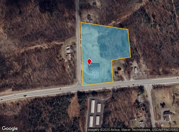
662 Stanley Rd
Departmentstore
Kennebec
X
Maine
23011C0483D
44
2024
4.09 AC
2024
Other Market Areas
014002
Augusta-Waterville, ME
3,880 SF
WINP-000009-000044-A000000
DEMOGRAPHICS near 662 Stanley Rd
1 Mile
3 Mile
5 Mile
2024 Total Population
606
5,690
10,498
2029 Population
635
5,966
10,971
Pop Growth 2024-2029
+ 4.79%
+ 4.85%
+ 4.51%
Average Age
46
44
44
2024 Total Households
259
2,506
4,519
HH Growth 2024-2029
+ 5.02%
+ 4.95%
+ 4.62%
Median Household Inc
$70,526
$70,784
$77,401
Avg Household Size
2.20
2.20
2.30
2024 Avg HH Vehicles
2.00
2.00
2.00
Median Home Value
$321,276
$265,711
$256,388
Median Year Built
1957
1971
1975
Nearby Places
Map Layers
Map Styles
 Street
 Aerial
- Restaurants
- Banks
- Shops
- Fitness
- Groceries
SALE & LEASE HISTORY
LISTING DATE
SALE/LEASE

Sep 26, 2016
For Lease
Sep 24, 2016
For Sale
Nearby Properties
Address
Land Use
TOTAL SIZE
Lot Size
Zoning
Address
Land Use
TOTAL SIZE
Lot Size
Zoning
Address
Land Use
TOTAL SIZE
Lot Size
Zoning
21,042 SF
MIX
Address
Land Use
TOTAL SIZE
Lot Size
Zoning
17.75 AC
V
Address
Land Use
TOTAL SIZE
Lot Size
Zoning
3.14 AC
V
Address
Land Use
TOTAL SIZE
Lot Size
Zoning
122,149 SF
18.97 AC
GC
Address
Land Use
TOTAL SIZE
Lot Size
Zoning
36,453 SF
3.94 AC
GC
Address
Land Use
TOTAL SIZE
Lot Size
Zoning
149.78 AC
MIX
Address
Land Use
TOTAL SIZE
Lot Size
Zoning
9,786 SF
2.32 AC
GC
Address
Land Use
TOTAL SIZE
Lot Size
Zoning
17.10 AC
GC
Address
Land Use
TOTAL SIZE
Lot Size
Zoning
124.99 AC
MIX
Address
Land Use
TOTAL SIZE
Lot Size
Zoning
0.55 AC
SHOREL
Address
Land Use
TOTAL SIZE
Lot Size
Zoning
10 AC
MIX
Address
Land Use
TOTAL SIZE
Lot Size
Zoning
4,828 SF
10.68 AC
COMMUN
Address
Land Use
TOTAL SIZE
Lot Size
Zoning
3.67 AC
GR
Address
Land Use
TOTAL SIZE
Lot Size
Zoning
3.19 AC
V
Address
Land Use
TOTAL SIZE
Lot Size
Zoning
10,902 SF
3.20 AC
GC
Address
Land Use
TOTAL SIZE
Lot Size
Zoning
1,176 SF
RP
Address
Land Use
TOTAL SIZE
Lot Size
Zoning
2.15 AC
GR
Address
Land Use
TOTAL SIZE
Lot Size
Zoning
8.50 AC
RU
Address
Land Use
TOTAL SIZE
Lot Size
Zoning
3.50 AC
MIX
Address
Land Use
TOTAL SIZE
Lot Size
Zoning
5.65 AC
MIX
Address
Land Use
TOTAL SIZE
Lot Size
Zoning
99.66 AC
MIX
Address
Land Use
TOTAL SIZE
Lot Size
Zoning
8,400 SF
1.47 AC
GC
Address
Land Use
TOTAL SIZE
Lot Size
Zoning
4,457 SF
1.84 AC
PW
Address
Land Use
TOTAL SIZE
Lot Size
Zoning
33.70 AC
GENERA
Address
Land Use
TOTAL SIZE
Lot Size
Zoning
11,036 SF
3.14 AC
MIX
Address
Land Use
TOTAL SIZE
Lot Size
Zoning
70 AC
MIX
Address
Land Use
TOTAL SIZE
Lot Size
Zoning
408 SF
9 AC
V
Address
Land Use
TOTAL SIZE
Lot Size
Zoning
9,828 SF
0.45 AC
V
Address
Land Use
TOTAL SIZE
Lot Size
Zoning
10,114 SF
0.17 AC
V
The World's #1 Commercial Real Estate Marketplace
Connect with us
© 2025 CoStar Group
The information above has been obtained from sources believed reliable. While we do not doubt its accuracy we have not verified it and make no guarantee, warranty or representation about it. It is your responsibility to independently confirm its accuracy and completeness. Any projections, opinions, assumptions, or estimates used are for example only and do not represent the current or future performance of the property. The value of this transaction to you depends on tax and other factors which should be evaluated by your tax, financial, and legal advisors. You and your advisors should conduct a careful, independent investigation of the property to determine to your satisfaction the suitability of the property for your needs.