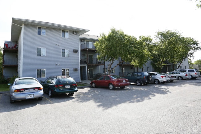
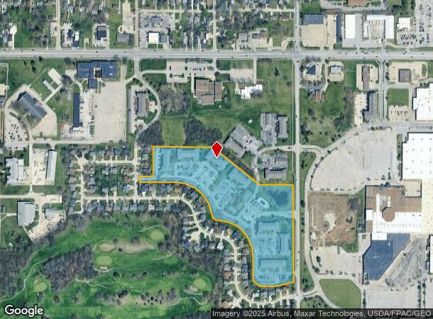
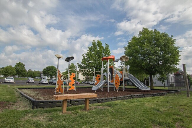
Property Record
6620 Se 5Th St, Des Moines, IA 50315
NEARBY LISTINGS FOR SALE OR LEASE
Property Detail
6620 Se 5Th St
Des Moines-West Des Moines, IA
Somerset
120-04640491000
LOT 91 SOMERSET
Apartment
Polk
X
Iowa
19153C0365F
91
2024
14.42 AC
2025
Somerset
004702
Des Moines
208,456 SF
DEMOGRAPHICS near 6620 Se 5Th St
1 Mile
3 Mile
5 Mile
2024 Total Population
10,246
55,734
100,452
2029 Population
10,714
57,829
105,683
Pop Growth 2024-2029
+ 4.57%
+ 3.76%
+ 5.21%
Average Age
37
38
37
2024 Total Households
4,089
21,739
42,878
HH Growth 2024-2029
+ 4.74%
+ 3.95%
+ 5.48%
Median Household Inc
$44,222
$61,981
$61,678
Avg Household Size
2.40
2.50
2.30
2024 Avg HH Vehicles
2.00
2.00
2.00
Median Home Value
$123,672
$160,088
$177,030
Median Year Built
1977
1972
1976
Nearby Places
Map Layers
Map Styles
 Street
 Aerial
- Restaurants
- Banks
- Shops
- Fitness
- Groceries
PUBLIC TRANSPORTATION
AIRPORT
Des Moines International
DRIVE
WALK
Distance
Des Moines International
11 min
4.3 mi
Freight Ports
Port Milwaukee
DRIVE
WALK
Distance
Port Milwaukee
423 min
377.9 mi
Nearby Properties
Address
Land Use
TOTAL SIZE
Lot Size
Zoning
Address
Land Use
TOTAL SIZE
Lot Size
Zoning
397,938 SF
27.97 AC
PUD
Address
Land Use
TOTAL SIZE
Lot Size
Zoning
298,716 SF
18.90 AC
PUD
Address
Land Use
TOTAL SIZE
Lot Size
Zoning
231,168 SF
22.29 AC
PUD
Address
Land Use
TOTAL SIZE
Lot Size
Zoning
260,420 SF
18.17 AC
R-3
Address
Land Use
TOTAL SIZE
Lot Size
Zoning
178,415 SF
13.35 AC
R-6
Address
Land Use
TOTAL SIZE
Lot Size
Zoning
160,680 SF
20.08 AC
C-2
Address
Land Use
TOTAL SIZE
Lot Size
Zoning
684,064 SF
2 AC
C-3
Address
Land Use
TOTAL SIZE
Lot Size
Zoning
155,640 SF
9.15 AC
R-6
Address
Land Use
TOTAL SIZE
Lot Size
Zoning
138,490 SF
10.01 AC
R-6
Address
Land Use
TOTAL SIZE
Lot Size
Zoning
51,965 SF
3.83 AC
C-4
Address
Land Use
TOTAL SIZE
Lot Size
Zoning
169,201 SF
13.66 AC
C-4
Address
Land Use
TOTAL SIZE
Lot Size
Zoning
82,044 SF
2.91 AC
Address
Land Use
TOTAL SIZE
Lot Size
Zoning
147,173 SF
20.84 AC
PUD
Address
Land Use
TOTAL SIZE
Lot Size
Zoning
58,366 SF
11.58 AC
Address
Land Use
TOTAL SIZE
Lot Size
Zoning
301,434 SF
29.03 AC
C4
Address
Land Use
TOTAL SIZE
Lot Size
Zoning
121,200 SF
10.32 AC
C-2
Address
Land Use
TOTAL SIZE
Lot Size
Zoning
178,721 SF
8.19 AC
C-2
Address
Land Use
TOTAL SIZE
Lot Size
Zoning
73,000 SF
4.07 AC
PUD
Address
Land Use
TOTAL SIZE
Lot Size
Zoning
310,851 SF
18.05 AC
C-4
Address
Land Use
TOTAL SIZE
Lot Size
Zoning
91,166 SF
C-4
Address
Land Use
TOTAL SIZE
Lot Size
Zoning
92,232 SF
6.01 AC
R-3
Address
Land Use
TOTAL SIZE
Lot Size
Zoning
110,260 SF
9.56 AC
PUD
Address
Land Use
TOTAL SIZE
Lot Size
Zoning
73,860 SF
2.52 AC
Address
Land Use
TOTAL SIZE
Lot Size
Zoning
74,600 SF
8.50 AC
Address
Land Use
TOTAL SIZE
Lot Size
Zoning
86,304 SF
3.56 AC
R-3
Address
Land Use
TOTAL SIZE
Lot Size
Zoning
100,800 SF
10.57 AC
Address
Land Use
TOTAL SIZE
Lot Size
Zoning
147,400 SF
15.05 AC
C-2
Address
Land Use
TOTAL SIZE
Lot Size
Zoning
50,969 SF
4.64 AC
R-2
The World's #1 Commercial Real Estate Marketplace
Connect with us
© 2026 CoStar Group
The information above has been obtained from sources believed reliable. While we do not doubt its accuracy we have not verified it and make no guarantee, warranty or representation about it. It is your responsibility to independently confirm its accuracy and completeness. Any projections, opinions, assumptions, or estimates used are for example only and do not represent the current or future performance of the property. The value of this transaction to you depends on tax and other factors which should be evaluated by your tax, financial, and legal advisors. You and your advisors should conduct a careful, independent investigation of the property to determine to your satisfaction the suitability of the property for your needs.